More perspective?
I found something that might help those who aren't from this area understand the utter devastation we're going through. You saw the aerial pic I showed you, where the bridges are completely underwater. Here's more comparisons:
This is what the bridges looked like on the 11th, in the morning. This is a couple of hours before we were evacuated:
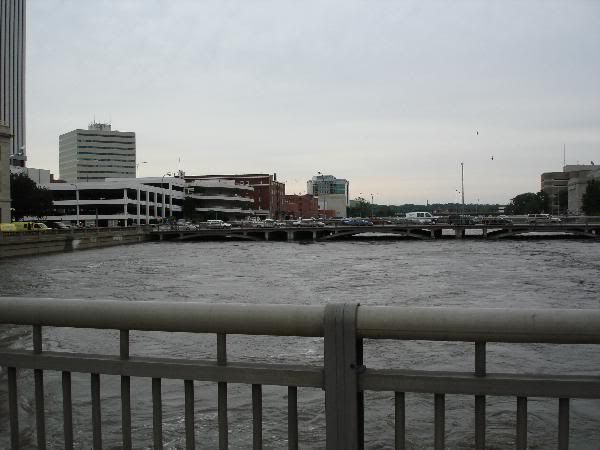
This is looking south, from the sameish angle as the aerial showed you earlier. Note the swirly parking garage I pointed out earlier. The tall, white Alliant Tower is next to it and the brownish corner in front of the parking garage is the federal courthouse. These bridges are normally filled with parked cars, from people downtown and people going in and out of the municipal buildings, as you can see.
Now, for perspective, this picture is from November last year, looking towards the highway (where the aerial picture was shot from):
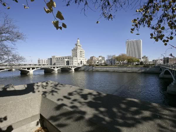
I-380 is sort of hidden back there. Way, way in the back is the Quaker Oats factory, the squareish, pointy-type building in the middle is Mays Island. There's the Alliant Tower. My building is next to the Alliant building, a short, squat white building partially hidden by trees. This is the normal level, where the river usually is.
This is why 100 blocks, 10 miles, of CR is underwater. We're currently 18 feet over flood stage.
This is what the bridges looked like on the 11th, in the morning. This is a couple of hours before we were evacuated:
This is looking south, from the sameish angle as the aerial showed you earlier. Note the swirly parking garage I pointed out earlier. The tall, white Alliant Tower is next to it and the brownish corner in front of the parking garage is the federal courthouse. These bridges are normally filled with parked cars, from people downtown and people going in and out of the municipal buildings, as you can see.
Now, for perspective, this picture is from November last year, looking towards the highway (where the aerial picture was shot from):
I-380 is sort of hidden back there. Way, way in the back is the Quaker Oats factory, the squareish, pointy-type building in the middle is Mays Island. There's the Alliant Tower. My building is next to the Alliant building, a short, squat white building partially hidden by trees. This is the normal level, where the river usually is.
This is why 100 blocks, 10 miles, of CR is underwater. We're currently 18 feet over flood stage.