EDITED: This sort of shows it all, to put it in perspective.
This was taken from I-380, the highway that goes through the middle of downtown and um, obviously the only bridge that is high enough to remain open. If this floods? The rest of E IA is underwater. This is a picture from the front page of www.gazetteonline.com, the website for CR's main newspaper.
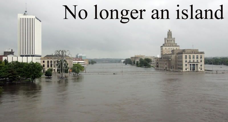
The picture in the middle is Mays Island, which is the municipal building for Cedar Rapids/Linn County. The Linn Co jail is beyond that. On the left, the small brown building is the Federal Courthouse. To the left of that is a small white building and beyond that small white building is a tall white building. The tall white building is Alliant Tower; it's the head quarters for power to most of Eastern Iowa. The small white building is my work.
ETA: I should mention that the right most tree on the left side and beyond that, the swirly white thing (parking garage) are normally on the river's edge. In addition, there are grounds around Mays Island you can't see. This is one side of the river, of course, there's more on the other side of Mays Island. Oh and the lines across the river are the tops of the railings of the bridges for 1st, 2nd and 3rd Avenue.