Following the acorn from winter to summer - part 2
Part one was here
Day four: Painswick to Dursley
Day four (Bank Holiday Monday) started off misty. It also started off with an interesting breakfast. Each individual table in our B&B contained a beautifully presented and very varied Continental buffet: local cheeses and meat, interesting fruit medleys, cakes, pastries, local breads etc. The pastries came with a resealable cardbox box, given explicitly so we could take away anything we couldn't manage and have it later in the day. So that was lunch sorted. :-)
Painswick is very pretty, full of lovely 18th century town houses, plus early 20th century Arts & Crafts buildings, with decorative writing. The church yard is famous for its 99 yew trees. Supposedly the hundredth has repeatedly been planted, but has never prospered. Naturally, the Devil has been blamed. Why the Devil would be entirely fine with 99 trees, but consider that 100 is Right Out, I'm not sure. But, then, the Devil in the British landscape is always up to odd things. (I can enthusiastically recommend a book called Cloven Country, about all those Devil's Punch Bowls, Devil's Bridges and the like that bedeck the countryside. It's very engagingly written, and makes clear that in many cases, the devil was belatedly slotted into an existing giant story. He's normally a hapless buffoon, and easily thwarted.)
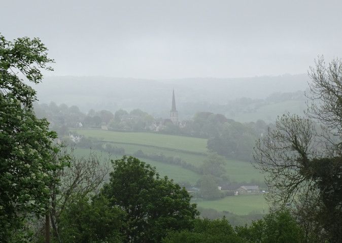
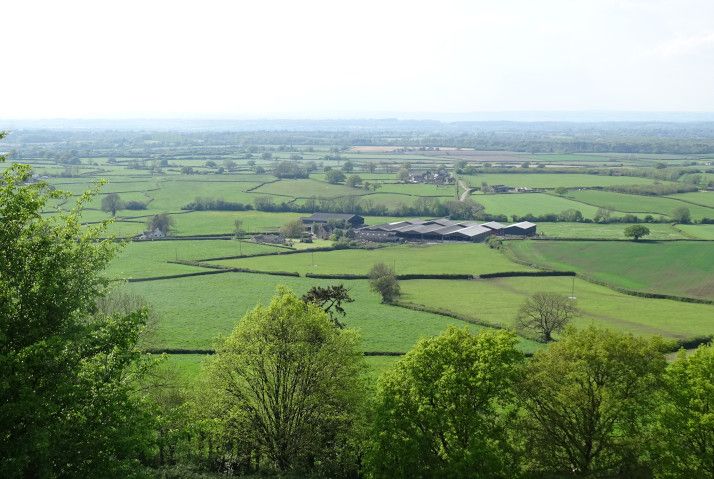
Anyway... Here's Painswick Church from a mile away, fading into the fog.
(Interesting aside: One of the main appeals of the Cotswolds to modern tourists is its "unspoiled" villages. I lived in one (sorry, Mum! Not a village, a town! A town!) for some years, but never quite made the connection. The main reason for their appeal nowadays is that the Cotswolds was actually a very deprived area from the late 18th century onwards. It was hugely rich on wool and cloth, but couldn't compete with the industrial production in the north, so went into decline. As a result, nobody could afford to tear down their old houses and replace them with modern state-of-the-art affairs. Hence the "unspoiled" villages, full of houses built on the huge riches of the pre-18th century wool trade. It's rather like the way that some of the best stately homes are those belonging to Catholic families, who were on the fringes of power and couldn't afford to upgrade.)
Anyway....
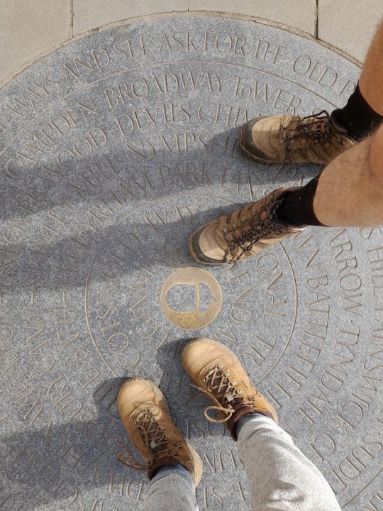
A mile or two later we came across a decorative Cotswold Way milestone, telling us that we were half way there... Oh. Telling us that we weren't quite halfway there, since we were allegedly 47 miles from Chipping Campden (I'm sure we'd walked further) but 55 miles from Bath. The milestone was just in the middle of a field, and not at any particular landmark, so I have no idea why the only milestone on the entire walk showed such an arbitrary distance. The path was rerouted quite a lot when it became a National Trail, though, so maybe once upon a time it WAS half way.
Then to Haresfield Beacon - yet another hillfort. In very faded writing, a monument called the Cromwell Stone recorded the relief of the Siege of Gloucester, although Gloucester was some miles away, and invisible behind the trees. Clearly this area was the place for Monuments Placed Baffingly In Not Quite The Right Place.
The mist lifted as we neared the top of the Beacon, our path snaking around to follow the promontaries and headlands of the escarpment. ("I'll probably see you again near the car park," said the passing dog-walker who stopped to help us with the Cromwell Stone. "It's just up there, five minutes' walk away, but your path's going to make you walk 3 miles to get to it." It did indeed. And we did indeed see him again, relaxing on a bench and looking smug. Mind you, we'd paused for a nice cup of tea from the car park cafe van, so were feeling quite smug ourselves, too.)
I liked this contoured topograph, making it much easier to see what you were looking at.
Then more woods, before descending into the valley on the edge of Stroud. There the path bifurcated, giving us two options, both of them officially marked Cotswold Way. We decided to take the longer one, along a canal - the Stroudwater Navigation - then sharply up hill to Selsey Common with its lovely views. We paused a while at a very nice pub in Selsey, for a drink with a view.
Selsey Church, with its interesting tower.
After a few miles, the two branches reunited, and on we went to Coaley Peak - a viewpoint with a car park, and thus heaving with people. There was a small long barrow - Nymphsfield Long Barrow - by the path. Nearby was Hetty Pegler's Tump, a better barrow with a far better name, but it was off the trail and we failed to notice its proximity until far too late, so missed it.
From Coaley Peak we could peer south towards our destination. Between us and it lay an isolated hill. "I bet the path makes us go up that, only to go down again," we said darkly. It did indeed. It was Cam Long Down, and quite a ferocious climb.
The weather was beginning to menace somewhat as we climbed Cam Long Down and paused to look back towards Coaley Peak.
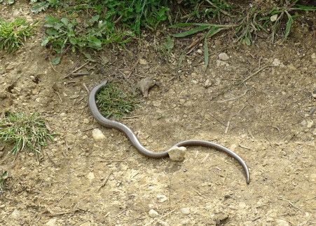
On Selsey Common a man pointed out a slow worm, but we couldn't see it. We scored one on Cam Long Down, though. (But no adders all week, despite many promises of them at various beauty spots along the way. Grump! I saw a lizard on Cleeve Hill, though. No idea what sort, though, partly because I am not wise in the ways of lizards, but mostly because it was one of those "Argh! Must desperately arrest that step before it goes down or I'll stand on that fast darting thing that's racing across where I'm about to land!" moments.)
As we looked towards Dursley from Cam Long Down, we saw something amazing: an isolating pointy hill that the Cotswold Way did NOT plan to take us up, only to take us down again. Since it was small and pleasingly conical, we decided to climb it anyway... but then it started raining. It was light at first, and we were less than a mile from the end of our walk, so we ignored it. Then, suddenly, without us really noticing, we realised that it was now actually very heavy rain indeed.
Annoyingly, as we squelched across Dursley to our B&B half a mile from the town centre, we saw that the roads were dry. Grump!
Day 4: 18.77 miles.
Day five: Dursley to Old Sodbury
Another misty start, but no longer raining, although it had rained again overnight. We shared our breakfast table with a pair of American women from Washington State, who were doing the walk in small stages, with many a trip off route (presumably by taxi?) to see nearby attractions. They were planning to visit Highgrove House that day, "so we must dress nicely - you never know who you'll bump into."
Coming out of Dursley is the most egregious of Cotswold Way wiggly diversions. So egregious is it that it actually concedes that you might want to take a shortcut, and gives it official marking. The long version follows the edge of a promontory golf course for about three miles. The shortcut just walks across the next of the promontory, taking about 300 yards to do the same.
Being completist, we did the long version. (The American looked at us as if we were insane when we announced this intention.)
The long version offered lots of nice viewpoints - especially nice since the early mist was very quick to lift.
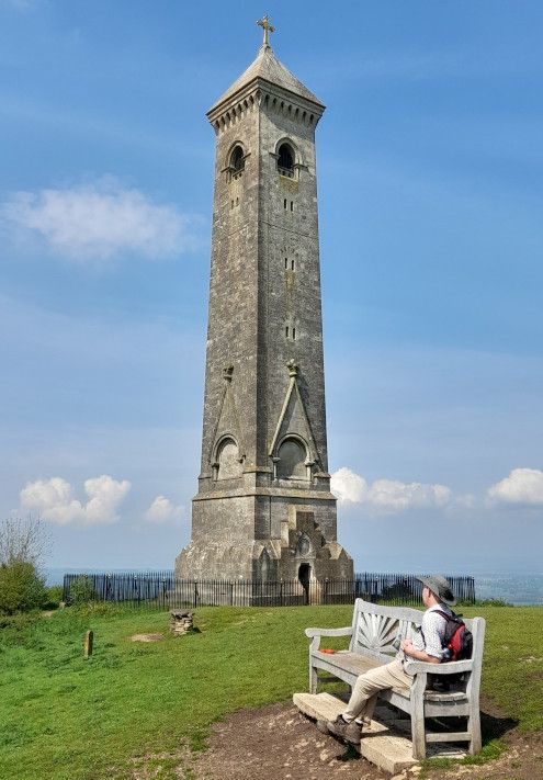
In the background of the above picture (on the left) you can just seen the next destination: the Tyndale Monument near North Nibley. (William Tyndale, translator of the Bible, was born nearby.) It was a steep climp up to it, through a lovely beech-lined sunken path. Once there, you could climb right to the top, paying a pound in an honesty box.
The views from the top were lovely, but I was particularly taken by this much nearer sight:
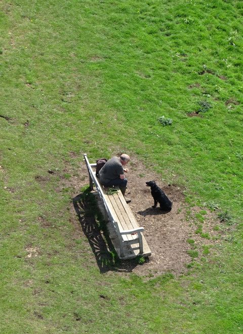
That was a lovely bench, by the way: very new, and in memory of a young man who was clearly a very keen mathematician, since the bench was covered with mathematical formulae and symbols.
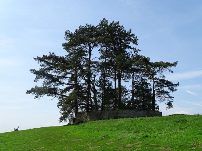
Then some more woods, and eventually down into Wotton under Edge, by way of a Clump planted to commemorate the Battle of Waterloo.
I have a load of ancestors from Wotton Under Edge - cloth workers whom we managed to trace back to the early sixteenth century - so I’d hoped for a little time to revisit the places we used to explore. However, our B&B breakfast had been smaller than some, so we felt ourselves in need of Proper Lunch, not just a snack. The Proper Lunch we had - in a tearoom with a lovely back garden - was very nice, but it took an eternity to arrive.
This put me in considerable anxiety about time. From Wotton, the “southbound” Cotswold Way hares off for several miles in an easterly direction. Coupled with the extreme wiggliness of the morning’s path, by mid-afternoon we were barely a quarter of the way from Dursley to Old Sodbury in crowfloos (my term for one mile as a crow flies.) (But why single out a crow? Do no other birds fly straight?)
Eventually the path grudgingly consented to let us proceed south, periodically coinciding with the Monarch’s Way - a route that enormously outshines the Cotswold Way in terms of sheer wiggliness. (It takes 625 miles to go from Worcester to West Sussex.)
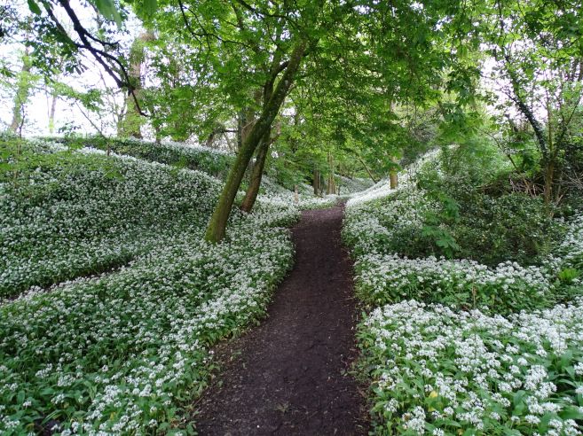
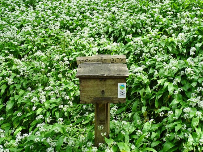
Much of this was through immense expanses of ramsons. There was SO MUCH GARLIC throughout the walk. Swathes of cowslips on the open hillsides, but the woods were garlic, garlic everywhere. (Strangely, though, we noticed that when we were in vast swathes of the stuff, we could barely smell it. Then, half a mile later, we’d suddenly get a strong whiff of garlic, and search around to spot one tiny patch some way from the path.)
We passed another tall monument - the Somerset Monument - then along a nice broad, easy-walking (and straight! and southerly!) path through the Badminton Estate. (Apparently they were going to start trying horses the next day, but we saw no sign of procedures.) After days of western views across the Severn Plain, for the first time we started getting significant views to the east, over towards the Wiltshire Downs. We passed pretty manors, a “folly” (actually a modern decorative tower designed for nesting owls) and several hillforts.
Eventually Old Sodbury neared. It was very hot by now, and after 5.30, so we were briefly tempted to skip the last “let’s deviate from the direct route to randomly climb a hill then come down again” wiggle of the way, but we resisted that temptation. It turned out to be a probably the best hillfort of the walk - small, but perfectly formed.
(I've no idea where these pictures were taken, except that they were taken at the same time, but here they are, anyway, to break up the text.)
And then down into Old Sodbury, pausing for a great viewpoint by the church, where we headed off the trail to an old coaching inn just outside the village. The day had grown hotter and hotter, and it was our longest day of the walk, so we didn’t initially bother checking in, just went straight to the beer garden for a nice cooling drink.
When we DID get to check in, we found that our luggage hadn’t arrived. A flurry of anxious texts ensured, but it turned out that the poor driver had been stuck in massive road closure for half the day, and our luggage eventually reached us by 7. Phew! (And poor man; he still had to get home to Cheltenham.)
Our room had a plaque on the wall, informing us that the Queen had stayed in that very room in 1981 when sheltering from a blizzard!
The pub was expecting to be full of people preparing to try horses, but we found a very comfortable table in the bar, complete with leather armchairs, and had a very nice evening. Pellinor scored lasagne number 3 of the week. All our Hadrian’s Wall accommodation providers had fed us on lasagne, so he had concluded that when walking a national trail, lasagne was the One True Meal.
Day five: 21.62 miles
Day six: Old Sodbury to Bath
After the first of our many crossings of the A46, we returned to the Way, for a pleasant few miles passing through the Capability Brown landscape of Dodington Park. (The house itself, now home to James Dyson, remained stubbornly invisible.) Then back across the A46 without a bridge, and over the M4, fortunately with a bridge.
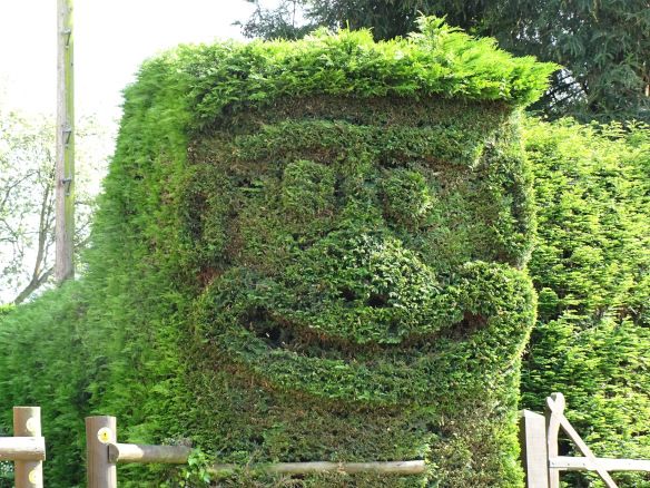
Pleasing topiary in a normal garden, taken at some point early this day - no idea where:
A mile or two on, we were expecting to turn right, but a sign advised us that the Cotswold Way had been recently diverted to avoid an area of "persistent antisocial and indecent behaviour." The curious part of our minds rather wanted to find out more, and my completist nature felt a little unhappy about deviating from the path as it was written on the map, but the sensible majority opted to obey the diversion.
(I looked it up later, eventually finding some very eloquent descriptions on a trig-point-baggers’ forum, almost all of whom had seen some of the said "indecent behaviour" on their visits, and several of whom had to beat a hasty retreat to avoid being invited to join in.)
Then past the perimeter of the Deer Park at Dryham - any deer present hidden by the stone wall - and past the main gates of the house. "No entry," said the sign. "Entry via the A46" - i.e. several miles away, via a very busy road with no pavement. I have ongoing mental letter to the National Trust about their lack of pedestrian access to sites. I was just bringing it out and dusting it off, full of righteous indignation, when we came to a turning signed "pedestrian access to Dryham Park."
Oh. Well. It can be quite a let-down, sometimes, when you suddenly find yourself thwarted in your righteous indignation. How dare people give you just what you wanted!
(What we wanted, in this case, was just a tea room and toilets, but that’s beside the point.)
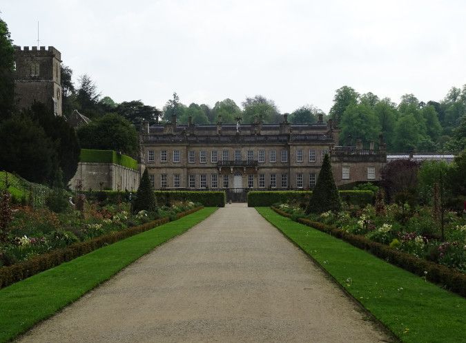
Dryham House photographed through the "you shall not pass!" gateway:
A few more miles south, then, to cross the A46 at Philadelphia, then to Cold Aston - a small village with a lovely manor house and rectory, and loads of topiary. Then - after crossing A46 again, which seemed busier and more impassible with every fresh crossing - down a very steep hill, then up again, eventually reaching Landsdowne Hill. This was the site of a battle in 1643, commemorated in a monument, pleasant stone carvings and various interpretation boards.
At some point, we found a visitor book alongside the path - a lovely touch - and paused to add an entry.
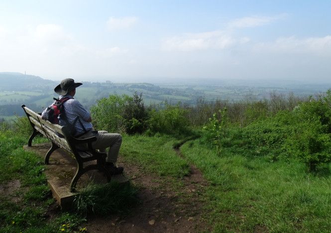
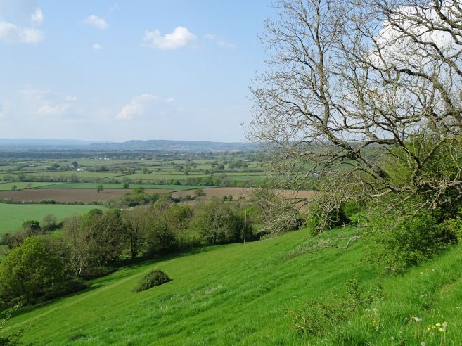
Landsdowne Hill isn’t that far from Bath at this point, but of course the Cotswold Way too us off in the opposite direction, veering us away to the west. This was a Good Thing, though, since it took us back onto the escarpment after many miles away, with lovely views over the Severn Plain over to Bristol and beyond.
On a path beside a golf course, a wizard and his undead dog were battling dragons. No explanation was given.
After several more hilltops and viewpoints, we finally snaked round to the south and saw Bath below us: a lovely view! We descended slowly towards Bath, reaching it in its western environs - hurrah! - only to realise that that treacherous Cotswold Way now wanted us to climb a Gurt Hill out of Bath again, in order to come down into it a second time from the north.
To be fair, the northern approach was very scenic, via fields and parks, then past the Royal Crescent and Circus, but that last climb was not nice. It was very hot, and mentally we’d pretty much finished the whole thing by then, so felt that this last Gurt Hill was a mean trick.
But eventually we reached the end, outside the Abbey, where there was much rejoicing!
After that, I immediately - and voluntarily - climbed back up most of that Gurt Hill to get to our hotel, while Pellinor went to fetch the car. The people checking in just ahead of me looked cool and groomed and polite. I staggered in mud-spattered, scarlet and dripping. I’m surprised I was allowed in.
Day six: 20.44 miles (plus a couple of miles going into town again for dinner from our hotel)
Day four: Painswick to Dursley
Day four (Bank Holiday Monday) started off misty. It also started off with an interesting breakfast. Each individual table in our B&B contained a beautifully presented and very varied Continental buffet: local cheeses and meat, interesting fruit medleys, cakes, pastries, local breads etc. The pastries came with a resealable cardbox box, given explicitly so we could take away anything we couldn't manage and have it later in the day. So that was lunch sorted. :-)
Painswick is very pretty, full of lovely 18th century town houses, plus early 20th century Arts & Crafts buildings, with decorative writing. The church yard is famous for its 99 yew trees. Supposedly the hundredth has repeatedly been planted, but has never prospered. Naturally, the Devil has been blamed. Why the Devil would be entirely fine with 99 trees, but consider that 100 is Right Out, I'm not sure. But, then, the Devil in the British landscape is always up to odd things. (I can enthusiastically recommend a book called Cloven Country, about all those Devil's Punch Bowls, Devil's Bridges and the like that bedeck the countryside. It's very engagingly written, and makes clear that in many cases, the devil was belatedly slotted into an existing giant story. He's normally a hapless buffoon, and easily thwarted.)
Anyway... Here's Painswick Church from a mile away, fading into the fog.
(Interesting aside: One of the main appeals of the Cotswolds to modern tourists is its "unspoiled" villages. I lived in one (sorry, Mum! Not a village, a town! A town!) for some years, but never quite made the connection. The main reason for their appeal nowadays is that the Cotswolds was actually a very deprived area from the late 18th century onwards. It was hugely rich on wool and cloth, but couldn't compete with the industrial production in the north, so went into decline. As a result, nobody could afford to tear down their old houses and replace them with modern state-of-the-art affairs. Hence the "unspoiled" villages, full of houses built on the huge riches of the pre-18th century wool trade. It's rather like the way that some of the best stately homes are those belonging to Catholic families, who were on the fringes of power and couldn't afford to upgrade.)
Anyway....
A mile or two later we came across a decorative Cotswold Way milestone, telling us that we were half way there... Oh. Telling us that we weren't quite halfway there, since we were allegedly 47 miles from Chipping Campden (I'm sure we'd walked further) but 55 miles from Bath. The milestone was just in the middle of a field, and not at any particular landmark, so I have no idea why the only milestone on the entire walk showed such an arbitrary distance. The path was rerouted quite a lot when it became a National Trail, though, so maybe once upon a time it WAS half way.
Then to Haresfield Beacon - yet another hillfort. In very faded writing, a monument called the Cromwell Stone recorded the relief of the Siege of Gloucester, although Gloucester was some miles away, and invisible behind the trees. Clearly this area was the place for Monuments Placed Baffingly In Not Quite The Right Place.
The mist lifted as we neared the top of the Beacon, our path snaking around to follow the promontaries and headlands of the escarpment. ("I'll probably see you again near the car park," said the passing dog-walker who stopped to help us with the Cromwell Stone. "It's just up there, five minutes' walk away, but your path's going to make you walk 3 miles to get to it." It did indeed. And we did indeed see him again, relaxing on a bench and looking smug. Mind you, we'd paused for a nice cup of tea from the car park cafe van, so were feeling quite smug ourselves, too.)
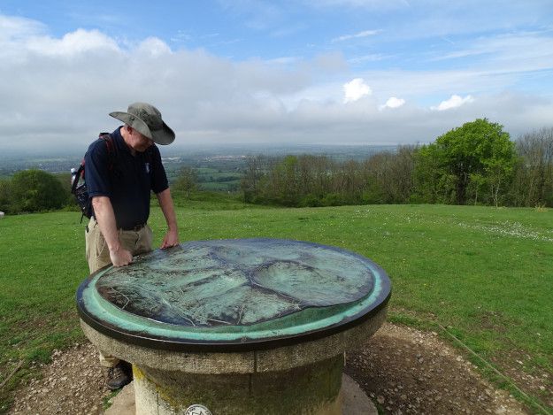
I liked this contoured topograph, making it much easier to see what you were looking at.
Then more woods, before descending into the valley on the edge of Stroud. There the path bifurcated, giving us two options, both of them officially marked Cotswold Way. We decided to take the longer one, along a canal - the Stroudwater Navigation - then sharply up hill to Selsey Common with its lovely views. We paused a while at a very nice pub in Selsey, for a drink with a view.
Selsey Church, with its interesting tower.
After a few miles, the two branches reunited, and on we went to Coaley Peak - a viewpoint with a car park, and thus heaving with people. There was a small long barrow - Nymphsfield Long Barrow - by the path. Nearby was Hetty Pegler's Tump, a better barrow with a far better name, but it was off the trail and we failed to notice its proximity until far too late, so missed it.
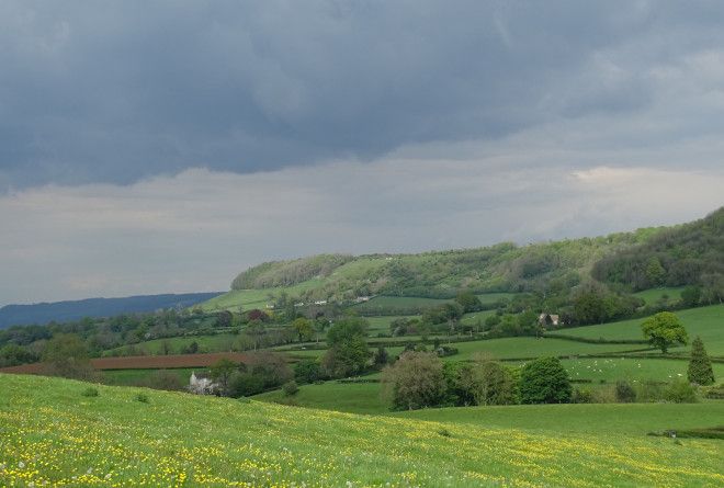
From Coaley Peak we could peer south towards our destination. Between us and it lay an isolated hill. "I bet the path makes us go up that, only to go down again," we said darkly. It did indeed. It was Cam Long Down, and quite a ferocious climb.
The weather was beginning to menace somewhat as we climbed Cam Long Down and paused to look back towards Coaley Peak.
On Selsey Common a man pointed out a slow worm, but we couldn't see it. We scored one on Cam Long Down, though. (But no adders all week, despite many promises of them at various beauty spots along the way. Grump! I saw a lizard on Cleeve Hill, though. No idea what sort, though, partly because I am not wise in the ways of lizards, but mostly because it was one of those "Argh! Must desperately arrest that step before it goes down or I'll stand on that fast darting thing that's racing across where I'm about to land!" moments.)
As we looked towards Dursley from Cam Long Down, we saw something amazing: an isolating pointy hill that the Cotswold Way did NOT plan to take us up, only to take us down again. Since it was small and pleasingly conical, we decided to climb it anyway... but then it started raining. It was light at first, and we were less than a mile from the end of our walk, so we ignored it. Then, suddenly, without us really noticing, we realised that it was now actually very heavy rain indeed.
Annoyingly, as we squelched across Dursley to our B&B half a mile from the town centre, we saw that the roads were dry. Grump!
Day 4: 18.77 miles.
Day five: Dursley to Old Sodbury
Another misty start, but no longer raining, although it had rained again overnight. We shared our breakfast table with a pair of American women from Washington State, who were doing the walk in small stages, with many a trip off route (presumably by taxi?) to see nearby attractions. They were planning to visit Highgrove House that day, "so we must dress nicely - you never know who you'll bump into."
Coming out of Dursley is the most egregious of Cotswold Way wiggly diversions. So egregious is it that it actually concedes that you might want to take a shortcut, and gives it official marking. The long version follows the edge of a promontory golf course for about three miles. The shortcut just walks across the next of the promontory, taking about 300 yards to do the same.
Being completist, we did the long version. (The American looked at us as if we were insane when we announced this intention.)
The long version offered lots of nice viewpoints - especially nice since the early mist was very quick to lift.
In the background of the above picture (on the left) you can just seen the next destination: the Tyndale Monument near North Nibley. (William Tyndale, translator of the Bible, was born nearby.) It was a steep climp up to it, through a lovely beech-lined sunken path. Once there, you could climb right to the top, paying a pound in an honesty box.
The views from the top were lovely, but I was particularly taken by this much nearer sight:
That was a lovely bench, by the way: very new, and in memory of a young man who was clearly a very keen mathematician, since the bench was covered with mathematical formulae and symbols.
Then some more woods, and eventually down into Wotton under Edge, by way of a Clump planted to commemorate the Battle of Waterloo.
I have a load of ancestors from Wotton Under Edge - cloth workers whom we managed to trace back to the early sixteenth century - so I’d hoped for a little time to revisit the places we used to explore. However, our B&B breakfast had been smaller than some, so we felt ourselves in need of Proper Lunch, not just a snack. The Proper Lunch we had - in a tearoom with a lovely back garden - was very nice, but it took an eternity to arrive.
This put me in considerable anxiety about time. From Wotton, the “southbound” Cotswold Way hares off for several miles in an easterly direction. Coupled with the extreme wiggliness of the morning’s path, by mid-afternoon we were barely a quarter of the way from Dursley to Old Sodbury in crowfloos (my term for one mile as a crow flies.) (But why single out a crow? Do no other birds fly straight?)
Eventually the path grudgingly consented to let us proceed south, periodically coinciding with the Monarch’s Way - a route that enormously outshines the Cotswold Way in terms of sheer wiggliness. (It takes 625 miles to go from Worcester to West Sussex.)
Much of this was through immense expanses of ramsons. There was SO MUCH GARLIC throughout the walk. Swathes of cowslips on the open hillsides, but the woods were garlic, garlic everywhere. (Strangely, though, we noticed that when we were in vast swathes of the stuff, we could barely smell it. Then, half a mile later, we’d suddenly get a strong whiff of garlic, and search around to spot one tiny patch some way from the path.)
We passed another tall monument - the Somerset Monument - then along a nice broad, easy-walking (and straight! and southerly!) path through the Badminton Estate. (Apparently they were going to start trying horses the next day, but we saw no sign of procedures.) After days of western views across the Severn Plain, for the first time we started getting significant views to the east, over towards the Wiltshire Downs. We passed pretty manors, a “folly” (actually a modern decorative tower designed for nesting owls) and several hillforts.
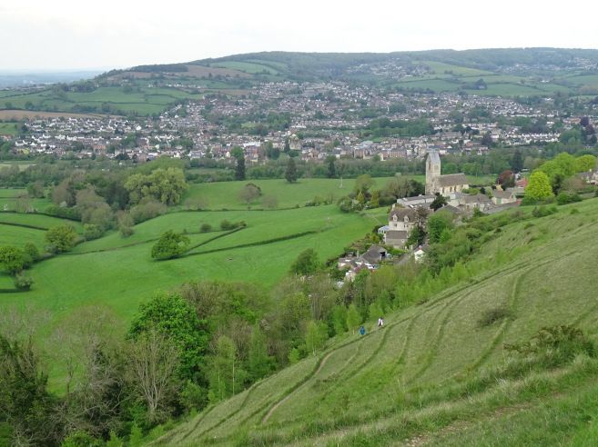
Eventually Old Sodbury neared. It was very hot by now, and after 5.30, so we were briefly tempted to skip the last “let’s deviate from the direct route to randomly climb a hill then come down again” wiggle of the way, but we resisted that temptation. It turned out to be a probably the best hillfort of the walk - small, but perfectly formed.
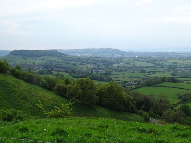
(I've no idea where these pictures were taken, except that they were taken at the same time, but here they are, anyway, to break up the text.)
And then down into Old Sodbury, pausing for a great viewpoint by the church, where we headed off the trail to an old coaching inn just outside the village. The day had grown hotter and hotter, and it was our longest day of the walk, so we didn’t initially bother checking in, just went straight to the beer garden for a nice cooling drink.
When we DID get to check in, we found that our luggage hadn’t arrived. A flurry of anxious texts ensured, but it turned out that the poor driver had been stuck in massive road closure for half the day, and our luggage eventually reached us by 7. Phew! (And poor man; he still had to get home to Cheltenham.)
Our room had a plaque on the wall, informing us that the Queen had stayed in that very room in 1981 when sheltering from a blizzard!
The pub was expecting to be full of people preparing to try horses, but we found a very comfortable table in the bar, complete with leather armchairs, and had a very nice evening. Pellinor scored lasagne number 3 of the week. All our Hadrian’s Wall accommodation providers had fed us on lasagne, so he had concluded that when walking a national trail, lasagne was the One True Meal.
Day five: 21.62 miles
Day six: Old Sodbury to Bath
After the first of our many crossings of the A46, we returned to the Way, for a pleasant few miles passing through the Capability Brown landscape of Dodington Park. (The house itself, now home to James Dyson, remained stubbornly invisible.) Then back across the A46 without a bridge, and over the M4, fortunately with a bridge.
Pleasing topiary in a normal garden, taken at some point early this day - no idea where:
A mile or two on, we were expecting to turn right, but a sign advised us that the Cotswold Way had been recently diverted to avoid an area of "persistent antisocial and indecent behaviour." The curious part of our minds rather wanted to find out more, and my completist nature felt a little unhappy about deviating from the path as it was written on the map, but the sensible majority opted to obey the diversion.
(I looked it up later, eventually finding some very eloquent descriptions on a trig-point-baggers’ forum, almost all of whom had seen some of the said "indecent behaviour" on their visits, and several of whom had to beat a hasty retreat to avoid being invited to join in.)
Then past the perimeter of the Deer Park at Dryham - any deer present hidden by the stone wall - and past the main gates of the house. "No entry," said the sign. "Entry via the A46" - i.e. several miles away, via a very busy road with no pavement. I have ongoing mental letter to the National Trust about their lack of pedestrian access to sites. I was just bringing it out and dusting it off, full of righteous indignation, when we came to a turning signed "pedestrian access to Dryham Park."
Oh. Well. It can be quite a let-down, sometimes, when you suddenly find yourself thwarted in your righteous indignation. How dare people give you just what you wanted!
(What we wanted, in this case, was just a tea room and toilets, but that’s beside the point.)
Dryham House photographed through the "you shall not pass!" gateway:
A few more miles south, then, to cross the A46 at Philadelphia, then to Cold Aston - a small village with a lovely manor house and rectory, and loads of topiary. Then - after crossing A46 again, which seemed busier and more impassible with every fresh crossing - down a very steep hill, then up again, eventually reaching Landsdowne Hill. This was the site of a battle in 1643, commemorated in a monument, pleasant stone carvings and various interpretation boards.
At some point, we found a visitor book alongside the path - a lovely touch - and paused to add an entry.
Landsdowne Hill isn’t that far from Bath at this point, but of course the Cotswold Way too us off in the opposite direction, veering us away to the west. This was a Good Thing, though, since it took us back onto the escarpment after many miles away, with lovely views over the Severn Plain over to Bristol and beyond.
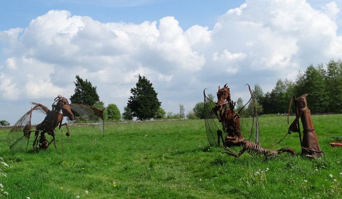
On a path beside a golf course, a wizard and his undead dog were battling dragons. No explanation was given.
After several more hilltops and viewpoints, we finally snaked round to the south and saw Bath below us: a lovely view! We descended slowly towards Bath, reaching it in its western environs - hurrah! - only to realise that that treacherous Cotswold Way now wanted us to climb a Gurt Hill out of Bath again, in order to come down into it a second time from the north.
To be fair, the northern approach was very scenic, via fields and parks, then past the Royal Crescent and Circus, but that last climb was not nice. It was very hot, and mentally we’d pretty much finished the whole thing by then, so felt that this last Gurt Hill was a mean trick.
But eventually we reached the end, outside the Abbey, where there was much rejoicing!
After that, I immediately - and voluntarily - climbed back up most of that Gurt Hill to get to our hotel, while Pellinor went to fetch the car. The people checking in just ahead of me looked cool and groomed and polite. I staggered in mud-spattered, scarlet and dripping. I’m surprised I was allowed in.
Day six: 20.44 miles (plus a couple of miles going into town again for dinner from our hotel)