Following the acorn from winter to summer - part 1
Oh dear. I've really not done well with that whole "let's get back to reading and posting things here" resolution of two months ago. So here I am, returning to my usual habit of coming here only when I want to post another immensely long post-holiday write-up. Maybe I'll do better from now on...
Anyway... We needed to be in Bradford-on-Avon last Saturday for a day of dance, and didn't fancy doing it as a day trip, so decided to spend a week walking there from the north Cotswolds. Well, the thought process wasn't quite as simple as that, but... well, that's really what it boiled down to.
On Wednesday 1 May, we got up at 3.45 as usual, to dance before sunrise. I mention this only to demonstrate that the sun DID rise and that May's weather started off rather lovely.
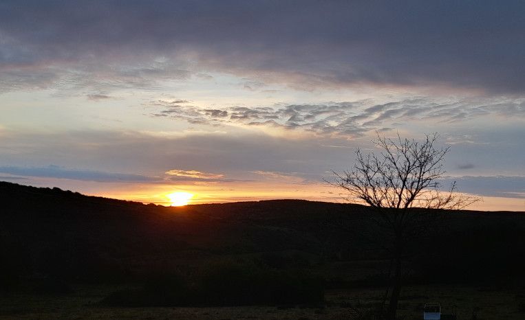
Sadly, it didn't last, and it was positively wintry by evening. The following day, we drove to Bath through drizzle and gloom. We parked our car in parking space we'd booked for a week, then got the train to Cheltenham, where my Dad picked us up.
Day one: Chipping Campden to Winchcombe
The following morning, my Dad drove us to Chipping Campden, for the start of the Cotswold Way. It wasn't a promising drive: through thick low cloud, rain hammering on the windscreen, roadsigns reading "viewpoint" barely visible in the murk. A van overtook us in the fog, then pulled over into a lay-by, where a clump of sad and soggy walkers with sad and soggy rucksacks were waving at him in desperate hope. Since this was barely a two miles from the start of the Cotswold Way, it didn't bode well.
However, the rain DID stop just in time for us to start walking. Sadly, the gloom and low cloud did not. Atmospheric, though.
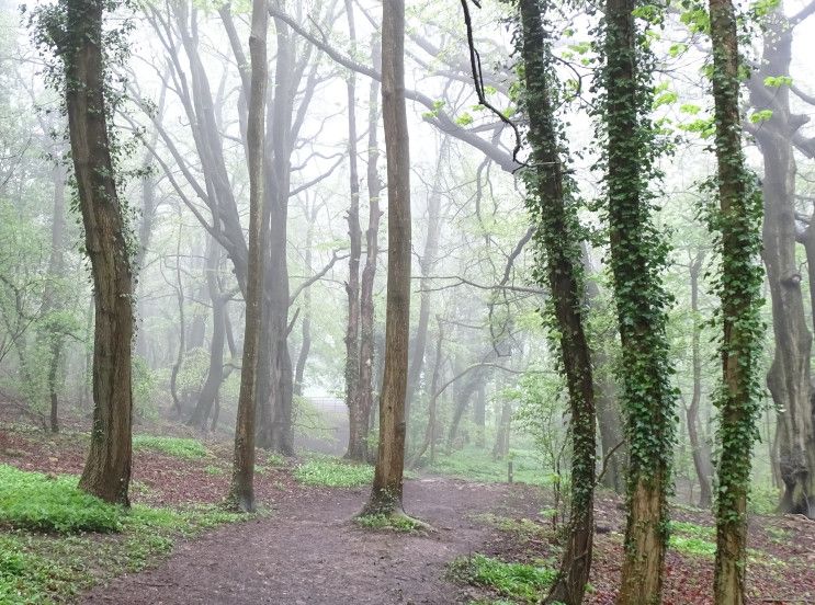
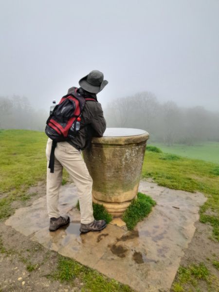
We climbed up to Dover's Hill, where the Cotswold Olimpick Games were first held in the early 17th century. (We were a month early for them this year, though.) Then to a viewpoint, where a topograph described the distant marvels we should have been able to see.
Some miles later, we reached Broadway Tower, through pleasing fairy paths of cowslips. We were told that we could see 16 counties from the top of tower, but, deciding that we would be lucky to see even one, we opted not to pay to climb it.
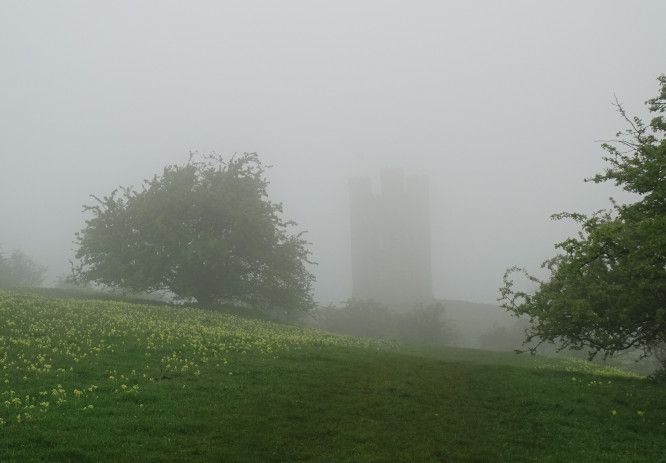
Then down into Broadway - a tourist magnet - and out the other side. Looking back, we saw that we could now see Broadway Tower, so decided that the weather was improving.
It was not. As we stopped for lunch half way up a hill, it started to rain. It wasn't heavy rain. For the most part, it was light, sometimes increasing to moderate. (And that's proper moderate, not Isle of Wight Ferry style "moderate" - as in "we've got a very moderate crossing today" which means "hold on for dear life and expect all your fellow passengers to start screaming.") However, it was driven into our faces by a sharp wind, and after four hours, even light to moderate rain leaves you drench-ed unto the skin.
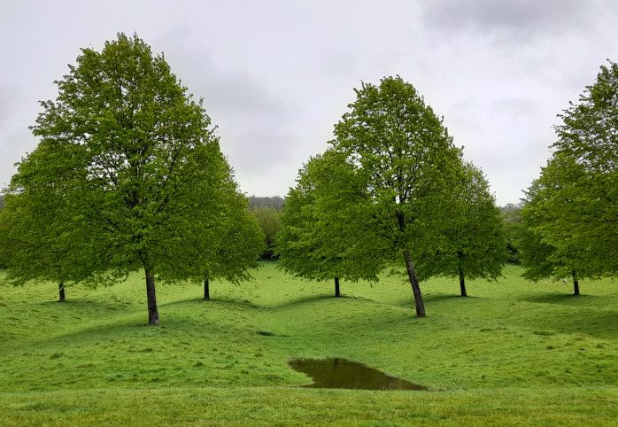
I liked this avenue running from Stanway to Wood Stanway, across the ridge and furrow.
We passed a pair of soggy Americans here, trudging sadly along under umbrellas, and I worried that they were regretting their decision to come to England for a walking holiday in May. (But worry not: we saw them again the next day, in glorious sunshine, and they said they were very happy.) At Wood Stanway, we had the first real demonstration of the main characteristic of the Cotswold Way. When you're at point A and need to get to point B a mile away, the Cotswold Way almost always takes you off in the opposite direction, makes you climb a massive hill, skirts you round a great semi-circle of escarpment, then desposits you back down in the valley an hour later, just half a mile from where you started.
That said, it was a very pleasing hilltop, especially Cromwell's Clump - a very landmarky clump of beeches on the edge of a hillfort, with a Victorian stone seat commemorating the spot where Thomas Cromwell supposedly sat to survey to dissolution of Hailes Abbey. The clump is visible from my parents' house, but not that day.
Nearby we noticed that the avenue of trees I'd photographed over an hour before was still carrying on. Apparently it runs for two miles across the Stanway House estate.
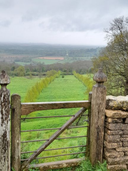
As we descended to Hailes, notices warned us not to interfere with an ongoing monitoring of water run-off. Our squelchy boots told us that, yes, there was indeed water run-off.
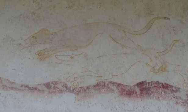
Hailes Abbey didn't look enticing in the rain, but Hailes Church promised wall paintings and No Rain, so in we went:
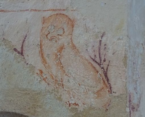
I'm not sure what this is supposed to be. It MIGHT be carrying a buckler, but I see it as Mickey Mouse rushing up with an urgent message.
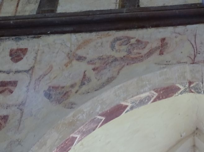
Happy dogs!
And then from Hailes to Winchcombe, across some very slippery fields of clay. "Winchcombe Welcomes Walkers" - it's official. (I can never decide if this should be "Winchcombe welcomes walkers, unlike that dreadful Broadway," or "Winchcombe Welcomes Walkers, but everyone else can go hang.") Winchcombe is particularly fond of walkers walking paths that start with W. There's the Winchcombe Way, the Windrush Way and the Warden's Way, all going through the town. (I suspect they wish the Cotswold Way was actually called the Woldcots Way.) Although all these paths often go from the same A to the same B, they go out of their way to follow different route. We walked the Winchcombe Way some years ago, but this time I pointedly snubbed it. When the paths coincided for a small way then went their separate ways, I informed the Winchcombe Way that we were Cotswold Way people - followers of the acorn - and not mere Winchcombe Way folk.
Anyway... we squelched our way through Winchcombe, past complicated road works, and back to my parents' house, where we made great use of their airing cupboard and radiators.
Day one: c. 19 miles (but I forgot to restart the count after Hailes Church, so can't be entirely sure.)
Day two: Winchcombe to Charlton Kings
The second day - Saturday - was like a different world from the day before. Sunshine! No rain! It was perfect walking weather, since there was just enough breeze to keep it from being too hot.
Leaving our bags on my parents' drive - and hoping that the baggage transfer people would pick them up - we headed out to the hills.
Blue skies!
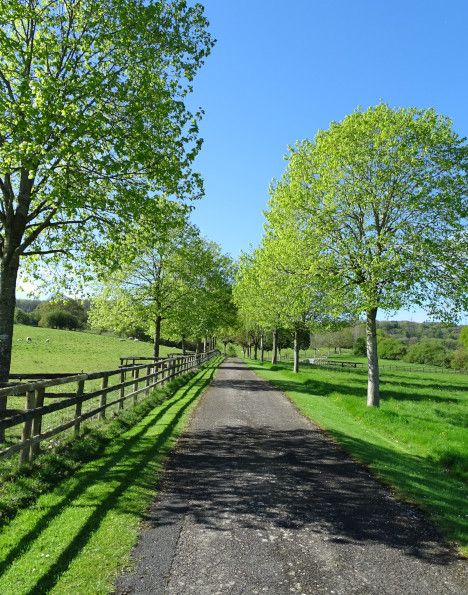
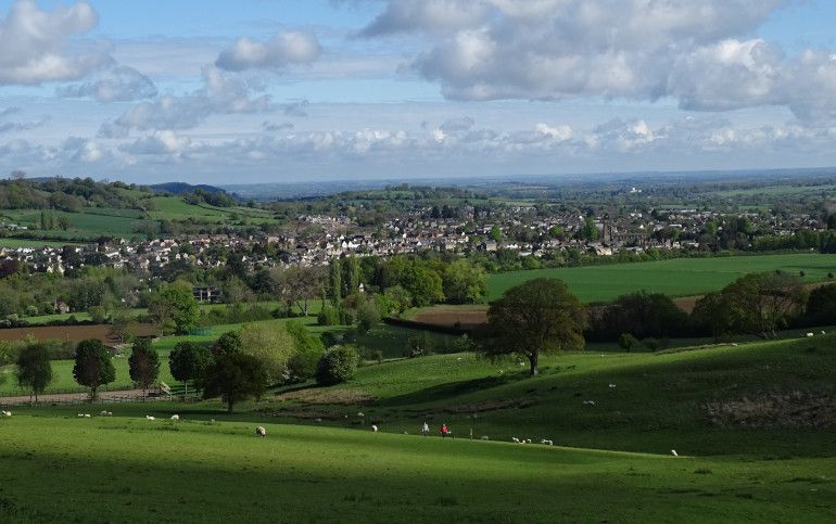
Winchcombe below us:
We headed to Belas Knap (by a totally different path from that taken by the Winchcombe Way, naturally) - a well-preserved long barrow. Although I've been many times before, I did intend to pause to look at it and photograph it, but we saw that someone had moved two very over-enthusiastic dogs away from the gate leading away from the barrow, and was clearly waiting for us to pass through, so it felt more polite just to move on.
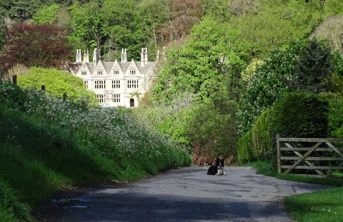
The very scenic path took us almost to Cleeve Hill, before pulling a Cotswold Way ("It Is The Way," Pellinor intoned, whenever I told him that our path was about to take us away from our actual destination) and haring off in the opposite direction, down a steep hill (Breakheart Hill - not a promising name) and half way back to Winchcombe. But at least it allowed us a good view of Postlip Hall, guarded by a ferocious beast.
Then - finally - we were allowed to climb up to Cleeve Hill, where we stopped for a cup of tea at the golf club house, and watched crowds of men on the putting green entirely fail to get a single ball into any hole.
Finally a viewpoint with an actual view!
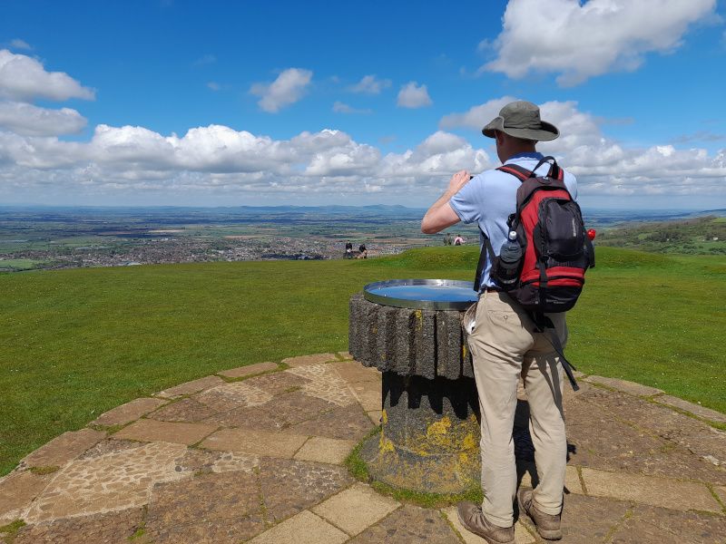
Our wedding reception was at a hotel on Cleeve Hill, and at that time they asking people to buy (or maybe just sponsor?) trig points. My Dad threatened to sponsor the Cleeve Hill trig point in our name as a wedding present, and bring the entire wedding party to the hill top for a hand over ceremony. I almost kind of wish he'd done it...
Anyway... After Cleeve Hill, the wacky Cotswold Way route planners were in a calm mood, since the path went fairly solidly south all the way to the main road at Dowdswell.
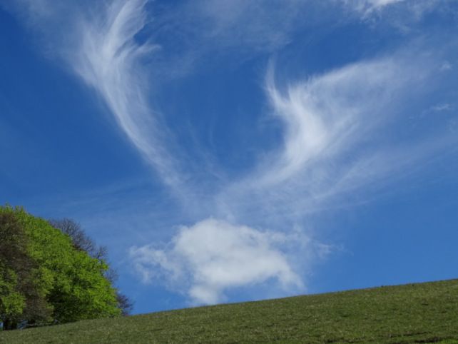
We saw a cloud dragon!
And dramatic yellow fields.
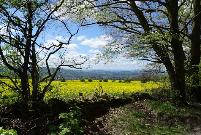
Then down the Dowdswell... and (naturally) up again - up, up, up, very steeply... only to find that after we'd slogged up a massive hill, that there was a main road at the top. (It almost annoys me when I climb a hill only to find a busy road. It never seems quite right.) We followed the route of the road, through very muddy woods alongside it, to Seven Springs - possibly a source of a Thames (but probably not.) Then, not long after, we departed from the Path of the Acorn and descended into Charlton Kings, where we found out hotel AND our luggage - hurrah!
It was a shorter day today, leaving us time for a wander through Charlton Kings, where I lived between the ages of 11 and 20. Strangely, though, it doesn't seem anything like as much like "home" as Winchcombe does, although I only lived there from 7 to 11 - although my parents moved back when I was 20 and have lived there ever since, so it's been the "home" I've returned to for the last 30+ years. Still, it was nice to see our old house (still called by the name my parents gave it in 1982, when it was brand new) and various other haunts.
Day two: 16.5 miles (plus 3 miles wandering around Charlton Kings)
Day three: Charlton Kings to Painswick
After a mile or so returning to the Path of the Acorn, we climbed up to the top of the escarpment. Charlton Kings Common looked positively vertical, looming over our hotel, but the climb wasn't quite as bad as it appeared. The next few miles were some of the nicest of the walk, as we followed the edge of the escarpment, gently curving around the south of Cheltenham, above Charlton Kings and Leckhampton. Lots of chances for me to look down into town and exclaim "I can see my school!" or "I remember walking in that park!"
Here is the Cotswold version of the Devil's Chimney. The Isle of Wight version - a narrow cleft in the cliff - sadly died in one of this winter's massive landslips.
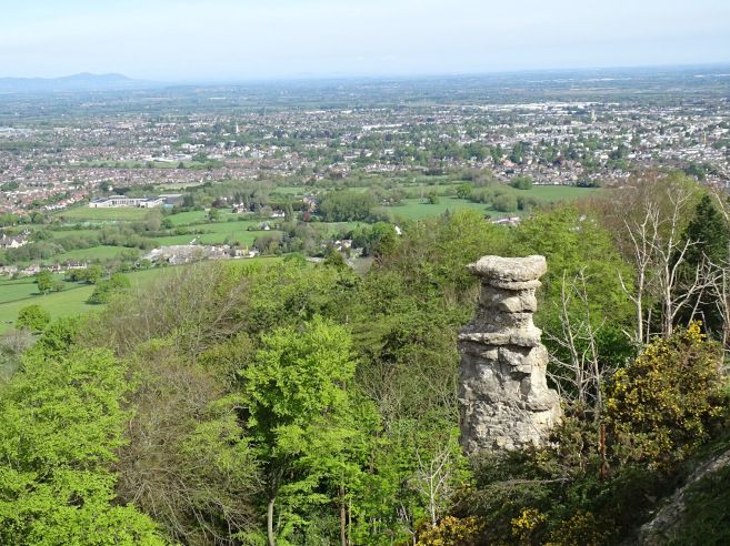
After a few miles of woods and lanes, we reached Crickley Hill, with neolithic, Iron Age and post-Roman settlement. I volunteered for a dig in the summer after my O-levels, but sadly didn't really enjoy it. I was the youngest there - a shy 16 year old surrounded by students and grown-ups, none of whom made any attempt to take me under their wing. The weather was either hideously wet or scorchingly hot, and all I did was draw rocks all day.
Anyway, it's still a nice place, and nowadays has a cafe and toilets, too, both of which we made use of.
Oh, and we saw Groot:
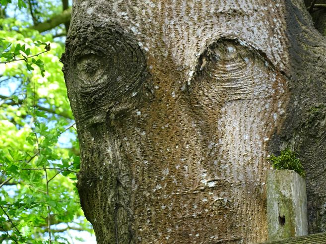
After Crickley Hill came the much-dreaded hideous road crossing at the notorious Air Balloon roundabout. So terrifying is this that when my Dad walked the Cotswold Way in stages with an organised group, they all got picked up by minibus from a layby on one side and deposited on the other. The only hope was to stand there looking poised and desperate, and hope several motorists simultaneously stopped enough to let you sprint across. They're currently busy with major road improvements at this very busy spot, which I expect will remove the roundabout and replace it with a dual carriageway, so one can only hope that a pedestrian crossing will be included.
Then came the pleasingly-named Barrow Wake hill, and after that woods. Many woods. Miles and miles of woods. They were not unpleasant woods, but oh how tired I got of those woods after several hours of them! We did emerge from them briefly, though, for Cooper's Hill, where we climbed the immensely steep hill to look down in disbelief at the well-nigh-vertical slope where the annual cheese rolling takes place. (I did photograph it, but it didn't remotely do justice to the sheer steepness of it.)
Then more woods... and eventually Painswick Beacon. Here the Cotswold Way was VERY out of character and didn't actually climb to the top of the hill, contenting itself with skirting the shoulders of the ramparts (yes, it's another hillfort) but we climbed it, anyway. However, it had been clouding over steadily all afternoon, and just as we reached the top of the ramparts, it started to rain, so visibility wasn't what it should have been. Oh well.
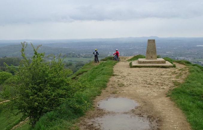
Oh, my photos here remind me to mention that we were making a mental note of all the piece of lost clothing we saw carefully displayed on stiles. I thought we'd soon get a full set, but Pellinor thought we'd never score any trousers. But we did! There were no underpants or bras (thankfully) but we definitely scored a full set apart from that.
Anyway... A little later, we popped into Painswick Rococo Gardens, which were laid out in the mid eighteenth century in full Rococo style, complete with follies, ornate viewing platforms and the like. To be honest, there's precious little garden there, and it's more like a woodland - yes, yet more wood! - scattered with follies. But the tea and cake was nice, and the maze was fun.
There was Art. Unintentionally(?) comical...
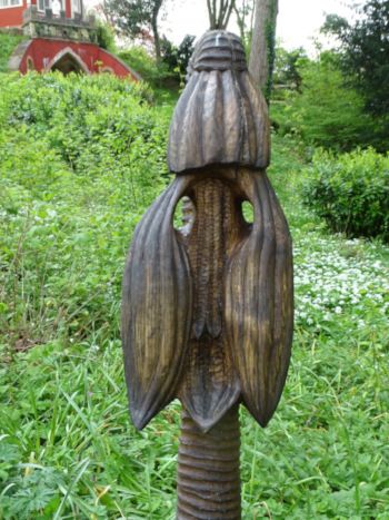
pretty...
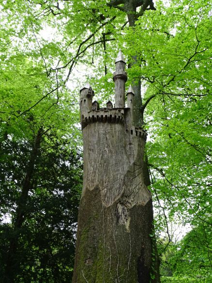
...and downright disturbing, in a Probably Ritual way.
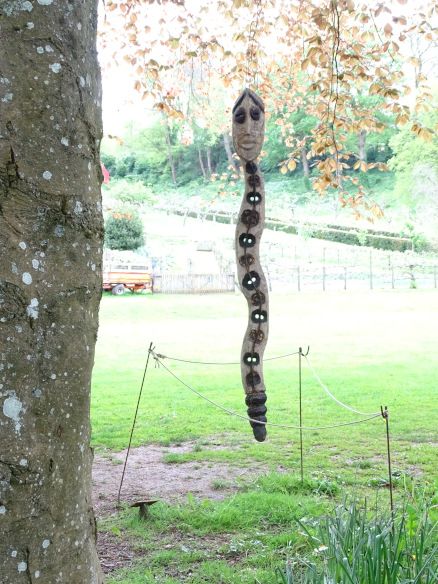
And so into Painswick, for a nice B&B. We ate in a nearby pub, where the waiter came over to tell us the specials of the day. We duly ordered them... only for him to remember that it was Sunday and therefore it was roast or nothing. Oh well. It was a nice enough roast.
Day three: c. 17 miles
More to come...
Anyway... We needed to be in Bradford-on-Avon last Saturday for a day of dance, and didn't fancy doing it as a day trip, so decided to spend a week walking there from the north Cotswolds. Well, the thought process wasn't quite as simple as that, but... well, that's really what it boiled down to.
On Wednesday 1 May, we got up at 3.45 as usual, to dance before sunrise. I mention this only to demonstrate that the sun DID rise and that May's weather started off rather lovely.

Sadly, it didn't last, and it was positively wintry by evening. The following day, we drove to Bath through drizzle and gloom. We parked our car in parking space we'd booked for a week, then got the train to Cheltenham, where my Dad picked us up.
Day one: Chipping Campden to Winchcombe
The following morning, my Dad drove us to Chipping Campden, for the start of the Cotswold Way. It wasn't a promising drive: through thick low cloud, rain hammering on the windscreen, roadsigns reading "viewpoint" barely visible in the murk. A van overtook us in the fog, then pulled over into a lay-by, where a clump of sad and soggy walkers with sad and soggy rucksacks were waving at him in desperate hope. Since this was barely a two miles from the start of the Cotswold Way, it didn't bode well.
However, the rain DID stop just in time for us to start walking. Sadly, the gloom and low cloud did not. Atmospheric, though.

We climbed up to Dover's Hill, where the Cotswold Olimpick Games were first held in the early 17th century. (We were a month early for them this year, though.) Then to a viewpoint, where a topograph described the distant marvels we should have been able to see.

Some miles later, we reached Broadway Tower, through pleasing fairy paths of cowslips. We were told that we could see 16 counties from the top of tower, but, deciding that we would be lucky to see even one, we opted not to pay to climb it.

Then down into Broadway - a tourist magnet - and out the other side. Looking back, we saw that we could now see Broadway Tower, so decided that the weather was improving.
It was not. As we stopped for lunch half way up a hill, it started to rain. It wasn't heavy rain. For the most part, it was light, sometimes increasing to moderate. (And that's proper moderate, not Isle of Wight Ferry style "moderate" - as in "we've got a very moderate crossing today" which means "hold on for dear life and expect all your fellow passengers to start screaming.") However, it was driven into our faces by a sharp wind, and after four hours, even light to moderate rain leaves you drench-ed unto the skin.
I liked this avenue running from Stanway to Wood Stanway, across the ridge and furrow.

We passed a pair of soggy Americans here, trudging sadly along under umbrellas, and I worried that they were regretting their decision to come to England for a walking holiday in May. (But worry not: we saw them again the next day, in glorious sunshine, and they said they were very happy.) At Wood Stanway, we had the first real demonstration of the main characteristic of the Cotswold Way. When you're at point A and need to get to point B a mile away, the Cotswold Way almost always takes you off in the opposite direction, makes you climb a massive hill, skirts you round a great semi-circle of escarpment, then desposits you back down in the valley an hour later, just half a mile from where you started.
That said, it was a very pleasing hilltop, especially Cromwell's Clump - a very landmarky clump of beeches on the edge of a hillfort, with a Victorian stone seat commemorating the spot where Thomas Cromwell supposedly sat to survey to dissolution of Hailes Abbey. The clump is visible from my parents' house, but not that day.
Nearby we noticed that the avenue of trees I'd photographed over an hour before was still carrying on. Apparently it runs for two miles across the Stanway House estate.

As we descended to Hailes, notices warned us not to interfere with an ongoing monitoring of water run-off. Our squelchy boots told us that, yes, there was indeed water run-off.
Hailes Abbey didn't look enticing in the rain, but Hailes Church promised wall paintings and No Rain, so in we went:

I'm not sure what this is supposed to be. It MIGHT be carrying a buckler, but I see it as Mickey Mouse rushing up with an urgent message.

Happy dogs!

And then from Hailes to Winchcombe, across some very slippery fields of clay. "Winchcombe Welcomes Walkers" - it's official. (I can never decide if this should be "Winchcombe welcomes walkers, unlike that dreadful Broadway," or "Winchcombe Welcomes Walkers, but everyone else can go hang.") Winchcombe is particularly fond of walkers walking paths that start with W. There's the Winchcombe Way, the Windrush Way and the Warden's Way, all going through the town. (I suspect they wish the Cotswold Way was actually called the Woldcots Way.) Although all these paths often go from the same A to the same B, they go out of their way to follow different route. We walked the Winchcombe Way some years ago, but this time I pointedly snubbed it. When the paths coincided for a small way then went their separate ways, I informed the Winchcombe Way that we were Cotswold Way people - followers of the acorn - and not mere Winchcombe Way folk.
Anyway... we squelched our way through Winchcombe, past complicated road works, and back to my parents' house, where we made great use of their airing cupboard and radiators.
Day one: c. 19 miles (but I forgot to restart the count after Hailes Church, so can't be entirely sure.)
Day two: Winchcombe to Charlton Kings
The second day - Saturday - was like a different world from the day before. Sunshine! No rain! It was perfect walking weather, since there was just enough breeze to keep it from being too hot.
Leaving our bags on my parents' drive - and hoping that the baggage transfer people would pick them up - we headed out to the hills.
Blue skies!

Winchcombe below us:

We headed to Belas Knap (by a totally different path from that taken by the Winchcombe Way, naturally) - a well-preserved long barrow. Although I've been many times before, I did intend to pause to look at it and photograph it, but we saw that someone had moved two very over-enthusiastic dogs away from the gate leading away from the barrow, and was clearly waiting for us to pass through, so it felt more polite just to move on.
The very scenic path took us almost to Cleeve Hill, before pulling a Cotswold Way ("It Is The Way," Pellinor intoned, whenever I told him that our path was about to take us away from our actual destination) and haring off in the opposite direction, down a steep hill (Breakheart Hill - not a promising name) and half way back to Winchcombe. But at least it allowed us a good view of Postlip Hall, guarded by a ferocious beast.

Then - finally - we were allowed to climb up to Cleeve Hill, where we stopped for a cup of tea at the golf club house, and watched crowds of men on the putting green entirely fail to get a single ball into any hole.
Finally a viewpoint with an actual view!

Our wedding reception was at a hotel on Cleeve Hill, and at that time they asking people to buy (or maybe just sponsor?) trig points. My Dad threatened to sponsor the Cleeve Hill trig point in our name as a wedding present, and bring the entire wedding party to the hill top for a hand over ceremony. I almost kind of wish he'd done it...
Anyway... After Cleeve Hill, the wacky Cotswold Way route planners were in a calm mood, since the path went fairly solidly south all the way to the main road at Dowdswell.
We saw a cloud dragon!

And dramatic yellow fields.

Then down the Dowdswell... and (naturally) up again - up, up, up, very steeply... only to find that after we'd slogged up a massive hill, that there was a main road at the top. (It almost annoys me when I climb a hill only to find a busy road. It never seems quite right.) We followed the route of the road, through very muddy woods alongside it, to Seven Springs - possibly a source of a Thames (but probably not.) Then, not long after, we departed from the Path of the Acorn and descended into Charlton Kings, where we found out hotel AND our luggage - hurrah!
It was a shorter day today, leaving us time for a wander through Charlton Kings, where I lived between the ages of 11 and 20. Strangely, though, it doesn't seem anything like as much like "home" as Winchcombe does, although I only lived there from 7 to 11 - although my parents moved back when I was 20 and have lived there ever since, so it's been the "home" I've returned to for the last 30+ years. Still, it was nice to see our old house (still called by the name my parents gave it in 1982, when it was brand new) and various other haunts.
Day two: 16.5 miles (plus 3 miles wandering around Charlton Kings)
Day three: Charlton Kings to Painswick
After a mile or so returning to the Path of the Acorn, we climbed up to the top of the escarpment. Charlton Kings Common looked positively vertical, looming over our hotel, but the climb wasn't quite as bad as it appeared. The next few miles were some of the nicest of the walk, as we followed the edge of the escarpment, gently curving around the south of Cheltenham, above Charlton Kings and Leckhampton. Lots of chances for me to look down into town and exclaim "I can see my school!" or "I remember walking in that park!"
Here is the Cotswold version of the Devil's Chimney. The Isle of Wight version - a narrow cleft in the cliff - sadly died in one of this winter's massive landslips.

After a few miles of woods and lanes, we reached Crickley Hill, with neolithic, Iron Age and post-Roman settlement. I volunteered for a dig in the summer after my O-levels, but sadly didn't really enjoy it. I was the youngest there - a shy 16 year old surrounded by students and grown-ups, none of whom made any attempt to take me under their wing. The weather was either hideously wet or scorchingly hot, and all I did was draw rocks all day.
Anyway, it's still a nice place, and nowadays has a cafe and toilets, too, both of which we made use of.
Oh, and we saw Groot:

After Crickley Hill came the much-dreaded hideous road crossing at the notorious Air Balloon roundabout. So terrifying is this that when my Dad walked the Cotswold Way in stages with an organised group, they all got picked up by minibus from a layby on one side and deposited on the other. The only hope was to stand there looking poised and desperate, and hope several motorists simultaneously stopped enough to let you sprint across. They're currently busy with major road improvements at this very busy spot, which I expect will remove the roundabout and replace it with a dual carriageway, so one can only hope that a pedestrian crossing will be included.
Then came the pleasingly-named Barrow Wake hill, and after that woods. Many woods. Miles and miles of woods. They were not unpleasant woods, but oh how tired I got of those woods after several hours of them! We did emerge from them briefly, though, for Cooper's Hill, where we climbed the immensely steep hill to look down in disbelief at the well-nigh-vertical slope where the annual cheese rolling takes place. (I did photograph it, but it didn't remotely do justice to the sheer steepness of it.)
Then more woods... and eventually Painswick Beacon. Here the Cotswold Way was VERY out of character and didn't actually climb to the top of the hill, contenting itself with skirting the shoulders of the ramparts (yes, it's another hillfort) but we climbed it, anyway. However, it had been clouding over steadily all afternoon, and just as we reached the top of the ramparts, it started to rain, so visibility wasn't what it should have been. Oh well.
Oh, my photos here remind me to mention that we were making a mental note of all the piece of lost clothing we saw carefully displayed on stiles. I thought we'd soon get a full set, but Pellinor thought we'd never score any trousers. But we did! There were no underpants or bras (thankfully) but we definitely scored a full set apart from that.
Anyway... A little later, we popped into Painswick Rococo Gardens, which were laid out in the mid eighteenth century in full Rococo style, complete with follies, ornate viewing platforms and the like. To be honest, there's precious little garden there, and it's more like a woodland - yes, yet more wood! - scattered with follies. But the tea and cake was nice, and the maze was fun.
There was Art. Unintentionally(?) comical...

pretty...

...and downright disturbing, in a Probably Ritual way.

And so into Painswick, for a nice B&B. We ate in a nearby pub, where the waiter came over to tell us the specials of the day. We duly ordered them... only for him to remember that it was Sunday and therefore it was roast or nothing. Oh well. It was a nice enough roast.
Day three: c. 17 miles
More to come...