Seven Falls and Three Pools
Yesterday I went hiking because, let's face it, it has been too long. The legs gotta move. Also, I still haven't gone to all the common places just in the local area, much less down toward Ventura where I'd like to go soon. Since we had a nice rain over the weekend, I went up to see these Seven Falls with a thought to maybe going further to something else in the area. I printed out a map piece expecting it to be of little help while actually going places, but useful if deciding on something more. This is indeed about how it was.
I did a couple errands and got up to the end of Tunnel Road half an hour before noon. There was a spot up by the trailhead that I could have fit into, but I didn't really feel like making the effort and unlike the badly parked people begging for tickets in this well ticketed area, I took a spot a little lower and made the effort to hike up instead. When I came to the creek, I turned up the use trail that follows beside it. There is so much vegetation that it can be hard to see the creek along much of this trail. Some people just rock hop up instead of taking the trail, and I did a little of that, but tended to the high route.
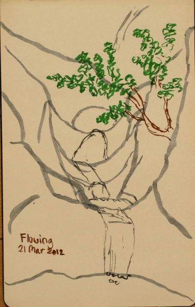
The use trail grows as it crosses Jesusita and the main one crosses over to the left side of the creek. I continued to stick to the high road until near the falls, where there kept being small trails that just seemed to take up strait up. The first few of those were large, so probably even well used. I stopped at one point to draw because I didn't feel like the camera was capturing what I saw.

This also turned out to be the spot where the high trail seemed to fizzle. I crossed the creek and made my way along it. There were many people, so if I wasn't sure where to go, I could quickly enough find someone to follow. Without too much balancing, I made my way up to the top of the first fall of the Seven Falls chain, but could not go past. I was told about crossing over to here and hugging rocks there but not today because today the water is high. I said but if the water was so low, it wouldn't be flowing. That seemed like a non-ideal time to go. One group with a leader that usually made his way through the falls decided to try a route directly to the right of the hard rocks that stick out to make the passage difficult. I told them that there was a major use trail back a little way on the other side that likely would go up and around but they felt that that actually goes somewhere else.
I looked around the bottom pool a few minutes and watched a frog trying to climb that one. The group came back down the slide having not found their way up and over. I followed them back down a few minutes later and took the more major use trail up the side. It split into a well used flat path back and a disused up route. I followed the flat even though it was going the wrong way. That brought me to a very well used path, probably going to Cathedral Peak. Figuring this was as good a spot to go on to, I went up it until the next flat path across, when I decided to continue on with my original plan. This path turned out to be a pretty good route through the difficult rocks, dropping down to the canyon a little past the falls with a few use trails that dropped faster and closer to the falls.
I looked around downward and continued up. The trail came to a fall that was also difficult to pass. I went up a rock with some nice steps in it and for the last handhold, a divot someone had carved that allowed me to get to a wide ledge and up an easy slope of dirt and growth. From there, I continued on to Three Pools and a little further. The water vanished to flow underground a couple times as I went. The pools are each the bottoms of waterfalls, the first two chained and the third after a shallow cascade over bare rock. The last one is quite deep and gets wider as it goes down. I think the only thing to expect after this is Mission Falls, which Tunnel Trail goes along the top of. I looked at the GPS which said I had only made it 2.5 miles so far and didn't really want to do all that. Well, there's also more creek, of course. But I wasn't really looking for a long hike, so I turned back.
Getting back down the free climb was a bit of a do. I hadn't much liked the very last bit along the crack. I poked around the upper section but didn't see anything inviting. Another climb to maybe get to somewhere where there was dirt to travel, but more likely have to find my way back down instead. I went back to the end of the lowest dirt and felt around for some hand holds and managed to make myself feel secure as I made my way back across to the wider section of the ledge. Then grabbed hold of that carved spot and found my way to the ever larger foot holds downward until being safely on the flat again.
I took the same trail back, up and over the falls. I came out a little higher on the major use trail and couldn't see it going further, but the satellite suggests this is the trail to Cathedral Peak. Jesusita is easily found on the far slope of another canyon. I followed the major use trail all the way back down, coming out just a few feet short of where Jesusita crosses the creek. I took Jesusita back to Tunnel and the road.
I did a couple errands and got up to the end of Tunnel Road half an hour before noon. There was a spot up by the trailhead that I could have fit into, but I didn't really feel like making the effort and unlike the badly parked people begging for tickets in this well ticketed area, I took a spot a little lower and made the effort to hike up instead. When I came to the creek, I turned up the use trail that follows beside it. There is so much vegetation that it can be hard to see the creek along much of this trail. Some people just rock hop up instead of taking the trail, and I did a little of that, but tended to the high route.
The use trail grows as it crosses Jesusita and the main one crosses over to the left side of the creek. I continued to stick to the high road until near the falls, where there kept being small trails that just seemed to take up strait up. The first few of those were large, so probably even well used. I stopped at one point to draw because I didn't feel like the camera was capturing what I saw.
This also turned out to be the spot where the high trail seemed to fizzle. I crossed the creek and made my way along it. There were many people, so if I wasn't sure where to go, I could quickly enough find someone to follow. Without too much balancing, I made my way up to the top of the first fall of the Seven Falls chain, but could not go past. I was told about crossing over to here and hugging rocks there but not today because today the water is high. I said but if the water was so low, it wouldn't be flowing. That seemed like a non-ideal time to go. One group with a leader that usually made his way through the falls decided to try a route directly to the right of the hard rocks that stick out to make the passage difficult. I told them that there was a major use trail back a little way on the other side that likely would go up and around but they felt that that actually goes somewhere else.
I looked around the bottom pool a few minutes and watched a frog trying to climb that one. The group came back down the slide having not found their way up and over. I followed them back down a few minutes later and took the more major use trail up the side. It split into a well used flat path back and a disused up route. I followed the flat even though it was going the wrong way. That brought me to a very well used path, probably going to Cathedral Peak. Figuring this was as good a spot to go on to, I went up it until the next flat path across, when I decided to continue on with my original plan. This path turned out to be a pretty good route through the difficult rocks, dropping down to the canyon a little past the falls with a few use trails that dropped faster and closer to the falls.
I looked around downward and continued up. The trail came to a fall that was also difficult to pass. I went up a rock with some nice steps in it and for the last handhold, a divot someone had carved that allowed me to get to a wide ledge and up an easy slope of dirt and growth. From there, I continued on to Three Pools and a little further. The water vanished to flow underground a couple times as I went. The pools are each the bottoms of waterfalls, the first two chained and the third after a shallow cascade over bare rock. The last one is quite deep and gets wider as it goes down. I think the only thing to expect after this is Mission Falls, which Tunnel Trail goes along the top of. I looked at the GPS which said I had only made it 2.5 miles so far and didn't really want to do all that. Well, there's also more creek, of course. But I wasn't really looking for a long hike, so I turned back.
Getting back down the free climb was a bit of a do. I hadn't much liked the very last bit along the crack. I poked around the upper section but didn't see anything inviting. Another climb to maybe get to somewhere where there was dirt to travel, but more likely have to find my way back down instead. I went back to the end of the lowest dirt and felt around for some hand holds and managed to make myself feel secure as I made my way back across to the wider section of the ledge. Then grabbed hold of that carved spot and found my way to the ever larger foot holds downward until being safely on the flat again.
I took the same trail back, up and over the falls. I came out a little higher on the major use trail and couldn't see it going further, but the satellite suggests this is the trail to Cathedral Peak. Jesusita is easily found on the far slope of another canyon. I followed the major use trail all the way back down, coming out just a few feet short of where Jesusita crosses the creek. I took Jesusita back to Tunnel and the road.