Nome, Alaska: Ruins of the White Alice facility
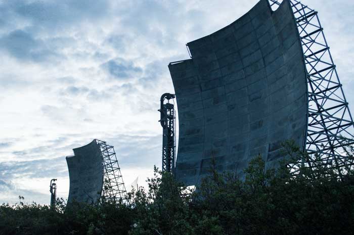
There's a mountain overlooking Nome. It's called Anvil Mountain, and on that mountain is a kind of monument to the Cold War. You can see it from just about anywhere in town. These four enormous antennas squat over the landscape, a silent testament to the money and lives squandered on endless political bickering.
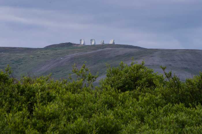
When I saw them, I had to check them out.
These four antennas are part of the old "White Alice" system, a communication system that was part of the old Distant Early Warning radar installation all along Alaska, constantly searching the sky for signs of Russian bombers sneaking over the Arctic and heading across Canada toward the United States.
The system was designed in the 1950s, when fear of the Commies was really starting to gain traction. The Distant Early Warning line was a set of remote high-powered radar facilities all along Alaska, but the designers had a problem. Alaska is huge. If you count the string of islands that extends from its western edge, many of which were home to DEW radar, Alaska is about the same distance stem to stern as the distance from California to New York.
And there are no roads, no telephone lines, and no power lines. Even today, there is no way to get to Nome by road; roads linking it to the rest of Alaska simply do not exist. You get in and out by air or barge, and that's it.
The radar stations along the DEW line needed to be able to talk to command and control centers. Normal radio wouldn't work; Alaska is so large that the curve of the earth renders line-of-sight radio unworkable.
So the Air Force came up with an idea: troposphere scattering. Basically, they decided to use enormous antennas pointed at the horizon to blast an immensely powerful radio signal, so strong it would bounce and scatter from the upper layers of the atmosphere, reaching stations beyond the curve of the earth.
The system was code-named "White Alice" and was built at enormous cost in the 1950s and operated through the 1970s, when satellite communication made it obsolete. By the time it was decommissioned, there were 71 of these stations, including the one on Anvil Mountain.
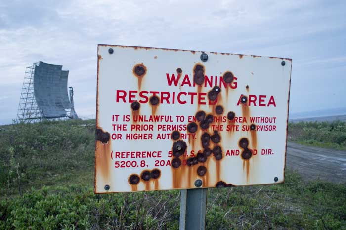
I borrowed a 4x4 and drove up the mountain. The facility is surrounded by a chain-link fence that has long since been pulled down and yanked apart in places. An ancient, battered sign warns trespassers that it's a restricted area; the locals seem to use it for target practice.
The White Alice installations were powered by enormous diesel generators. Each of the four antennas at a facility consumed up to 10 KW of power; the generators provided power for the transmitters, the living quarters, and small line-of-site microwave dishes that provided short-range communication.
Most of the White Alice facilities have been completely dismantled. Several of them are toxic waste sites, as diesel fuel and other contaminants have been dumped all over the place.
When the Anvil Mountain White Alice facility was decommissioned, the residents of Nome asked the Corps of Engineers to leave the four big antennas. Everything else is gone.
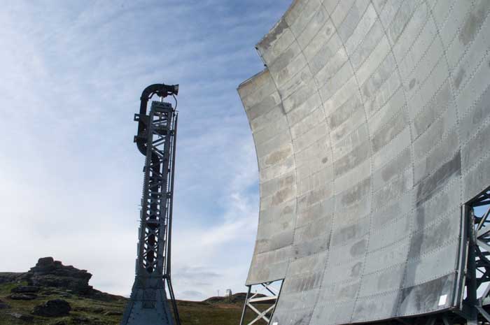
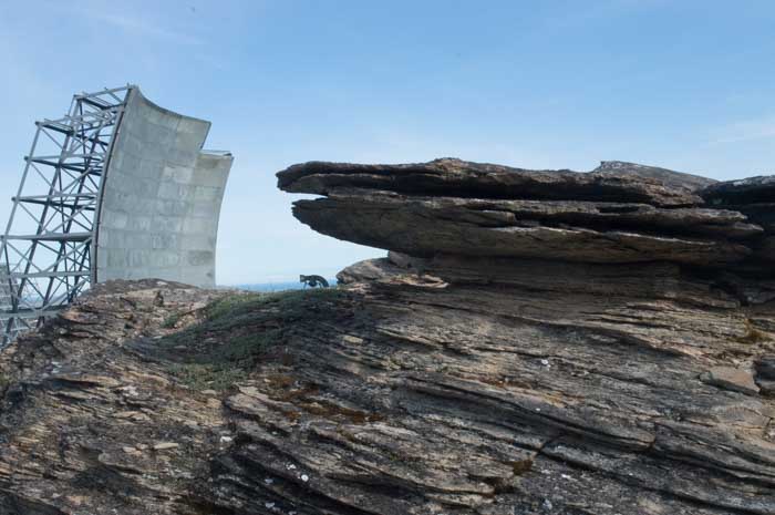
These antennas are huge--about five stories tall.
Cost overruns, under-engineered specifications, and overly optimistic maintenance projections made the White Alice project run ten times over budget. Most of the materials to build the installations--hundreds of tons of equipment for each one--were shipped to remote mountain peaks by dogsled. Airbases were constructed at many of the sites to get fuel, people, and supplies in and out. Technicians worked at these sites year round, facing minus 30 degree weather or worse during the winter.

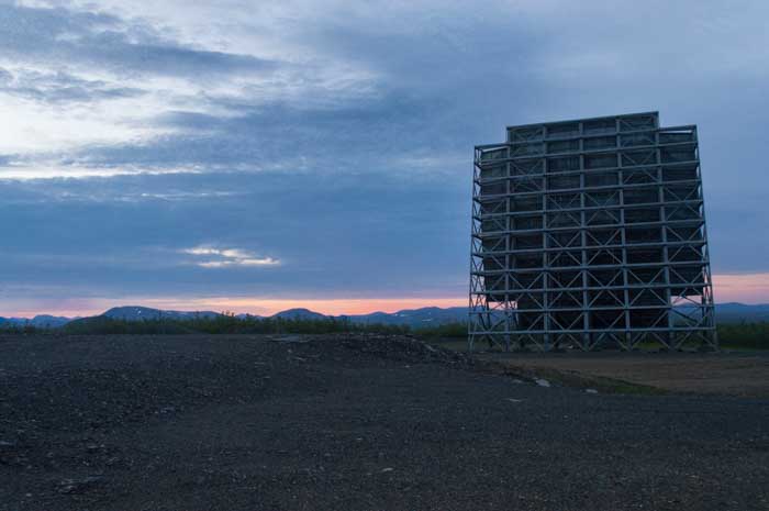
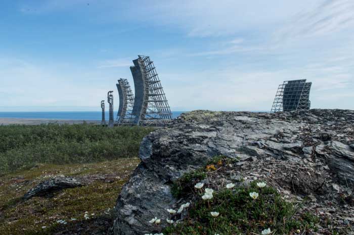
We went up twice, once during the afternoon and once at 1:30 in the morning to watch the simultaneous sunrise and sunset. I can only imagine how miserable it must have been to work here; in the middle of one of the warmest summers on record, when Nome was facing over-70-degree weather, it was cold and windy on top of the mountain. Winter, when the sun hardly comes up, must have been brutal.
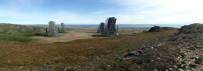
I used my smartphone to take a panorama showing the whole installation from the very peak of Anvil Mountain. Click to embiggen!

When I saw them, I had to check them out.
These four antennas are part of the old "White Alice" system, a communication system that was part of the old Distant Early Warning radar installation all along Alaska, constantly searching the sky for signs of Russian bombers sneaking over the Arctic and heading across Canada toward the United States.
The system was designed in the 1950s, when fear of the Commies was really starting to gain traction. The Distant Early Warning line was a set of remote high-powered radar facilities all along Alaska, but the designers had a problem. Alaska is huge. If you count the string of islands that extends from its western edge, many of which were home to DEW radar, Alaska is about the same distance stem to stern as the distance from California to New York.
And there are no roads, no telephone lines, and no power lines. Even today, there is no way to get to Nome by road; roads linking it to the rest of Alaska simply do not exist. You get in and out by air or barge, and that's it.
The radar stations along the DEW line needed to be able to talk to command and control centers. Normal radio wouldn't work; Alaska is so large that the curve of the earth renders line-of-sight radio unworkable.
So the Air Force came up with an idea: troposphere scattering. Basically, they decided to use enormous antennas pointed at the horizon to blast an immensely powerful radio signal, so strong it would bounce and scatter from the upper layers of the atmosphere, reaching stations beyond the curve of the earth.
The system was code-named "White Alice" and was built at enormous cost in the 1950s and operated through the 1970s, when satellite communication made it obsolete. By the time it was decommissioned, there were 71 of these stations, including the one on Anvil Mountain.
I borrowed a 4x4 and drove up the mountain. The facility is surrounded by a chain-link fence that has long since been pulled down and yanked apart in places. An ancient, battered sign warns trespassers that it's a restricted area; the locals seem to use it for target practice.

The White Alice installations were powered by enormous diesel generators. Each of the four antennas at a facility consumed up to 10 KW of power; the generators provided power for the transmitters, the living quarters, and small line-of-site microwave dishes that provided short-range communication.
Most of the White Alice facilities have been completely dismantled. Several of them are toxic waste sites, as diesel fuel and other contaminants have been dumped all over the place.
When the Anvil Mountain White Alice facility was decommissioned, the residents of Nome asked the Corps of Engineers to leave the four big antennas. Everything else is gone.
These antennas are huge--about five stories tall.


Cost overruns, under-engineered specifications, and overly optimistic maintenance projections made the White Alice project run ten times over budget. Most of the materials to build the installations--hundreds of tons of equipment for each one--were shipped to remote mountain peaks by dogsled. Airbases were constructed at many of the sites to get fuel, people, and supplies in and out. Technicians worked at these sites year round, facing minus 30 degree weather or worse during the winter.


We went up twice, once during the afternoon and once at 1:30 in the morning to watch the simultaneous sunrise and sunset. I can only imagine how miserable it must have been to work here; in the middle of one of the warmest summers on record, when Nome was facing over-70-degree weather, it was cold and windy on top of the mountain. Winter, when the sun hardly comes up, must have been brutal.


I used my smartphone to take a panorama showing the whole installation from the very peak of Anvil Mountain. Click to embiggen!
