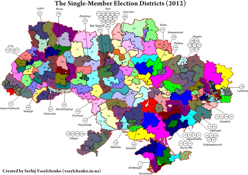
Single-mandate electoral districts by oblast (2012)
For everyone interested in the 2012 parliamentary elections in Ukraine, here are maps of electoral districts by oblast. They can be compared to the electoral districts from 2002 and the changes made to their boundaries.
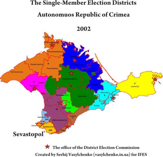
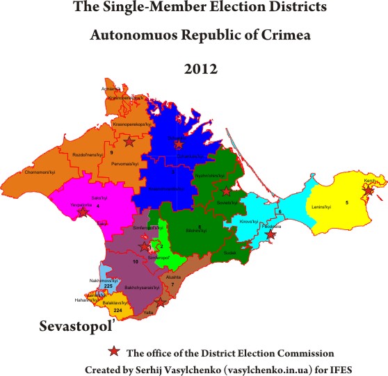
Autonomuos Republic of Crimea
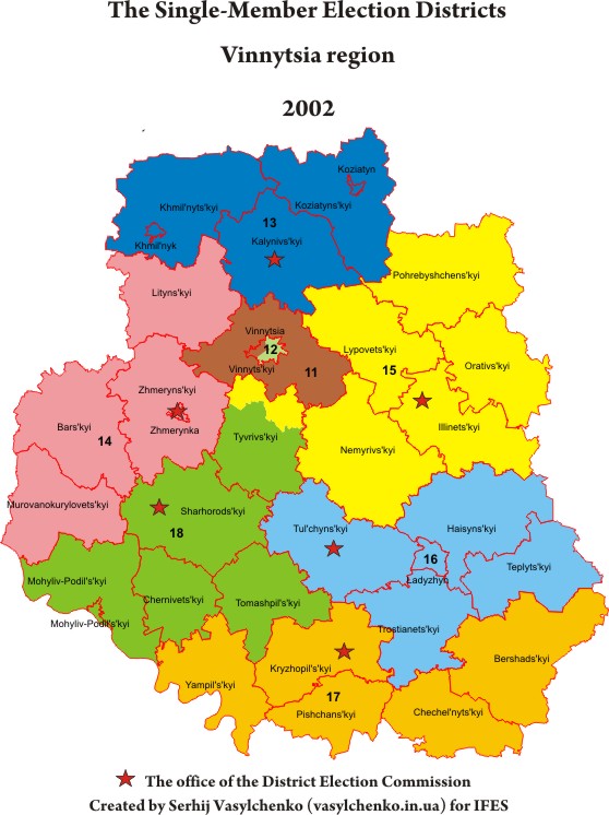
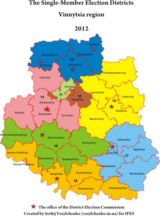
Vinnytsia region
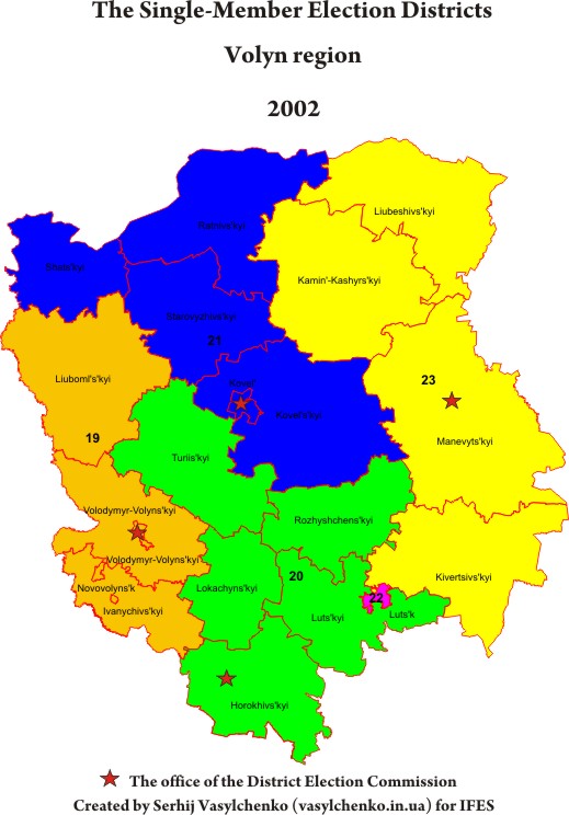
Volyn region

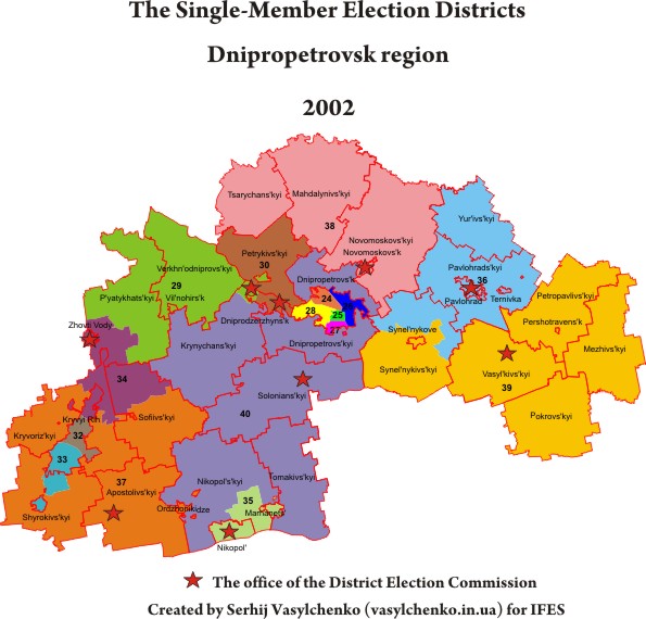
Dnipropetrovsk region
Then the CEC moved the center of electoral district #29 from Dnipropetrovsk to the city-type village Yuvileyne in the Dnipropetrovsk raion.

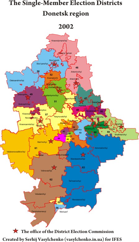
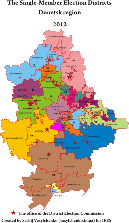
Donetsk region
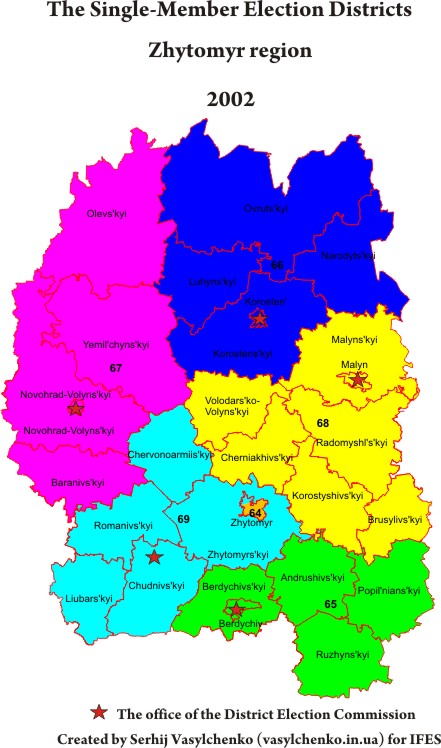
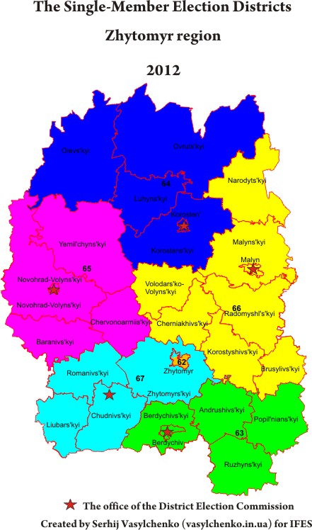
Zhytomyr region
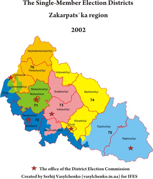
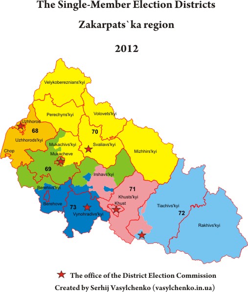
Zakarpats`ka region
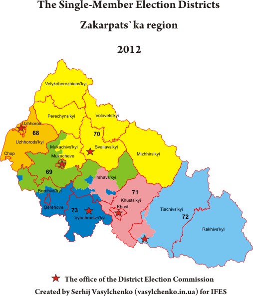
Then the CEC merged the Batrad village council in electoral district #69, thereby liquidating another enclave.
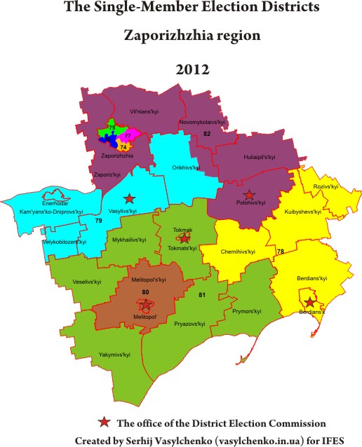
Zaporizhzhia region

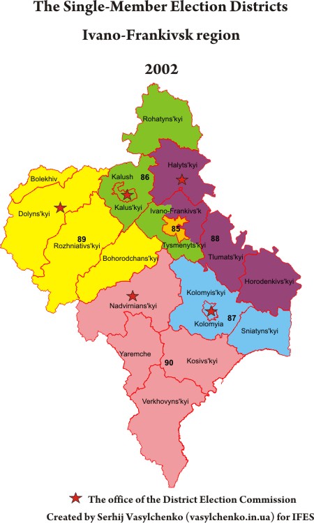
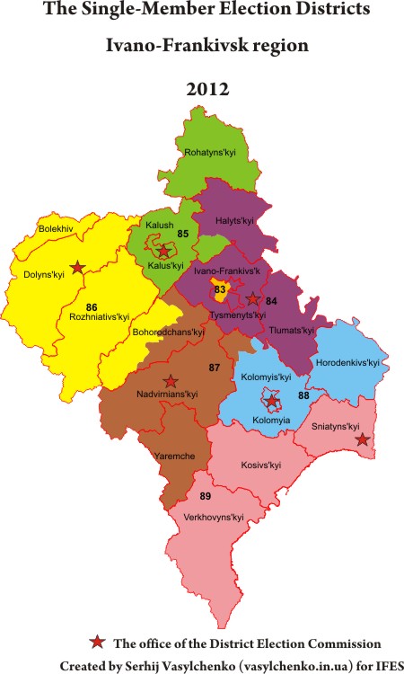
Ivano-Frankivsk region
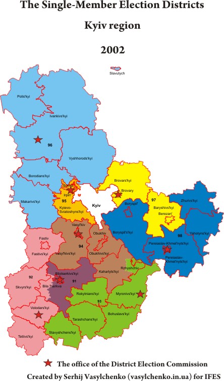
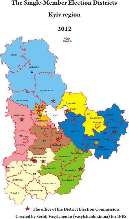
Kyiv region
Then the CEC merged the village Ruda in electoral district #91, but the current scale does not show this.
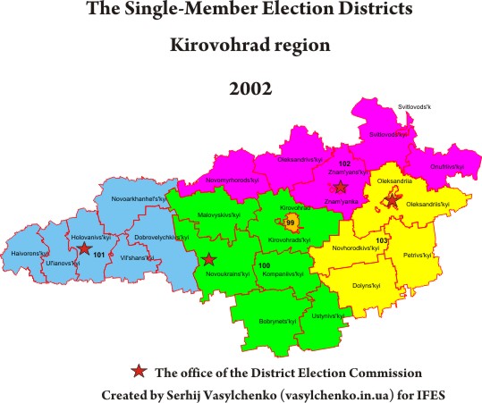
Kirovohrad region
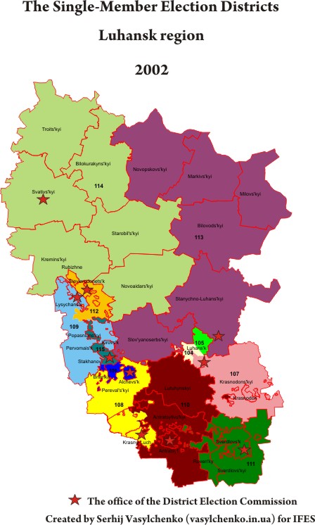
Luhansk region
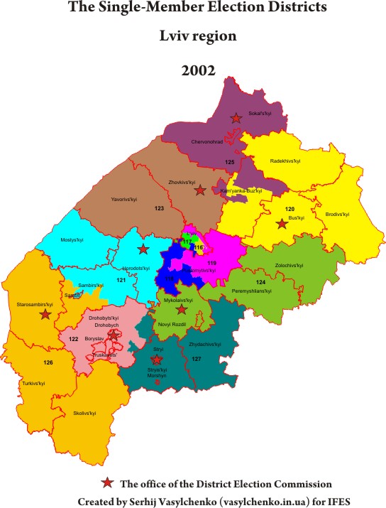
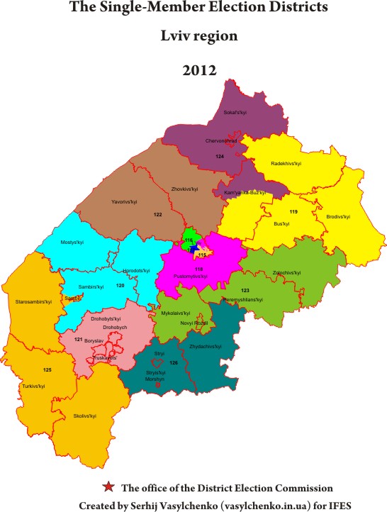
Lviv region
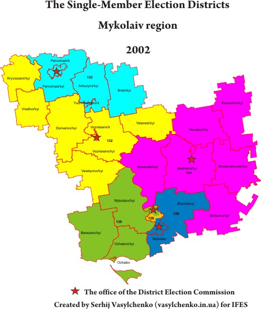
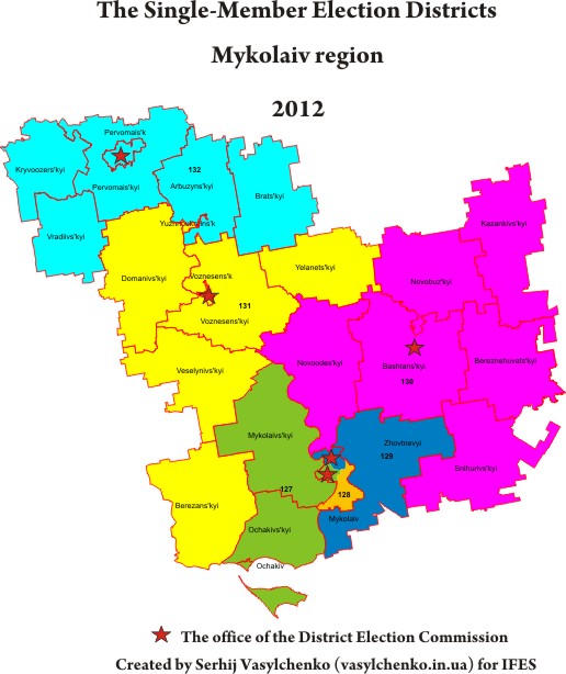
Mykolaiv region
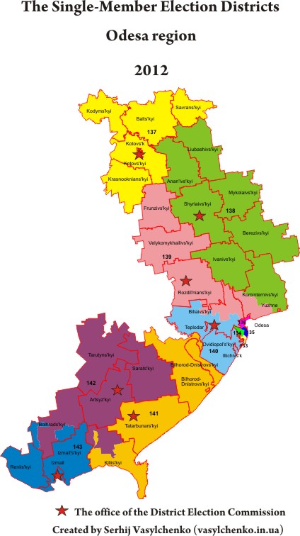
Odesa region
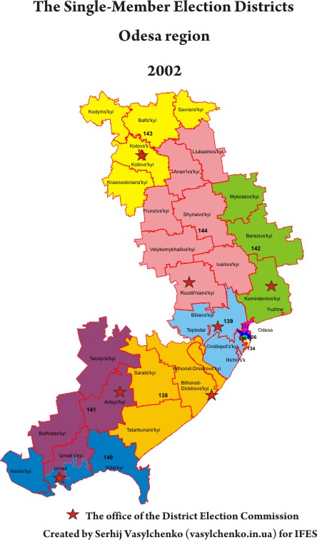

Then the CEC merged Pershotraven village council in electoral district #138
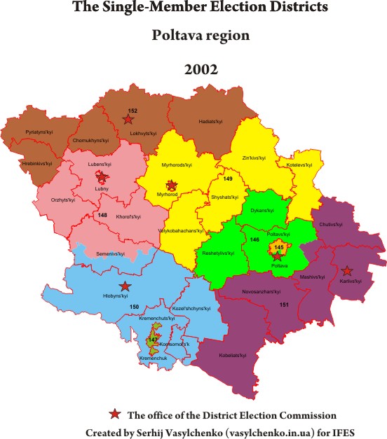
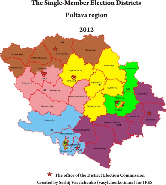
Poltava region
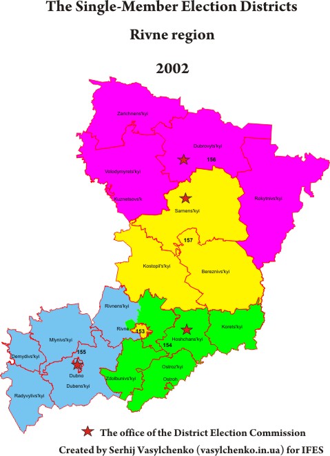
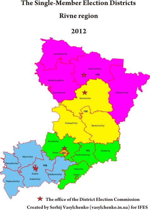
Rivne region
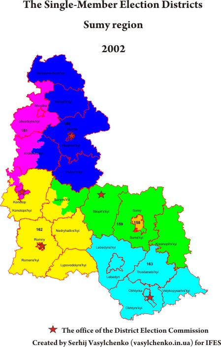
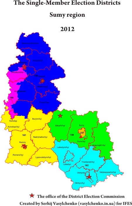
Sumy region
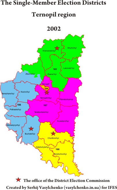
Ternopil region
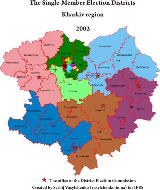
Kharkiv region
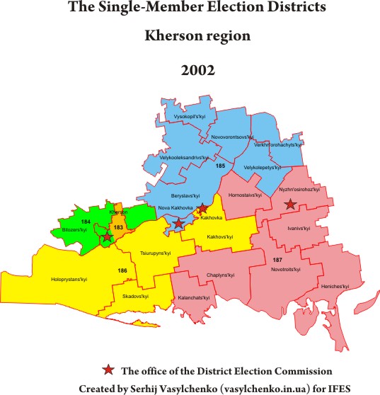
Kherson region
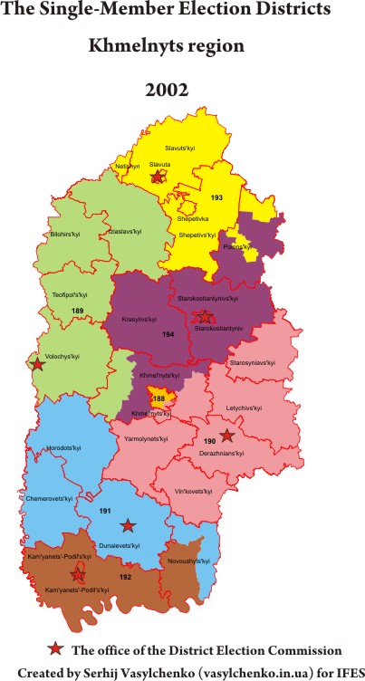
Khmelnyts region
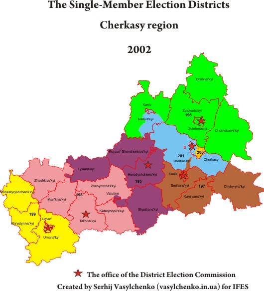
Cherkasy region
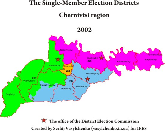
Chernivtsi region
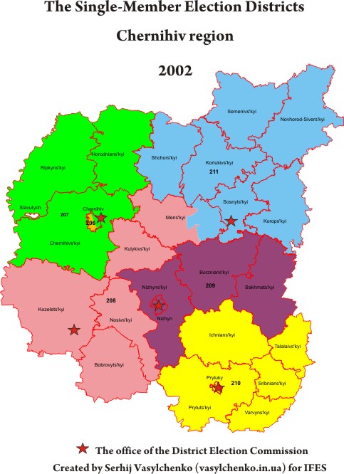
Chernihiv region
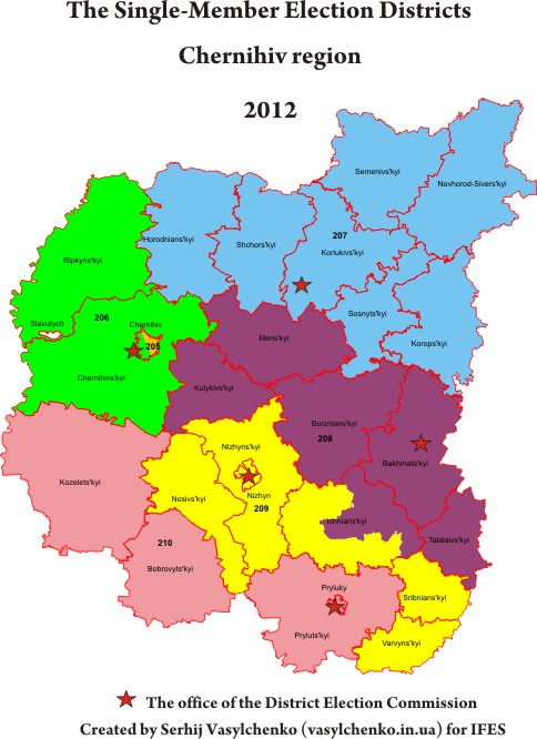
Then the CEC moved the center of electoral district #205 from Novozavod raion to Desniansky raion in Chernihiv.
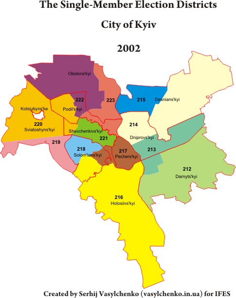
City of Kyiv
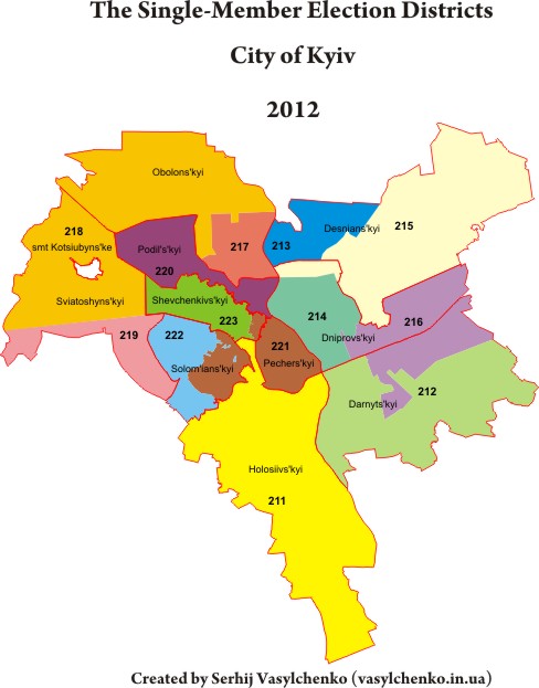
Then the CEC switched polling stations between electoral districts #221 and #223, thus uniting #221

The CEC made other changes to electoral districts, but they did not have significant impact on the districts.
Autonomuos Republic of Crimea
Vinnytsia region
Volyn region
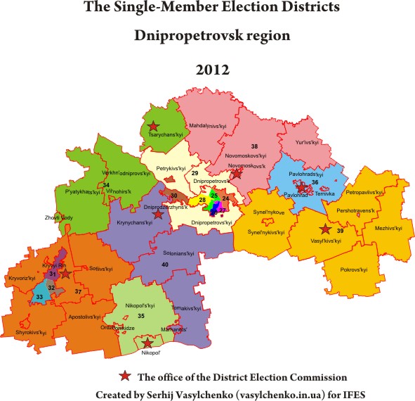
Dnipropetrovsk region
Then the CEC moved the center of electoral district #29 from Dnipropetrovsk to the city-type village Yuvileyne in the Dnipropetrovsk raion.
Donetsk region
Zhytomyr region
Zakarpats`ka region
Then the CEC merged the Batrad village council in electoral district #69, thereby liquidating another enclave.
Zaporizhzhia region
Ivano-Frankivsk region
Kyiv region
Then the CEC merged the village Ruda in electoral district #91, but the current scale does not show this.
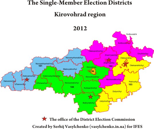
Kirovohrad region
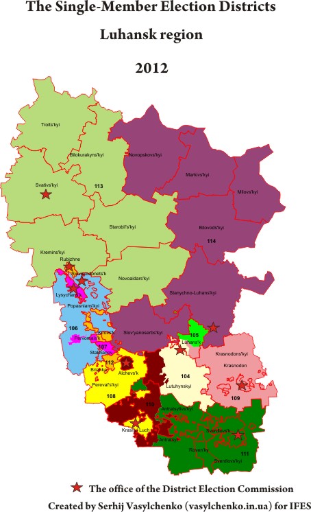
Luhansk region
Lviv region
Mykolaiv region
Odesa region
Then the CEC merged Pershotraven village council in electoral district #138
Poltava region
Rivne region
Sumy region
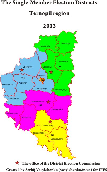
Ternopil region
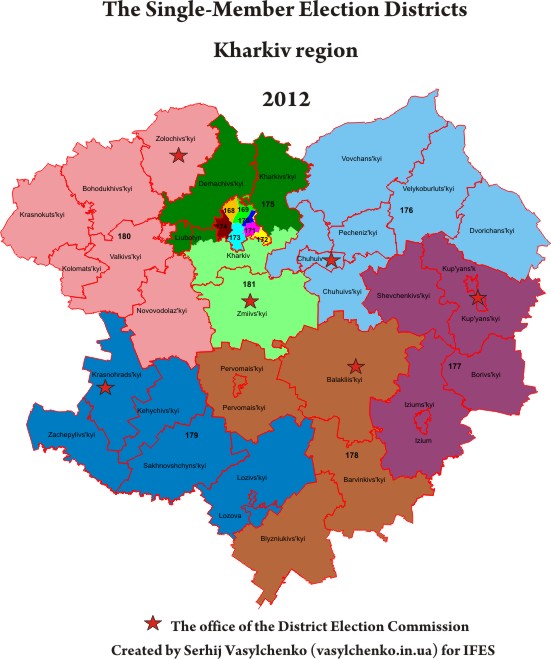
Kharkiv region
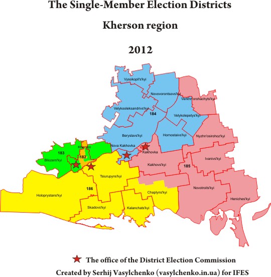
Kherson region
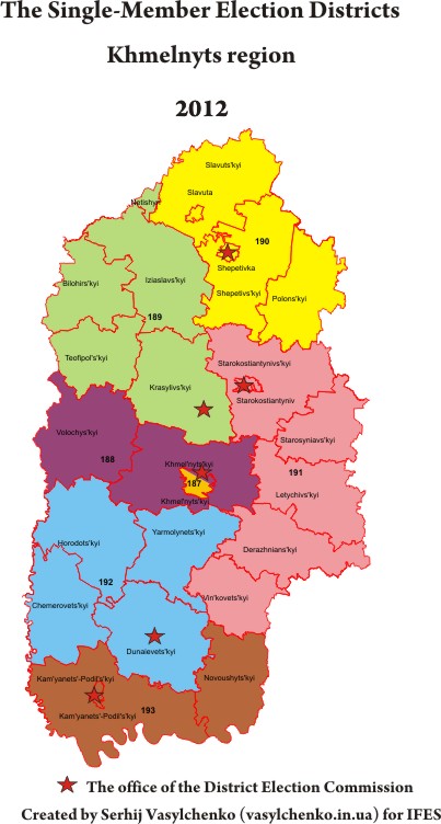
Khmelnyts region
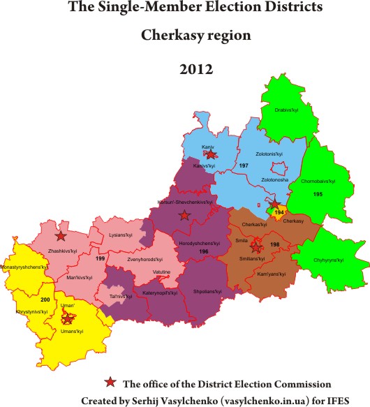
Cherkasy region
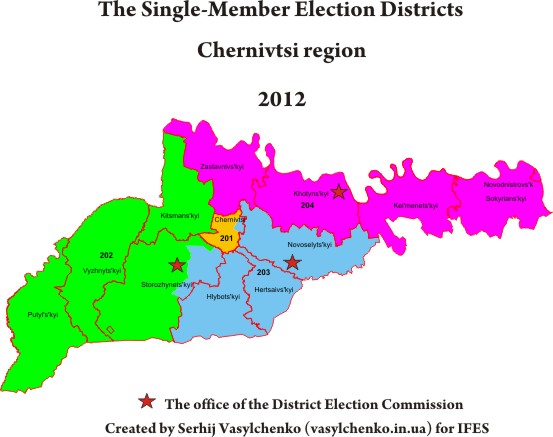
Chernivtsi region
Chernihiv region
Then the CEC moved the center of electoral district #205 from Novozavod raion to Desniansky raion in Chernihiv.
City of Kyiv
Then the CEC switched polling stations between electoral districts #221 and #223, thus uniting #221
The CEC made other changes to electoral districts, but they did not have significant impact on the districts.