Spring Outlook 2008
From the Weather Network:
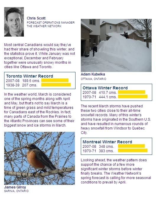
The recent March storms have pushed Ottawa and Toronto close to their all-time snowfall records. Many of this winter's storms have originated in the Southern U.S. and have resulted in numerous rounds of heavy snowfall from Windsor to Quebec City. Looking ahead, the weather pattern does support the chance of a few more significant winter storms before winter finally breaks. The Weather Network's spring forecast is calling for more seasonal conditions to prevail by April.

Canadians anxious for warmer weather will have to settle for a gradual warm-up to spring in most of the country. After a return to a normal Canadian winter for many areas, temperatures in March will start off slightly cooler for most of the country and balance out to near normal by the end of the season.
“The winter months for Western Canada were colder and drier than normal, with just the opposite conditions in Eastern Canada,” said meteorologist Jose Varela of The Weather Network. “Early spring temperatures for much of the country will be below normal, but by late spring, temperatures will balance out.”
Overall for residents of Ontario and Quebec the season will end with near normal temperatures with the exception of Northern Quebec, where temperatures are expected to be below normal. Precipitation will be above normal for the southern half of Ontario and below normal for extreme Northern Quebec. The snow pack is expected to melt gradually, meaning less concern for flooding.
I am so sick of winter. The large snow banks have melted a bit, but this weekend temperatures have been cold and sunny, halting the snowmelt. It doesn't look or feel like the end of March. I guess we should see more normal temperatures in a week or so.
The recent March storms have pushed Ottawa and Toronto close to their all-time snowfall records. Many of this winter's storms have originated in the Southern U.S. and have resulted in numerous rounds of heavy snowfall from Windsor to Quebec City. Looking ahead, the weather pattern does support the chance of a few more significant winter storms before winter finally breaks. The Weather Network's spring forecast is calling for more seasonal conditions to prevail by April.

Canadians anxious for warmer weather will have to settle for a gradual warm-up to spring in most of the country. After a return to a normal Canadian winter for many areas, temperatures in March will start off slightly cooler for most of the country and balance out to near normal by the end of the season.
“The winter months for Western Canada were colder and drier than normal, with just the opposite conditions in Eastern Canada,” said meteorologist Jose Varela of The Weather Network. “Early spring temperatures for much of the country will be below normal, but by late spring, temperatures will balance out.”
Overall for residents of Ontario and Quebec the season will end with near normal temperatures with the exception of Northern Quebec, where temperatures are expected to be below normal. Precipitation will be above normal for the southern half of Ontario and below normal for extreme Northern Quebec. The snow pack is expected to melt gradually, meaning less concern for flooding.
I am so sick of winter. The large snow banks have melted a bit, but this weekend temperatures have been cold and sunny, halting the snowmelt. It doesn't look or feel like the end of March. I guess we should see more normal temperatures in a week or so.