hills
There was a brief window of sunshine yesterday afternoon, so we headed north for a bracing walk.
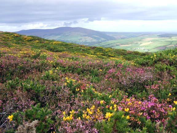
A shallow valley runs across the middle of my rock, from Peel to Douglas. We climbed to the top of Slieu Whallian, a hill just south of this valley. The sun had gone in by the time we got there, but the gorse and heather on the hillside were as bright as ever:

Slieu Whallian is a lop-sided hill, with a gentle slope on one side and a steep drop to sea level on the other. Maybe that's why it was used for testing witches. They'd drag you to the top, shove you in a barrel lined with nails, then roll you down the steep side. If you survived that, you were promptly executed for being a witch.
I doubt anyone survived the barrel-rolling. But at least they would've seen the beautiful view before their hideous death.

That's a 360 degree view from the top of Slieu Whallian, starting facing south and moving clockwise round the compass.
The hills to the south are South Barrule (with the remains of an ancient roundhouse settlement at the summit) and Cronk-ny-Arrey-Laa (with the remains of an early Christian hermit's cell on the steep coastal side).
To the west there's Peel Hill (with Corrin's Folly at the highest point -- William Corrin was an atheist, and perhaps a bit deranged. Anyway, he buried his wife up there and had a big tall tower built in her memory.)
The middle of the picture shows some of the hills to the north. From left to right we have Sartfell, Beary Mountain, Greeba Mountain, Slieu Maggle, Snaefell (the island's only actual mountain, here visible as the most distant, wispy peak), Colden, Beinn-y-Phott and Carraghan.
The dip after those hills is Douglas on the east coast. It's the island's capital and it's chavtastic.
Then to the east there's Archallagan, Chibbanagh and Stoney Mountain. And then we're back at South Barrule.
Good, isn't it?
A shallow valley runs across the middle of my rock, from Peel to Douglas. We climbed to the top of Slieu Whallian, a hill just south of this valley. The sun had gone in by the time we got there, but the gorse and heather on the hillside were as bright as ever:

Slieu Whallian is a lop-sided hill, with a gentle slope on one side and a steep drop to sea level on the other. Maybe that's why it was used for testing witches. They'd drag you to the top, shove you in a barrel lined with nails, then roll you down the steep side. If you survived that, you were promptly executed for being a witch.
I doubt anyone survived the barrel-rolling. But at least they would've seen the beautiful view before their hideous death.

That's a 360 degree view from the top of Slieu Whallian, starting facing south and moving clockwise round the compass.
The hills to the south are South Barrule (with the remains of an ancient roundhouse settlement at the summit) and Cronk-ny-Arrey-Laa (with the remains of an early Christian hermit's cell on the steep coastal side).
To the west there's Peel Hill (with Corrin's Folly at the highest point -- William Corrin was an atheist, and perhaps a bit deranged. Anyway, he buried his wife up there and had a big tall tower built in her memory.)
The middle of the picture shows some of the hills to the north. From left to right we have Sartfell, Beary Mountain, Greeba Mountain, Slieu Maggle, Snaefell (the island's only actual mountain, here visible as the most distant, wispy peak), Colden, Beinn-y-Phott and Carraghan.
The dip after those hills is Douglas on the east coast. It's the island's capital and it's chavtastic.
Then to the east there's Archallagan, Chibbanagh and Stoney Mountain. And then we're back at South Barrule.
Good, isn't it?