Charting a Course

Earlier this week, Ulixis, my colleague on the Mad Scientists of Etsy Street Team, featured my Mercator block print on her blog, and then cross-posted it to the Mad Scientists of Etsy blog (which, you know, you should follow, cause it's awesome). Then this morning, 'Etsy Finds' the daily shopping guide which one can receive via email from Etsy (or view here) featured my Mercator in a sailing and exploring themed (how apt is that?) missive, under the section "Charting a Course"! The print sold before I was even able to open my email, as some buyers are clearly swifter than I.

So, I am going to say that so far I like the Year of the Rabbit, what with one art show and five prints and one pillow sold already. In my experience, if you are an etsy seller and wonder about whether you might want to join a team, I would say yes! Also, I'm thinking that my on-going shop makeover project is going well.
Did I mention I love my new scanner?
Gerardus Mercator was a 16th century Flemish cartographer. I would say "The" cartographer, except Flanders seemed to be overrun with first rate cartographers in the 16th century (Gemma Frisius, Abraham Ortelius... stiff competition), perhaps because mapping their territory was extremely challenging, what with the floods and the succeeding armies... I don't even know how they managed to keep track of whether they were (bizarrely) part of Spain, or the Holy Roman Empire or what. Mercator himself had to be on the ball as his tendencies ran to the Protestant end of the spectrum.
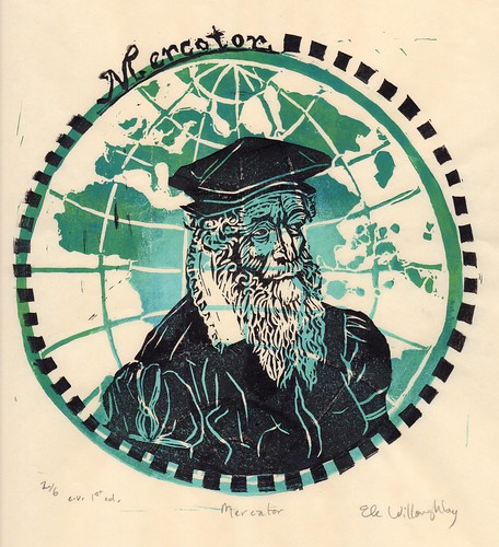
What made Mercator a contender for "The" cartographer, was in fact his abilities as a mathematician -and like those of us scientists who feel compelled also to create art he was wasn't hindered by his immense ability as an engraver. He produced beautiful world maps (a version of which is depicted in this print), globes, but his name has gone down in history for the Mercator Projection. The Mercator projection is a cylindrical map projection which became the standard map projection for nautical purposes because of its ability to represent lines of constant course, known as rhumb lines or loxodromes, as straight segments. While the linear scale is constant in all directions around any point, thus preserving the angles and the shapes of small objects (which makes the projection conformal), the Mercator projection distorts the size and shape of large objects, as the scale increases from the Equator to the poles, where it becomes infinite.
The Mercator projection will be quite familiar to you. It is generally used as a sort of 'default' projection, even today. If you are Canadian, like me, you might be lead to over-estimate the size of the arctic archipelago and underestimate the immensity of the African continent, due to the ubiquity of this projection. However, his achievement was fundamental to the explosion in exploration that came after his paradigm breaking world maps.
When the Mad Scientists of Etsy chose CARTOGRAPHY as our theme for November, 2008, I knew, as an earth scientist, (especially a marine geophysicist, used to spending quality time with nautical charts), a lover of the history of science and as a printmaker, that Mercator was the apt choice.
This is a two-colour (two block) lino block print. It is one of a first edition of only 6 prints. I carved two blocks in reverse; one representing his world map of 1595 in green and the second based on contemporary portraits in black, printed on Japanese washi paper 10" by 10.8" (25.5 cm by 27.5 cm). The edition is variable and each print is unique in its own way.