Hadrian's Wall
The week before last, we walked Hadrian's Wall. This being a National Trail, it meant following the sign of the acorn. Within a few hours, we started calling this "the unicorn," accidentally at first, but soon deliberately. "Hadrian's Wall Path" became "Hadrian's warpath," so here is an account, with pictures, of our adventures following the warpath of the unicorn.
As is our wont, we put in a couple of hours of travelling after work, stopping overnight at the delights of Watford Gap service station, where southern people proverbially think "the north" begins. A fingerpost outside the services showed us which way was "the north" and which "the south."
But at least we got there. Ten minutes away, we suddenly realised that it had never remotely occurred to either of us to check whether the hotel was on the northboard side of the southbound side. It was indeed the south. Fortunately, the internet revealed that we could get there from the Wrong Side by going through a few No Entry signs and sneaking through the service access. Well, I say "we." Going through No Entry signs is too much for me, with my Anxious Lawful Good alignment, so I hopped out and went over the footbridge, leaving it to Pellinor to contend with the lawlessness. (Which, as it turned out, was entirely lawful and Encouraged By Signs, so that was okay.)
The next day, we stopped en route at Pontefract Castle, once (allegedly) the largest country in the land, but now a scant but scenic ruin around a nice open picnic area. The interpretion boards had clearly decided that the siege in the Civil War was the One True Story of Pontefract Castle, and nothing else was as much as mentioned. (Richard II, anyone?) But it was free, and it had a nice cafe, and it a nicer place to stop than a service station.
I liked the logo. A castle, or an anxious king?
Then on to Whitley Bay, to stay with Pellinor's parents before embarking on The Walk the next day.
We took the Metro to Wallsend, where we had to loiter in the Segedunum shop for 20 minutes before they'd let us into the fort itself. The fort is just a ground plan, really, but there's a good viewing tower that gives you a bird's eye view of it, which is really helpful with ruins like this.
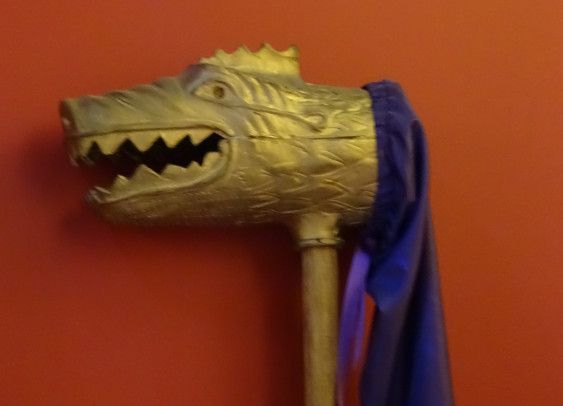
I liked this reproduction of a Roman cavalry banner in the museum:
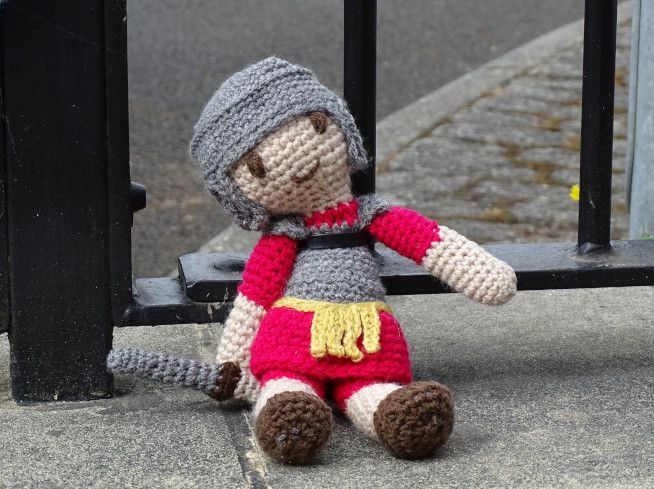
An authentic Roman lounged around outside, ready to see us on our way.
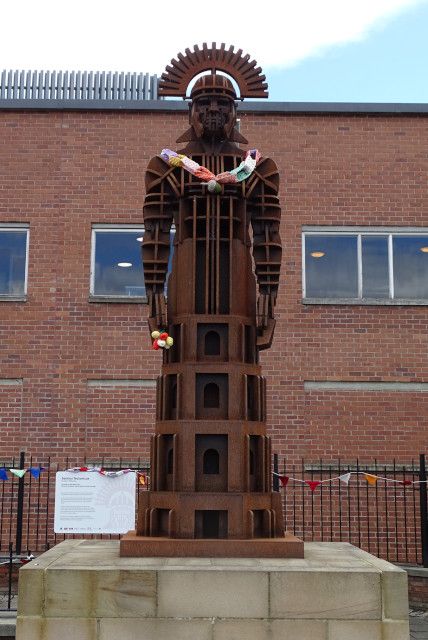
And a Roman / Angel of the North hybrid, with added knitwear.
A helpful roadsign told us that it was 84 miles to Bowness and 1110 miles to Rome. Another sign directed bikes onto Hadrian's Cycleway, but disappointingly it wasn't illustrated with a little logo of a cycling emperor.
It was very hot day, but the walk was unarduous. After Segedunum, the path through Newcastle makes no attempt to follow the path of the wall, but mostly follows the river. I had rather low expectations of this leg of the walk, but actually rather liked it, with all the bridges of Newcastle to pass under, and lots of information boards about the industrial heritage.
I took no pictures, though, since I'd managed to press an accidental button on my camera that made focusing very difficult, and needed to wait to a quiet sitdown in a shady place to work out what on earth I'd done, and how to undo it.
But had I been able to take pictures I'd have photographed kittiwakes nesting under one of the bridges. (LOADS of kittiwakes, all loudly demonstrating why they're so called.) Also the Dunston Staithes, allegedly the largest timber structure in Europe, which was the most dominant feature of a mile or two of our walk. We had to Google it to find out what it was, though, since none of the very informative information boards as much as mentioned it. It was over the river, you see, and therefore of no interest at all to the board-writing worthies north of the Tyne.
We made good time, and it was hot, so we paused a while in a pub in the riverside park near Newburn, which has its own brewery. There was a battle there in 1640 - not in the pub, sadly - between the English and the Scots, which resulted in the Scottish taking Newcastle. Why didn't I know that the Scottish had taken Newcastle in 1640?
Then a steep climb up to Heddon-on-the-Wall, following a distinctly undirect path which overshot, zigzagged back, reached Heddon, at which point the unicorn cackled and told us that, yes, we did want to be about 50 yards that way, but first we had to walk quarter of a mile in the opposite direction. Although, to be fair, this detour was to show us our Very First Bit Of Wall. ("I know what you want. It's over there - turn right at the bin!" a helpful local told us, with the air of someone who's spent years watching weary people with backpacks plod past his door.)
I'd fixed my camera by then, but didn't photograph Baby's First Wall, reminding myself to Remember Ostia! Ostia is the port of Rome, and when we went there, we spent ages exploring every last inch of the amazing baths we came to early in the site, only to discover that far greater wonders lay ahead, and these were pretty shoddy, really, by comparison with the Awesome Baths Yet To Come.
Then, having following the twisty turny unicorn path to Heddon, we left it again, ending up a few hundred yards from where we'd been nearly an hour before. Our first B&B gave us our own self-contained little chalet in a sunny garden. We'd ordered dinner (lasagne) which came freshly cooked to our door, for us to eat in our own private dining area. The fridge was full of things for us to make our own breakfast and packed lunch, and it was all very nice.
Day one: Wallsend to Heddon-on-the-Wall (plus a little bit extra): 16.37 miles
Day two
Day two started very hot, but the weather forecast... Well, the weather forecasts were in complete disagreement with each other, and even on the same site, often the icons and the map told a very different story. But general consensus was a band of rain coming in at about 4, with a strong possibility of thundery showers beforehand. The idea of thunder scared me. I like storms, but not when out on a hill.
But as it turned out, there was no thunder... although the rain did arrive at 4, just as expected. Fortunately, we'd planned our day around this timing, and were about 5 minutes away from our B&B when the rain started.
It was a pretty unexciting day, though, and I took no pictures. For this stretch of wall, a military road was built slap bang on top of the wall in the 1740s, totally destroying it. So the path duly follows the road, usually right next to it - although separated from the traffic by a hedge.
We stopped for lunch at a nice viewpoint that gave us our first good view of the vallum, the big earthwork that runs south of the wall. Then tea and a cake at a coffee shop on Dere Street. We saw our second bit of wall - saved at the 11th hour by an 18th century antiquarian. Then, a mile or two later, our third bit, with added turret. As we were looking at it, we heard a voice from the other side of the wall. "Have you come from the east?" it said. "Is there more wall there?" We confirmed that yes, we had, and no, there wasn't, but we assured him that there was much more wall to the west. "We'll go west, then," said the owner of the voice, and headed back to his camper van parked in the layby. I hope he found the mighty wall that he longed for.
Strictly speaking, Chesters Fort belonged to the next day's walk, but we detoured a bit to include it in day two. It's a nice fort, with good baths and the remains of a bridge over the North Tyne. Best of all, it has a charming museum, put together by John Clayton - 19th century antiquarian who single-handed saved much of what now remains of the Wall - and still presented in 19th century display cabinets.
Sadly, we were a bit pressed for time, not just because of the weather forecast, but because the local pub that night stopped serving food at 6. Our B&B was about a mile off route, in the village of Humshaugh (pronounced Humzhoff). "Have you booked dinner?" the landlady asked as soon as we walked through the door, and then insisted that we phoned RIGHT NOW. Since the pub stopped serving at 6, we assumed it would be winding down and half empty, but it was packed: a really thriving local pub. Fortunately we managed to fit in, and had a really great meal: the best hunter's chicken I've ever had - and I've had a fair few.
Day two: Heddon-on-the-Wall to Humshaugh near Chollerford (with a detour to Chesters): 17.90 miles
Day three
It was a lot cooler on day three, and mostly cloudy, with some sunny intervals and occasional very light and short showers. Annoyingly, the sun almost always went in whenever we neared a particularly good view. Oh well.
We headed back to Chollerford, then past Chesters again. A little further on, a man coming the other way warned us that there were some "rather feisty" cows in the next field. They hadn't alarmed HIM, he hastened to assure us, but the man ahead of him had seemed intimidated. I'm very easily intimated by cattle, and have been ever seen being chased by bullocks on the Winchcombe Way, so approached said field with trepidation, ready to flee. However, the cattle in question were in the process of strolling sedately into another field, so all was well. Phew.
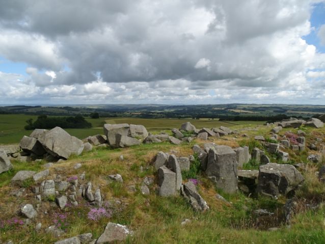
The general story of the day was gradually heading upwards, into more and more dramatic scenery, with ever increasing quantities of Wall. Here is Limestone Corner, where the ditch-digging Romans encountered Too Much Rock, and decided not to bother digging a ditch any more, on the grounds that it was Too Hard. The rocks of their half-started diggings still litter the half-finished ditch.
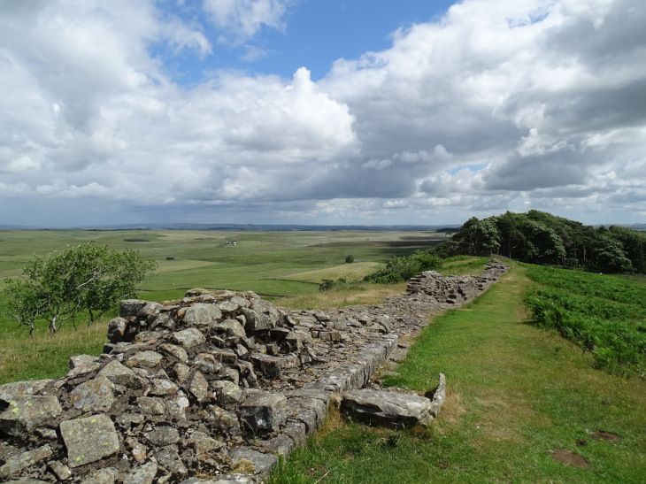
Here is The Wall. I have no idea which particular bit of Wall it is, though. Sorry!
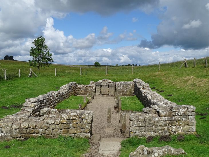
And here is a Mithraeum near a car park. Four bikers turned up when we were having a cup of tea. Only two of them could be bothered to make the short walk to the Mithraeum. "We'll tell them it was great," they said, when they got there. "A massive palace! Towering colums!"
More Wall.
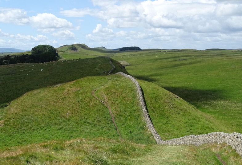
Not The Wall, just a wall, but a scenic one.
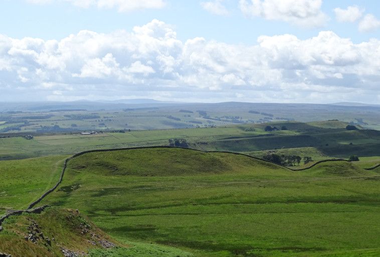
And then to Housesteads Fort, the best preserved on the Wall. After walking about three sides of its perimeter, we got to the ticket office and museum, where we got an English Heritage cup of tea - paper cup, from a machine. Then we asked where the toilet was. "By the car park," we were told, but could we find the car park? I resorted to Googling it, and learnt that it was 750 metres away down the hill. So off we went down the hill to the National Trust car park, where there was an actual cafe, so we got a National Trust pot of tea, too. Then back up the hill (750m) to explore the fort and the museum... whereupon we realised that we'd been there quite a while and had had quite a lot of tea... Yup, another tip down the hill.
There were communal Roman latrines in the fort. Sadly, we weren't allowed to use them.
Later in the week, chatting to some other walkers at the bus stop in Bowness, we mentioned the Many Toilet Treks of Housesteads. "Oh, there's a Portaloo behind the museum," they said. "We just used that."
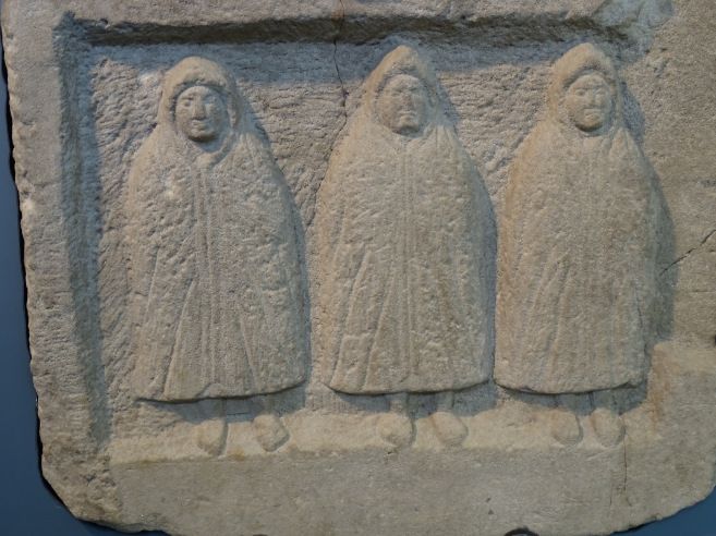
Here are some Genii Cucullati from Housesteads. They're probably queuing for the toilet.
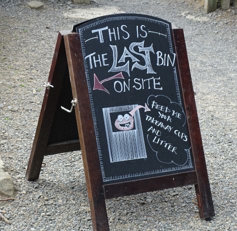
I was amused by the Last Homely Bin East of the National Trust Tea Room:
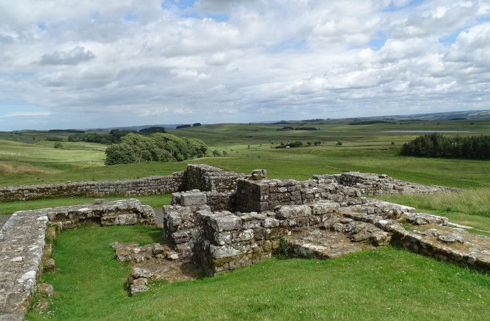
I think this must be Housesteads, although I've called the picture "milecastle." This Wall business is all very interesting, but it's just so hard to remember which bit of ruin is which!
What on earth can this picture be? Oh yes! More Wall!
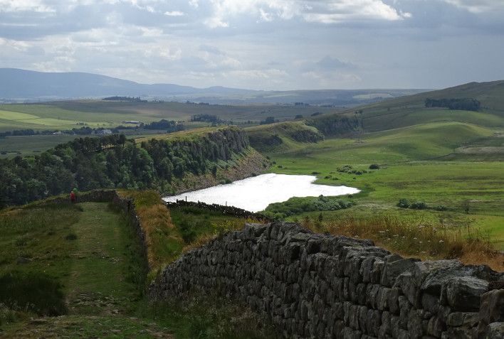
Crag Lough, I think, proving that all day the sun was generally shining on places that were Not Me.
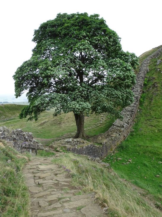
The famous Sycamore Gap. You HAVE to photograph Sycamore Gap; it's the law. It's also the law that every B&B, tourist attraction or cafe on or near The Wall has to have a picture of it on the wall (no capitals.) But it was drizzling on my camera so I didn't have time to take a GOOD picture of Sycamore Gap. I just did my duty quickly, then returned my camera to its wet-weather bolthole under my coat.
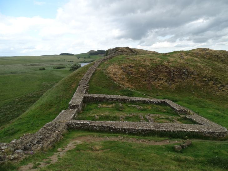
A milecastle somewhere or other:
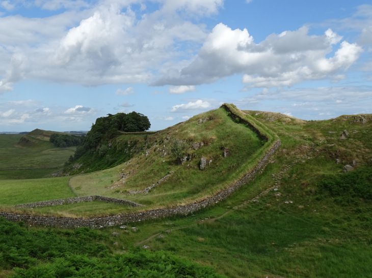
I'm not sure how I managed to spend a whole day walking along the edge of the craggy Whin Sill without any of my pictures actually showing said crags. Oh well.
Then a short and sharp descent through the rocks to another gap, where we officially finished the day's walk at the Steel Rigg car park near Once Brewed, except that we then had another mile to go to our accommodation at Saughy Rigg. We had a three course dinner, sitting next to a German couple who had come by motorbike. Four Canadian suitcases were sitting sadly in the lobby, and I was worried about the lost Canadians, but the landlady popped out to pick them up from the car park at about 9, so presumably they'd eaten in the pub a few miles away. They turned out to be the group we'd chatted to briefly at Segedunum right at the start, and they were very tired, but happy and intrigued by the card game we were playing in the lounge. (Seven Wonders: Duel, with a godly expansion. "Shall we take the gods on holiday?" we always ask when packing, since it's one of the few games that can fit easily into luggage.)
As an aside, there were LOADS of Americans or Canadians on the walk. (I'm rubbish at accents at the best of times, and there's no way I can tell the two apart on a brief "hi!" exchanged on a walk.) Quite a lot of Australians and lots of Germans, too. And, yes, I DID noisily peer at the luggage labels of everyone sharing our B&Bs throughout the week, to see where they were headed and where they'd been. I thought it was an entirely obvious thing to do, but Pellinor thinks it weird and it never occurred to him to do so.
Day three: Humshaugh to Saughy Rigg (near Once Brewed): 15.40 miles, most of it spent going to the toilets in Housesteads
Day four
Day four had some rather more extensive showers than day three, though they were still fairly light.
A gloomy view in light drizzle, heading up to the trig point above Saughy Rigg - the highest point on the Wall, with a 360 degree view.

For about a mile, our path was lined with large builders' sacks full of rocks, obviously waiting to be Made Into Something. We wondered if they'd been dropped by helicopter, and wondered if the Romans used such a method.
The rain eased as we neared a car park by a quarry lake, where a damp coach party was being shown a milecastle. We had tea and cake, watched by a fearless robin whom we propitiated with crumbs.
I think this was the day that we met a large and spread-out school party up on the moors - about 100 boys aged 11 or 12, with various adults and older teenagers spread through the group, all kitted out in boots and rucksacks. Finally, lagging way behind, a few tail-enders and a pair of teachers, including one gentleman we immediately dubbed "the Classics teacher," strolling along in blazer and cravat and brogues, absolutely no concession to the terrain at all.
After a while, the vallum returned! It had been gone from us for many miles, since the Romans decided that digging a complex earthwork through the hard rock of the Whin Sill was Too Much Like Hard Work, so took it on a long walk to the south, where the digging was easy.
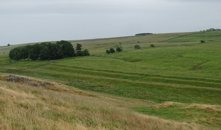
Near here, the map said there was an "Arthur's Well," as well as the intriguingly-named Nine Nicks of Thirlwall. We didn't see a well, but photographed the turret anyway, as Close Enough for Arthurian Work.
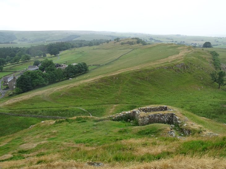
Yeah, yeah, I know this isn't a particularly good picture, but I liked the glowering sheep.
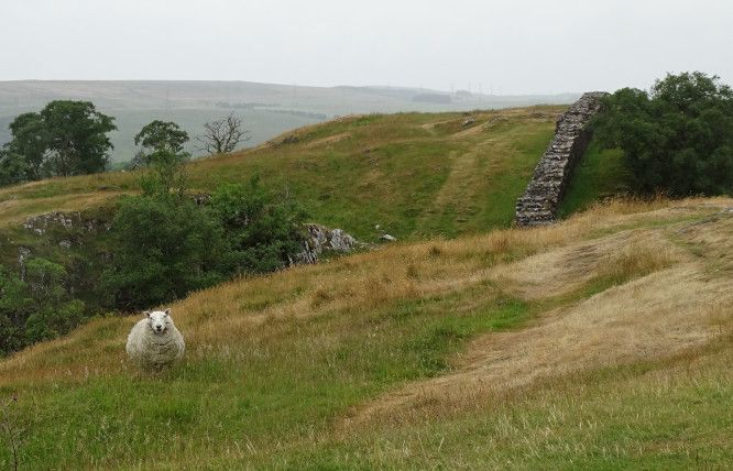
After this, the crags went, and we were down in rolling farmland again. And it was just as well. We made VERY slow progress in the first half of this day, with lots of steep downs on wet and slippery irregular stone "steps." However, our progress really wasn't helped by us spending a couple of hours in the Roman Army Museum, which was surprisingly good. I'd somehow got the impression that it was full of the Things Not Quite Interesting Enough To Be Displayed At Vindolanda, but it was very good. Especially the toilets.
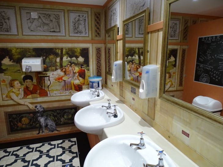
I liked a map colour coded into three colours: Hadrian visited; Hadrian never visited; Hadrian quite likely visited.
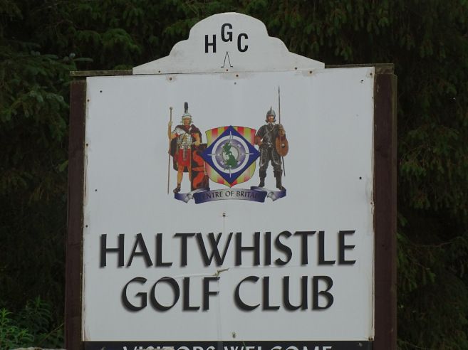
From there, conscious of time - and the long way still to go - we pressed on past Thirlwall Castle ruins, towards Gilsland, where there's a good long stretch of good wall, and a very well preserved milecastle. I liked the golf club, where Roman soldier and Border reiver battle for the heart of the land.
There was a Roman bridge over the Irthing, except that the river had moved and the bridge was now quite a way away from it. There was also an elegant modern bridge, put in when the National Trail was founded 20 years ago. Then Birdoswald Fort, but it was getting wetter and later, so we paused for little more than some tea and a very quick whizz around the ruins.
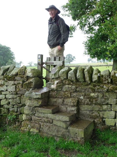
The last 7 or 8 miles was quite a trudge, since we had a good hour of sustained rain - not torrential, but plenty wet enough - and we were rapidly running out of any visible Wall. But you know how They Say that the Wall was the Work of Giants? Here is a giant, towering over a stile shaped for puny men.
Eventually we reached our B&B in Walton, where we had a lovely room in a small two room B&B. Apparently there were supposed to be five Americans sharing the other room, but much doubt was expressed over whether they'd actually arrive - and, if they DID arrive - how they'd manage to fit into a room made for two. We had a nice dinner (lasagne, again - no choice offered, this clearly being the One True Meal of Hadrian's Wall) and Pellinor sampled the fruits of their craft brewery.
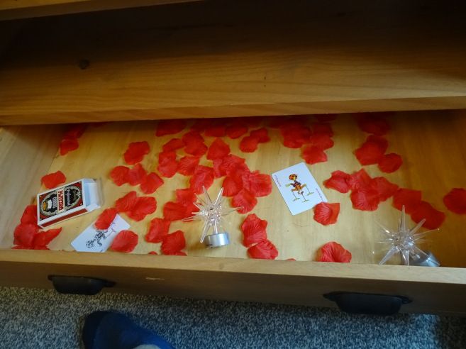
Our room had a drawer that contained this. If this isn't Probably Ritual, I don't know what is.
Day four: Saughy Rigg to Walton: 18.22 miles
Day five
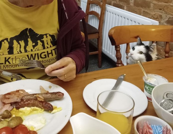
I made a new friend at breakfast. He was called Colin and he liked bacon. :-)
A fairly uninteresting morning, though. After a dry but grey start, it came on to rain about an hour in, and the rain turned fairly sustained - although still not torrential. We powered on through as fast as we could, through fields, lanes and villages. The Wall (site of) was normally on one side or the other of the path, but mostly invisible.
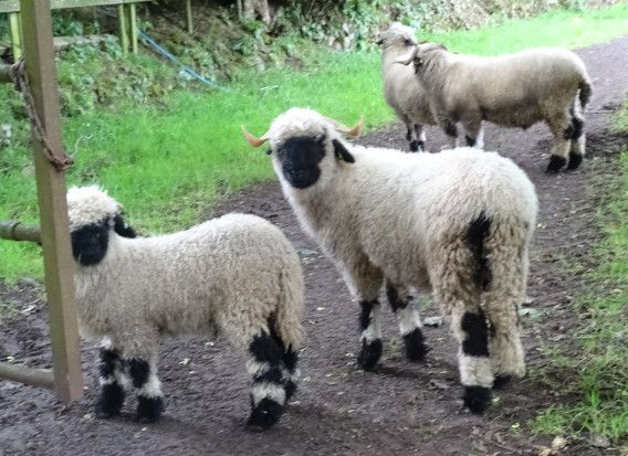
I liked these furry sheep who stared pugnaciously at us near Blea Tarn, after they'd kicked open the gate. Bad picture, but good sheep.
Near Carlisle, we were reunited with our old friend Cycle Path 72: Hadrian's Cycle Path, and together we crossed the motorway, headed past an intriguing octagonal tower, and took an enormously meandering route into Carlisle itself. There we headed for the museum, where we spent the afternoon, as Proper Rain pounded down outside.
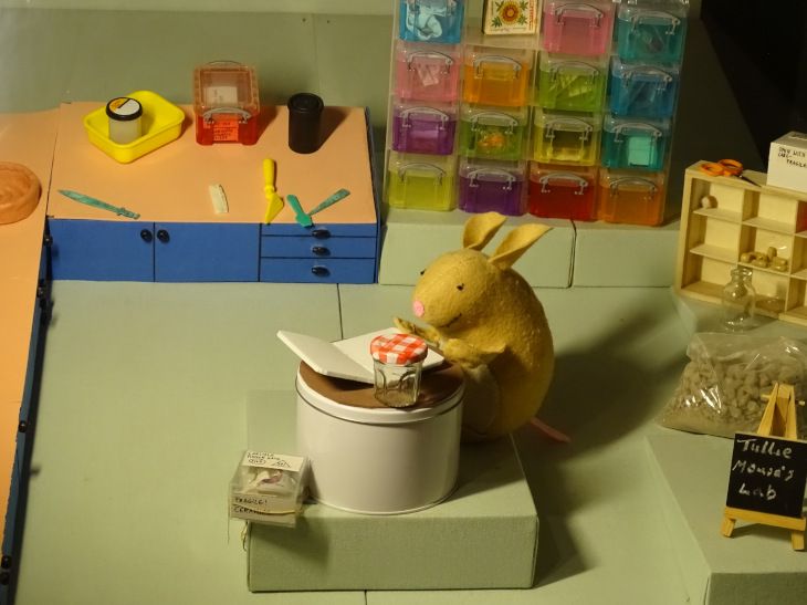
Here is a view of the curator at work:
Our B&B was very full of cherubs and nick-nacks from antique shops. The slip of paper with the wifi password had been carefully placed in the hand of a flying cherub descending from above.
We ate in a pub in the middle of Carlisle. It felt very big and bustly and noisy after four days out in the wilds: quite the culture shock.
Day five: Walton to Carlisle (plus a mile or two in Carlisle itself): 12.65 miles
Day six
Over breakfast we talked to a man (Australian? As I say, I'm rubbish at accents) who'd just walked the West Highland Way and most of Hadrian's Wall. His wife was joining him that day and they were about to do the Coast to Coast. Puts our efforts to shame, really.
The final day promised lots of sunny intervals, but was mostly overcast, but with interesting clouds. It was a flat day, heading out along the river, then crossing many many miles of dead flat road across the marshes on the edge of the Solway Estuary.
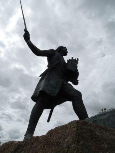
Edward I died at Burgh by Sands (pronounced Bruff, I believe) and is memoralised next to a pub. A roadsign pointed to another memorial, so we started to detour to it, before checking the internet and realising that it was over a mile away. "Tell us if it's worth it," some other walkers said, when we were debating to detour. We overtook them a little later and could report that we had no idea, since going to it felt far too much like hard work.
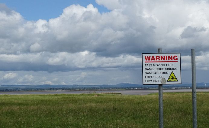
The books promised many nice pubs in many nice villages, so we'd planned a drink or two in a sunny beer garden, but the only pub we met - the one next to the king - was encountered Too Early, and the other two pubs had sadly closed. So instead there was nothing for it but to photograph clouds.
Clouds over the Lake District:
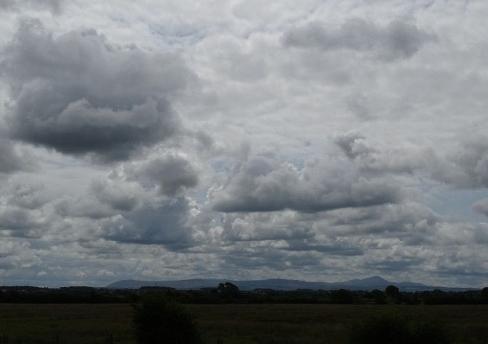
Clouds with added Doom:
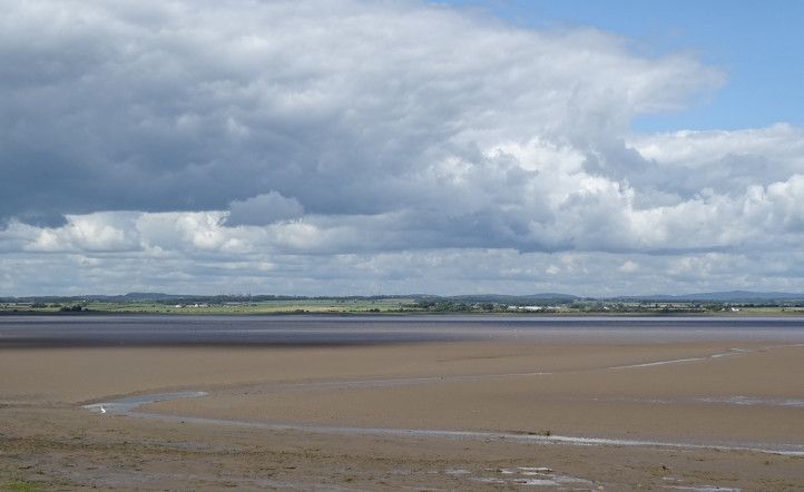
Clouds and a meander:
There were also many cows, whose main pleasure in life seemed to be standing in a great clump by the cattle grid, entirely blocking the road and refusing to move until they'd gathered a good half dozen inconvenienced motorists, whereupon they grudgingly moved, let the cars pass, then moved back again to block the next lot.
Eventually - and still publess - we neared Bowness, where a random local on a bike shouted "watch out for the Roman!" to us as he passed. We heard him shout to same to some walkers behind us, so presumably this is his full-time job: like some modern day ancient mariner, doomed for ever to wander the cycle the lanes uttering his warning.
We passed The Grey Havens, then finished in a nice mosaic-clad shelter, with congratulations - in English and Latin - written over the entrance. (I checked the other side, and it wished people good luck on the wall: "SEGEDVNO MP LXXXIII: FORTVNA VOBIS ADSIT.")
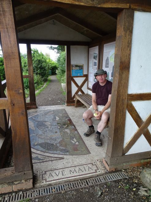
And then we DID go to the pub. And again, later on, for dinner. (Lasagne, obvs.) After dinner, a quick stroll down to a viewpoint showed us a fingerpost that told us that we were 1150 miles from Rome: i.e. 40 miles further away than we'd started. So if all roads lead to Rome, we spent a week getting 40 miles away from our goal. Oh well.
Day six: Carlisle to Bowness on Solway: 15.25 miles
And on the next day, we got the bus back to Carlisle, the train back to Newcastle, the Metro back to Whitley Bay... and the day after that, drove quite a significant chunk of those 1150 miles to Rome to get back home.
All in all, it was really good! The weather could have been better... but it could have been a lot worse, too. I enjoyed the walk, enjoyed the scenery and the history... but also enjoyed the sense of fellowship that came from knowing that everyone we met was doing the same. Being not particularly sociable, we didn't have long chats with people - didn't team up with them and walk side by side for hours - but it was just the little exchanges and the sense that we were all enjoying ourselves doing the same thing.
Now to decide what unicorn path to follow next...
As is our wont, we put in a couple of hours of travelling after work, stopping overnight at the delights of Watford Gap service station, where southern people proverbially think "the north" begins. A fingerpost outside the services showed us which way was "the north" and which "the south."
But at least we got there. Ten minutes away, we suddenly realised that it had never remotely occurred to either of us to check whether the hotel was on the northboard side of the southbound side. It was indeed the south. Fortunately, the internet revealed that we could get there from the Wrong Side by going through a few No Entry signs and sneaking through the service access. Well, I say "we." Going through No Entry signs is too much for me, with my Anxious Lawful Good alignment, so I hopped out and went over the footbridge, leaving it to Pellinor to contend with the lawlessness. (Which, as it turned out, was entirely lawful and Encouraged By Signs, so that was okay.)
The next day, we stopped en route at Pontefract Castle, once (allegedly) the largest country in the land, but now a scant but scenic ruin around a nice open picnic area. The interpretion boards had clearly decided that the siege in the Civil War was the One True Story of Pontefract Castle, and nothing else was as much as mentioned. (Richard II, anyone?) But it was free, and it had a nice cafe, and it a nicer place to stop than a service station.
I liked the logo. A castle, or an anxious king?

Then on to Whitley Bay, to stay with Pellinor's parents before embarking on The Walk the next day.
We took the Metro to Wallsend, where we had to loiter in the Segedunum shop for 20 minutes before they'd let us into the fort itself. The fort is just a ground plan, really, but there's a good viewing tower that gives you a bird's eye view of it, which is really helpful with ruins like this.
I liked this reproduction of a Roman cavalry banner in the museum:

An authentic Roman lounged around outside, ready to see us on our way.

And a Roman / Angel of the North hybrid, with added knitwear.

A helpful roadsign told us that it was 84 miles to Bowness and 1110 miles to Rome. Another sign directed bikes onto Hadrian's Cycleway, but disappointingly it wasn't illustrated with a little logo of a cycling emperor.
It was very hot day, but the walk was unarduous. After Segedunum, the path through Newcastle makes no attempt to follow the path of the wall, but mostly follows the river. I had rather low expectations of this leg of the walk, but actually rather liked it, with all the bridges of Newcastle to pass under, and lots of information boards about the industrial heritage.
I took no pictures, though, since I'd managed to press an accidental button on my camera that made focusing very difficult, and needed to wait to a quiet sitdown in a shady place to work out what on earth I'd done, and how to undo it.
But had I been able to take pictures I'd have photographed kittiwakes nesting under one of the bridges. (LOADS of kittiwakes, all loudly demonstrating why they're so called.) Also the Dunston Staithes, allegedly the largest timber structure in Europe, which was the most dominant feature of a mile or two of our walk. We had to Google it to find out what it was, though, since none of the very informative information boards as much as mentioned it. It was over the river, you see, and therefore of no interest at all to the board-writing worthies north of the Tyne.
We made good time, and it was hot, so we paused a while in a pub in the riverside park near Newburn, which has its own brewery. There was a battle there in 1640 - not in the pub, sadly - between the English and the Scots, which resulted in the Scottish taking Newcastle. Why didn't I know that the Scottish had taken Newcastle in 1640?
Then a steep climb up to Heddon-on-the-Wall, following a distinctly undirect path which overshot, zigzagged back, reached Heddon, at which point the unicorn cackled and told us that, yes, we did want to be about 50 yards that way, but first we had to walk quarter of a mile in the opposite direction. Although, to be fair, this detour was to show us our Very First Bit Of Wall. ("I know what you want. It's over there - turn right at the bin!" a helpful local told us, with the air of someone who's spent years watching weary people with backpacks plod past his door.)
I'd fixed my camera by then, but didn't photograph Baby's First Wall, reminding myself to Remember Ostia! Ostia is the port of Rome, and when we went there, we spent ages exploring every last inch of the amazing baths we came to early in the site, only to discover that far greater wonders lay ahead, and these were pretty shoddy, really, by comparison with the Awesome Baths Yet To Come.
Then, having following the twisty turny unicorn path to Heddon, we left it again, ending up a few hundred yards from where we'd been nearly an hour before. Our first B&B gave us our own self-contained little chalet in a sunny garden. We'd ordered dinner (lasagne) which came freshly cooked to our door, for us to eat in our own private dining area. The fridge was full of things for us to make our own breakfast and packed lunch, and it was all very nice.
Day one: Wallsend to Heddon-on-the-Wall (plus a little bit extra): 16.37 miles
Day two
Day two started very hot, but the weather forecast... Well, the weather forecasts were in complete disagreement with each other, and even on the same site, often the icons and the map told a very different story. But general consensus was a band of rain coming in at about 4, with a strong possibility of thundery showers beforehand. The idea of thunder scared me. I like storms, but not when out on a hill.
But as it turned out, there was no thunder... although the rain did arrive at 4, just as expected. Fortunately, we'd planned our day around this timing, and were about 5 minutes away from our B&B when the rain started.
It was a pretty unexciting day, though, and I took no pictures. For this stretch of wall, a military road was built slap bang on top of the wall in the 1740s, totally destroying it. So the path duly follows the road, usually right next to it - although separated from the traffic by a hedge.
We stopped for lunch at a nice viewpoint that gave us our first good view of the vallum, the big earthwork that runs south of the wall. Then tea and a cake at a coffee shop on Dere Street. We saw our second bit of wall - saved at the 11th hour by an 18th century antiquarian. Then, a mile or two later, our third bit, with added turret. As we were looking at it, we heard a voice from the other side of the wall. "Have you come from the east?" it said. "Is there more wall there?" We confirmed that yes, we had, and no, there wasn't, but we assured him that there was much more wall to the west. "We'll go west, then," said the owner of the voice, and headed back to his camper van parked in the layby. I hope he found the mighty wall that he longed for.
Strictly speaking, Chesters Fort belonged to the next day's walk, but we detoured a bit to include it in day two. It's a nice fort, with good baths and the remains of a bridge over the North Tyne. Best of all, it has a charming museum, put together by John Clayton - 19th century antiquarian who single-handed saved much of what now remains of the Wall - and still presented in 19th century display cabinets.
Sadly, we were a bit pressed for time, not just because of the weather forecast, but because the local pub that night stopped serving food at 6. Our B&B was about a mile off route, in the village of Humshaugh (pronounced Humzhoff). "Have you booked dinner?" the landlady asked as soon as we walked through the door, and then insisted that we phoned RIGHT NOW. Since the pub stopped serving at 6, we assumed it would be winding down and half empty, but it was packed: a really thriving local pub. Fortunately we managed to fit in, and had a really great meal: the best hunter's chicken I've ever had - and I've had a fair few.
Day two: Heddon-on-the-Wall to Humshaugh near Chollerford (with a detour to Chesters): 17.90 miles
Day three
It was a lot cooler on day three, and mostly cloudy, with some sunny intervals and occasional very light and short showers. Annoyingly, the sun almost always went in whenever we neared a particularly good view. Oh well.
We headed back to Chollerford, then past Chesters again. A little further on, a man coming the other way warned us that there were some "rather feisty" cows in the next field. They hadn't alarmed HIM, he hastened to assure us, but the man ahead of him had seemed intimidated. I'm very easily intimated by cattle, and have been ever seen being chased by bullocks on the Winchcombe Way, so approached said field with trepidation, ready to flee. However, the cattle in question were in the process of strolling sedately into another field, so all was well. Phew.
The general story of the day was gradually heading upwards, into more and more dramatic scenery, with ever increasing quantities of Wall. Here is Limestone Corner, where the ditch-digging Romans encountered Too Much Rock, and decided not to bother digging a ditch any more, on the grounds that it was Too Hard. The rocks of their half-started diggings still litter the half-finished ditch.

Here is The Wall. I have no idea which particular bit of Wall it is, though. Sorry!

And here is a Mithraeum near a car park. Four bikers turned up when we were having a cup of tea. Only two of them could be bothered to make the short walk to the Mithraeum. "We'll tell them it was great," they said, when they got there. "A massive palace! Towering colums!"

More Wall.

Not The Wall, just a wall, but a scenic one.

And then to Housesteads Fort, the best preserved on the Wall. After walking about three sides of its perimeter, we got to the ticket office and museum, where we got an English Heritage cup of tea - paper cup, from a machine. Then we asked where the toilet was. "By the car park," we were told, but could we find the car park? I resorted to Googling it, and learnt that it was 750 metres away down the hill. So off we went down the hill to the National Trust car park, where there was an actual cafe, so we got a National Trust pot of tea, too. Then back up the hill (750m) to explore the fort and the museum... whereupon we realised that we'd been there quite a while and had had quite a lot of tea... Yup, another tip down the hill.
There were communal Roman latrines in the fort. Sadly, we weren't allowed to use them.
Later in the week, chatting to some other walkers at the bus stop in Bowness, we mentioned the Many Toilet Treks of Housesteads. "Oh, there's a Portaloo behind the museum," they said. "We just used that."
Here are some Genii Cucullati from Housesteads. They're probably queuing for the toilet.

I was amused by the Last Homely Bin East of the National Trust Tea Room:

I think this must be Housesteads, although I've called the picture "milecastle." This Wall business is all very interesting, but it's just so hard to remember which bit of ruin is which!

What on earth can this picture be? Oh yes! More Wall!

Crag Lough, I think, proving that all day the sun was generally shining on places that were Not Me.

The famous Sycamore Gap. You HAVE to photograph Sycamore Gap; it's the law. It's also the law that every B&B, tourist attraction or cafe on or near The Wall has to have a picture of it on the wall (no capitals.) But it was drizzling on my camera so I didn't have time to take a GOOD picture of Sycamore Gap. I just did my duty quickly, then returned my camera to its wet-weather bolthole under my coat.

A milecastle somewhere or other:

I'm not sure how I managed to spend a whole day walking along the edge of the craggy Whin Sill without any of my pictures actually showing said crags. Oh well.
Then a short and sharp descent through the rocks to another gap, where we officially finished the day's walk at the Steel Rigg car park near Once Brewed, except that we then had another mile to go to our accommodation at Saughy Rigg. We had a three course dinner, sitting next to a German couple who had come by motorbike. Four Canadian suitcases were sitting sadly in the lobby, and I was worried about the lost Canadians, but the landlady popped out to pick them up from the car park at about 9, so presumably they'd eaten in the pub a few miles away. They turned out to be the group we'd chatted to briefly at Segedunum right at the start, and they were very tired, but happy and intrigued by the card game we were playing in the lounge. (Seven Wonders: Duel, with a godly expansion. "Shall we take the gods on holiday?" we always ask when packing, since it's one of the few games that can fit easily into luggage.)
As an aside, there were LOADS of Americans or Canadians on the walk. (I'm rubbish at accents at the best of times, and there's no way I can tell the two apart on a brief "hi!" exchanged on a walk.) Quite a lot of Australians and lots of Germans, too. And, yes, I DID noisily peer at the luggage labels of everyone sharing our B&Bs throughout the week, to see where they were headed and where they'd been. I thought it was an entirely obvious thing to do, but Pellinor thinks it weird and it never occurred to him to do so.
Day three: Humshaugh to Saughy Rigg (near Once Brewed): 15.40 miles, most of it spent going to the toilets in Housesteads
Day four
Day four had some rather more extensive showers than day three, though they were still fairly light.
A gloomy view in light drizzle, heading up to the trig point above Saughy Rigg - the highest point on the Wall, with a 360 degree view.

For about a mile, our path was lined with large builders' sacks full of rocks, obviously waiting to be Made Into Something. We wondered if they'd been dropped by helicopter, and wondered if the Romans used such a method.
The rain eased as we neared a car park by a quarry lake, where a damp coach party was being shown a milecastle. We had tea and cake, watched by a fearless robin whom we propitiated with crumbs.
I think this was the day that we met a large and spread-out school party up on the moors - about 100 boys aged 11 or 12, with various adults and older teenagers spread through the group, all kitted out in boots and rucksacks. Finally, lagging way behind, a few tail-enders and a pair of teachers, including one gentleman we immediately dubbed "the Classics teacher," strolling along in blazer and cravat and brogues, absolutely no concession to the terrain at all.
After a while, the vallum returned! It had been gone from us for many miles, since the Romans decided that digging a complex earthwork through the hard rock of the Whin Sill was Too Much Like Hard Work, so took it on a long walk to the south, where the digging was easy.

Near here, the map said there was an "Arthur's Well," as well as the intriguingly-named Nine Nicks of Thirlwall. We didn't see a well, but photographed the turret anyway, as Close Enough for Arthurian Work.

Yeah, yeah, I know this isn't a particularly good picture, but I liked the glowering sheep.

After this, the crags went, and we were down in rolling farmland again. And it was just as well. We made VERY slow progress in the first half of this day, with lots of steep downs on wet and slippery irregular stone "steps." However, our progress really wasn't helped by us spending a couple of hours in the Roman Army Museum, which was surprisingly good. I'd somehow got the impression that it was full of the Things Not Quite Interesting Enough To Be Displayed At Vindolanda, but it was very good. Especially the toilets.

I liked a map colour coded into three colours: Hadrian visited; Hadrian never visited; Hadrian quite likely visited.
From there, conscious of time - and the long way still to go - we pressed on past Thirlwall Castle ruins, towards Gilsland, where there's a good long stretch of good wall, and a very well preserved milecastle. I liked the golf club, where Roman soldier and Border reiver battle for the heart of the land.

There was a Roman bridge over the Irthing, except that the river had moved and the bridge was now quite a way away from it. There was also an elegant modern bridge, put in when the National Trail was founded 20 years ago. Then Birdoswald Fort, but it was getting wetter and later, so we paused for little more than some tea and a very quick whizz around the ruins.
The last 7 or 8 miles was quite a trudge, since we had a good hour of sustained rain - not torrential, but plenty wet enough - and we were rapidly running out of any visible Wall. But you know how They Say that the Wall was the Work of Giants? Here is a giant, towering over a stile shaped for puny men.

Eventually we reached our B&B in Walton, where we had a lovely room in a small two room B&B. Apparently there were supposed to be five Americans sharing the other room, but much doubt was expressed over whether they'd actually arrive - and, if they DID arrive - how they'd manage to fit into a room made for two. We had a nice dinner (lasagne, again - no choice offered, this clearly being the One True Meal of Hadrian's Wall) and Pellinor sampled the fruits of their craft brewery.
Our room had a drawer that contained this. If this isn't Probably Ritual, I don't know what is.

Day four: Saughy Rigg to Walton: 18.22 miles
Day five
I made a new friend at breakfast. He was called Colin and he liked bacon. :-)

A fairly uninteresting morning, though. After a dry but grey start, it came on to rain about an hour in, and the rain turned fairly sustained - although still not torrential. We powered on through as fast as we could, through fields, lanes and villages. The Wall (site of) was normally on one side or the other of the path, but mostly invisible.
I liked these furry sheep who stared pugnaciously at us near Blea Tarn, after they'd kicked open the gate. Bad picture, but good sheep.

Near Carlisle, we were reunited with our old friend Cycle Path 72: Hadrian's Cycle Path, and together we crossed the motorway, headed past an intriguing octagonal tower, and took an enormously meandering route into Carlisle itself. There we headed for the museum, where we spent the afternoon, as Proper Rain pounded down outside.
Here is a view of the curator at work:

Our B&B was very full of cherubs and nick-nacks from antique shops. The slip of paper with the wifi password had been carefully placed in the hand of a flying cherub descending from above.
We ate in a pub in the middle of Carlisle. It felt very big and bustly and noisy after four days out in the wilds: quite the culture shock.
Day five: Walton to Carlisle (plus a mile or two in Carlisle itself): 12.65 miles
Day six
Over breakfast we talked to a man (Australian? As I say, I'm rubbish at accents) who'd just walked the West Highland Way and most of Hadrian's Wall. His wife was joining him that day and they were about to do the Coast to Coast. Puts our efforts to shame, really.
The final day promised lots of sunny intervals, but was mostly overcast, but with interesting clouds. It was a flat day, heading out along the river, then crossing many many miles of dead flat road across the marshes on the edge of the Solway Estuary.
Edward I died at Burgh by Sands (pronounced Bruff, I believe) and is memoralised next to a pub. A roadsign pointed to another memorial, so we started to detour to it, before checking the internet and realising that it was over a mile away. "Tell us if it's worth it," some other walkers said, when we were debating to detour. We overtook them a little later and could report that we had no idea, since going to it felt far too much like hard work.

The books promised many nice pubs in many nice villages, so we'd planned a drink or two in a sunny beer garden, but the only pub we met - the one next to the king - was encountered Too Early, and the other two pubs had sadly closed. So instead there was nothing for it but to photograph clouds.
Clouds over the Lake District:

Clouds with added Doom:

Clouds and a meander:

There were also many cows, whose main pleasure in life seemed to be standing in a great clump by the cattle grid, entirely blocking the road and refusing to move until they'd gathered a good half dozen inconvenienced motorists, whereupon they grudgingly moved, let the cars pass, then moved back again to block the next lot.
Eventually - and still publess - we neared Bowness, where a random local on a bike shouted "watch out for the Roman!" to us as he passed. We heard him shout to same to some walkers behind us, so presumably this is his full-time job: like some modern day ancient mariner, doomed for ever to wander the cycle the lanes uttering his warning.
We passed The Grey Havens, then finished in a nice mosaic-clad shelter, with congratulations - in English and Latin - written over the entrance. (I checked the other side, and it wished people good luck on the wall: "SEGEDVNO MP LXXXIII: FORTVNA VOBIS ADSIT.")

And then we DID go to the pub. And again, later on, for dinner. (Lasagne, obvs.) After dinner, a quick stroll down to a viewpoint showed us a fingerpost that told us that we were 1150 miles from Rome: i.e. 40 miles further away than we'd started. So if all roads lead to Rome, we spent a week getting 40 miles away from our goal. Oh well.
Day six: Carlisle to Bowness on Solway: 15.25 miles
And on the next day, we got the bus back to Carlisle, the train back to Newcastle, the Metro back to Whitley Bay... and the day after that, drove quite a significant chunk of those 1150 miles to Rome to get back home.
All in all, it was really good! The weather could have been better... but it could have been a lot worse, too. I enjoyed the walk, enjoyed the scenery and the history... but also enjoyed the sense of fellowship that came from knowing that everyone we met was doing the same. Being not particularly sociable, we didn't have long chats with people - didn't team up with them and walk side by side for hours - but it was just the little exchanges and the sense that we were all enjoying ourselves doing the same thing.
Now to decide what unicorn path to follow next...