A Walk above the Clouds
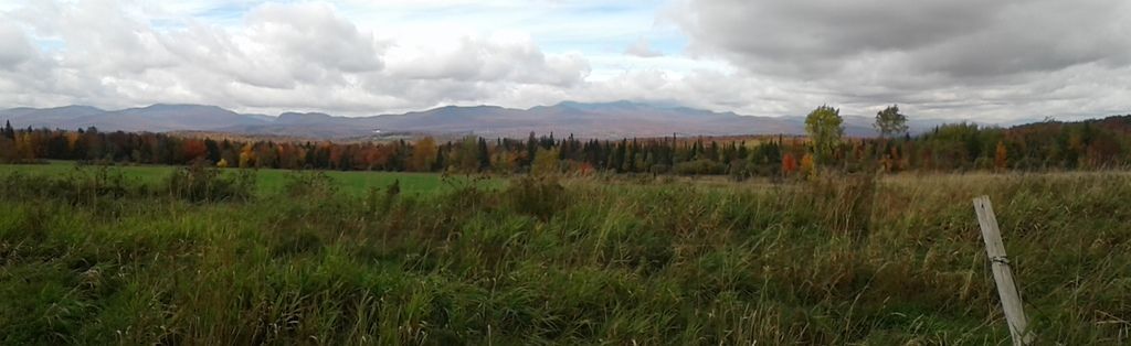
Earlier this week, we took a walk down my road, in the valley along the Barton River. These pictures, which we taken the day after the walk down my road, couldn't be more different. Instead of the valley, this walk was along the ridgeline of Mount Mansfield, Vermont's highest mountain. Instead of soft meadows, a gently coursing river, and a palette of colored trees in the distance, the landscape here is ragged rock and plants tough and strange enough to survive in such an unforgiving climate.
The only similarity was the weather: It was borderline unpleasant on both days. This was the weather on the drive down to Stowe. It was supposed to clear up but really didn't.
(As always, click for full-size!)
We ostensibly opted to do the Mansfield hike because of the views, but there weren't many views to be had: We were above the clouds for most of the walk, which only added to the strangeness of the scenery. The temperature on the ridgeline hovered right around freezing with wind chills dipping to the mid-20s F when the wind would kick up. Those were moments of ambivalence: They often swept away enough of the clouds to get a glimpse of the view, but they also tended to occur at moments when I was making crossings on rocks where I was not fully comfortable. I felt like the Fellowship on Caradhras, with the sense that the mountain was mocking me!
The ecosystem is alpine tundra, which exists in isolated pockets atop the highest peaks in New England. The linked Times article describes the alpine tundra as such:
Such is the weird world of alpine tundra, where life adapts to cold stone and thin soil, and snow, ice, wind, water and sunlight mix in rare and intense proportions to mimic conditions not widely seen since the end of the last ice age. Hike uphill high enough in parts of New England and you might as well be trekking in far northern Canada. Save for polar bears and permafrost, the look and feel of places like Mount Mansfield’s summit - a bald schist knob at 4,393 feet - mimic the arctic no-man’s land east of Hudson Bay.
We had originally planned to take the gondola from the resort and hike the Cliff Trail to the summit (called the Chin because the profile of Mansfield looks like a face in repose), but the poor weather made this unwise, so we took the Auto Toll Road to the end and hiked out from there instead. This was a good choice. Especially after my fall this summer and in dire need of new boots, climbing--especially descending--on rocks is anxiety-inducing for me. This walk was bad enough in places, owing to the wind that kicked up whenever I had to cross a fissure or skirt near a cliff.
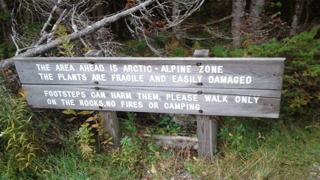
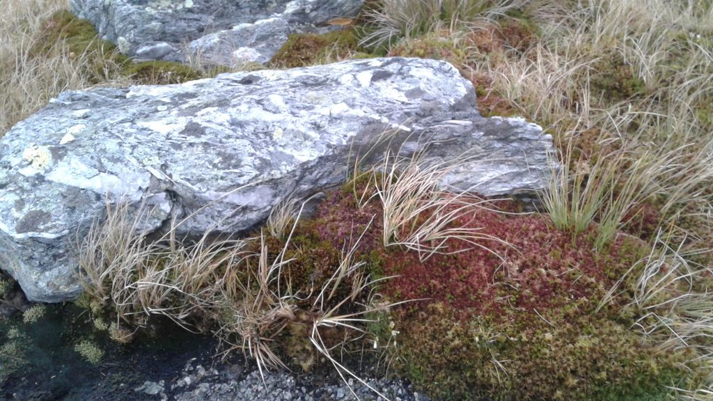
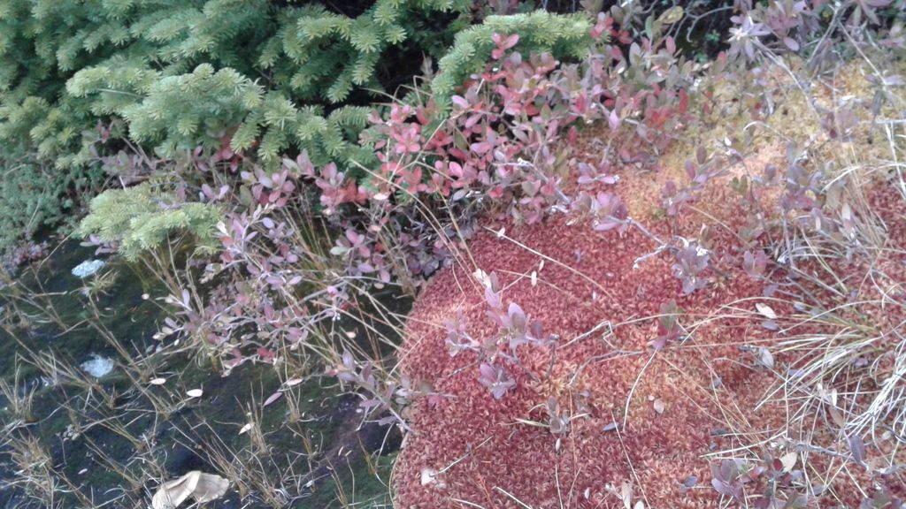
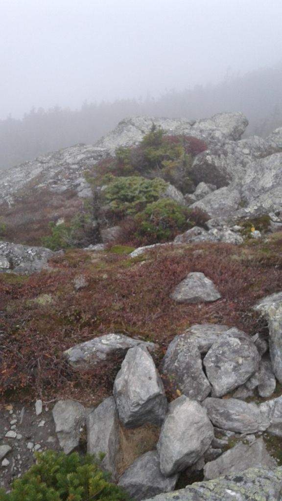
And walking on the rocks is a requirement here. In places, there were low plants growing, but walking on the vegetation is prohibited, as it is extremely fragile. (Who wouldn't be, living up here?)
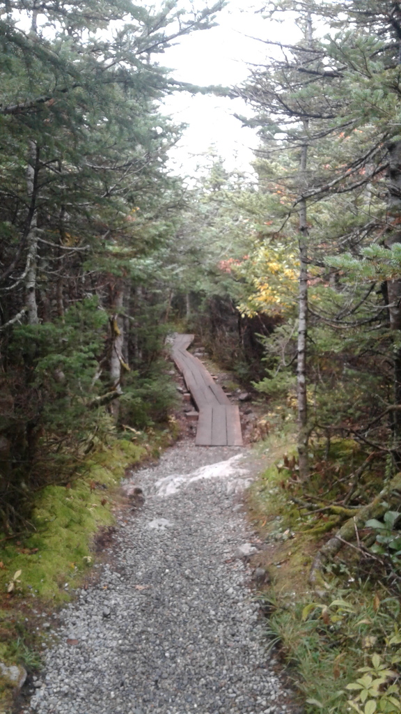
The lower sections of the trail progressed along boardwalks, again to keep feet and paws from damaging the plant life.
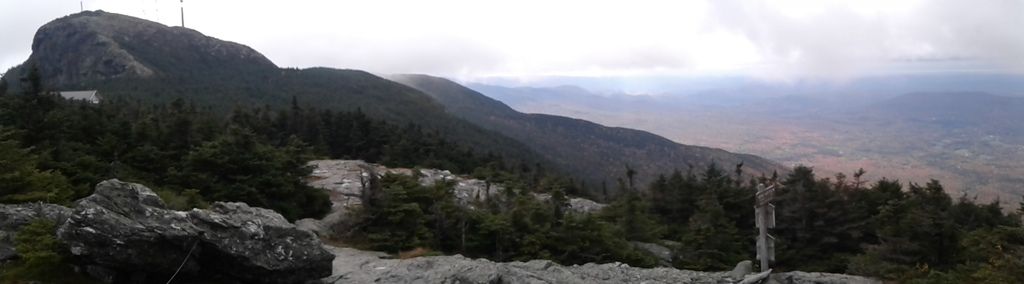
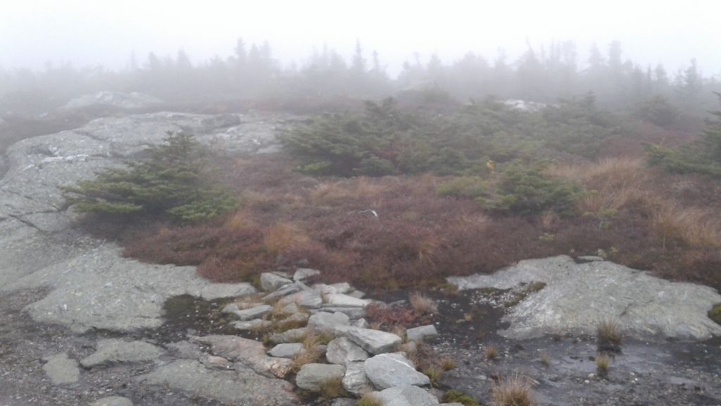
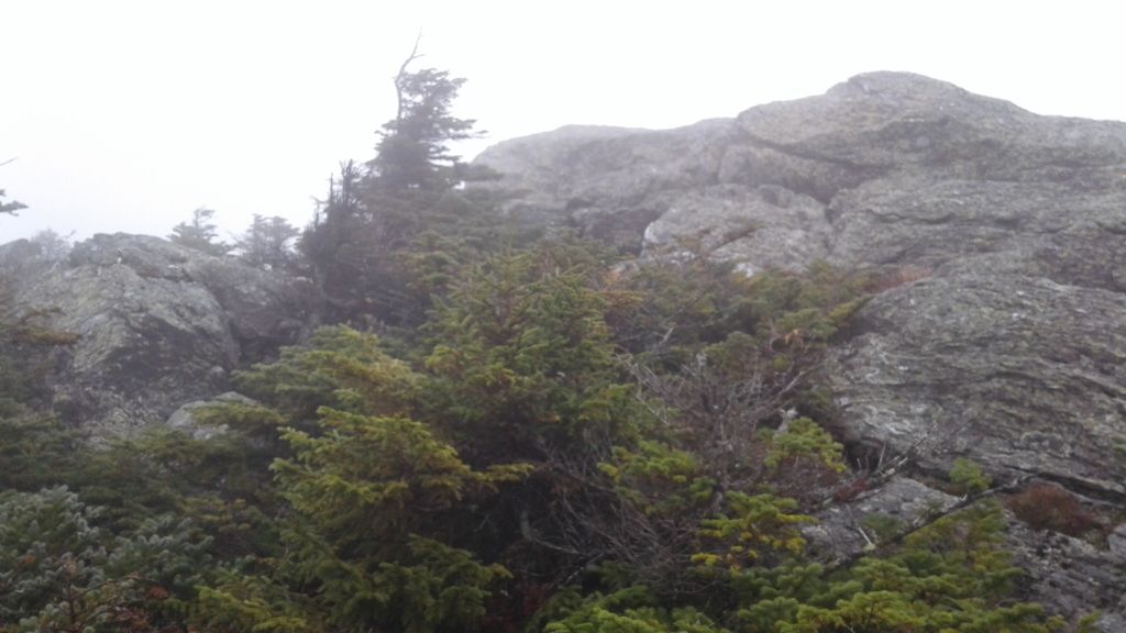
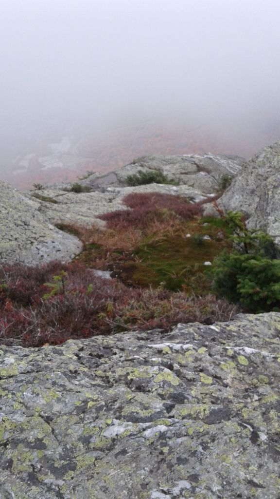
When we first arose into the alpine tundra, we were still low enough to have some patchy views.
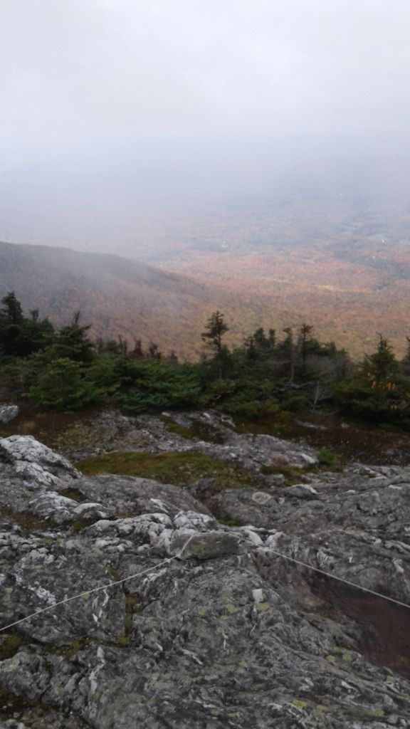
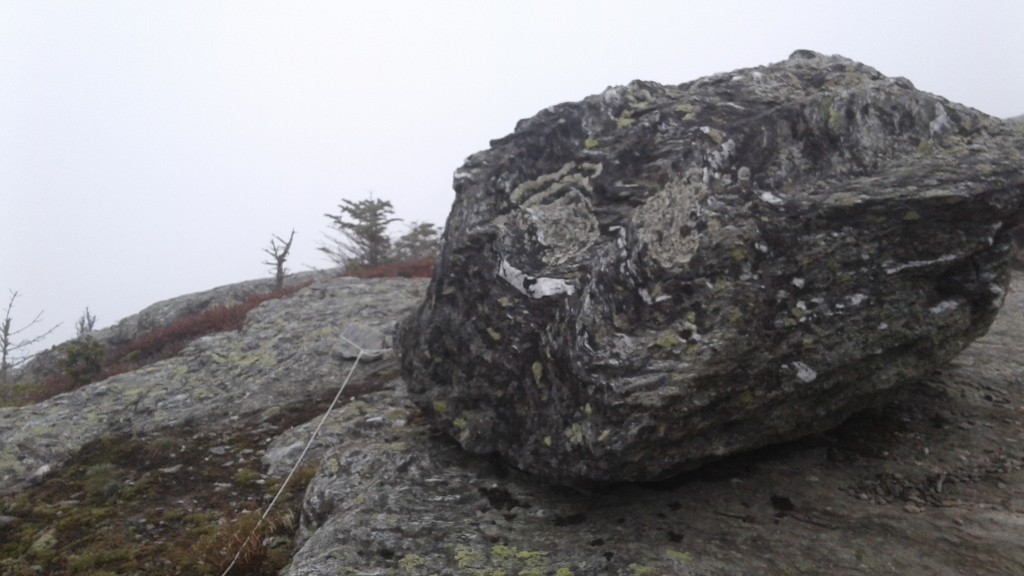
The strings visible in this picture mark the trail, again to keep people from treading off the trail and damaging the delicate ecosystem. This is one of Vermont's most popular hikes, and unfortunately that means that you see irresponsible people who walk off the trail despite the warnings and the trail markers. Before you ascend the Toll Road, you are given a CD that explains the protections needed to preserve the trail, yet we still saw people crossing boundaries, allowing their dogs off-lead, etc. Boo.
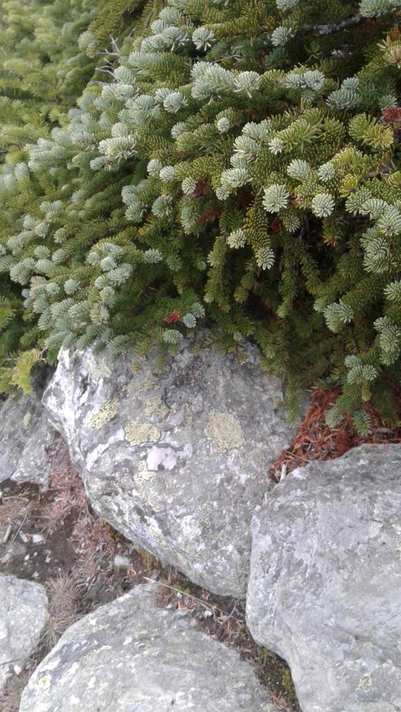
The plant life here is unusual. The trees are stunted--few were taller than Bobby--and tiny plants huddle in cracks and crevices away from the unabating wind.
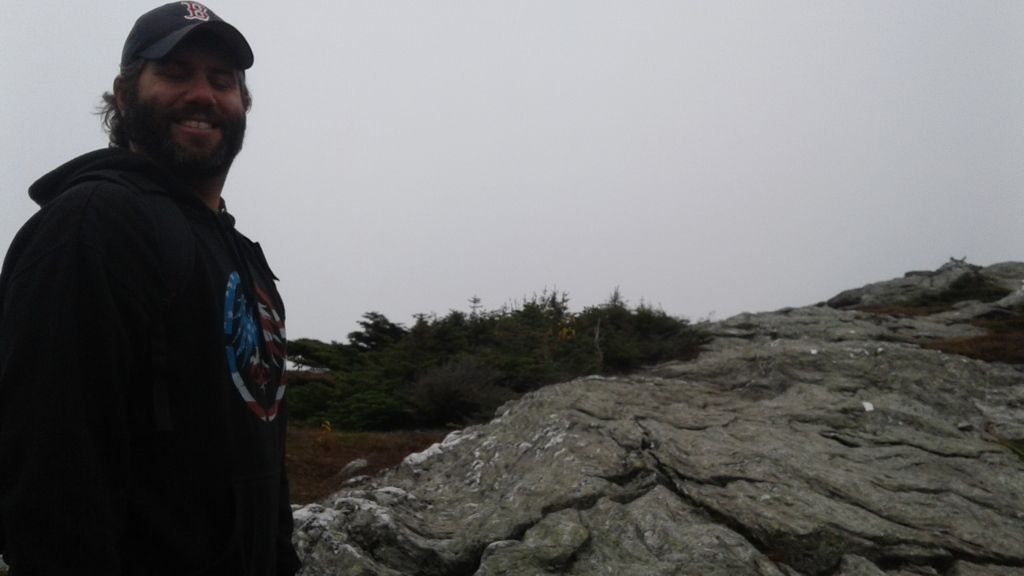
This guy.
Looking west toward Lake Champlain, New York, and the Adirondacks. Lake Champlain was visible, but I don't think it's all that identifiable in the pictures unfortunately. But if you see something that makes you think you're looking at a big body of water ... well, you probably just found Lake Champlain!
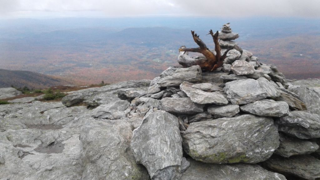
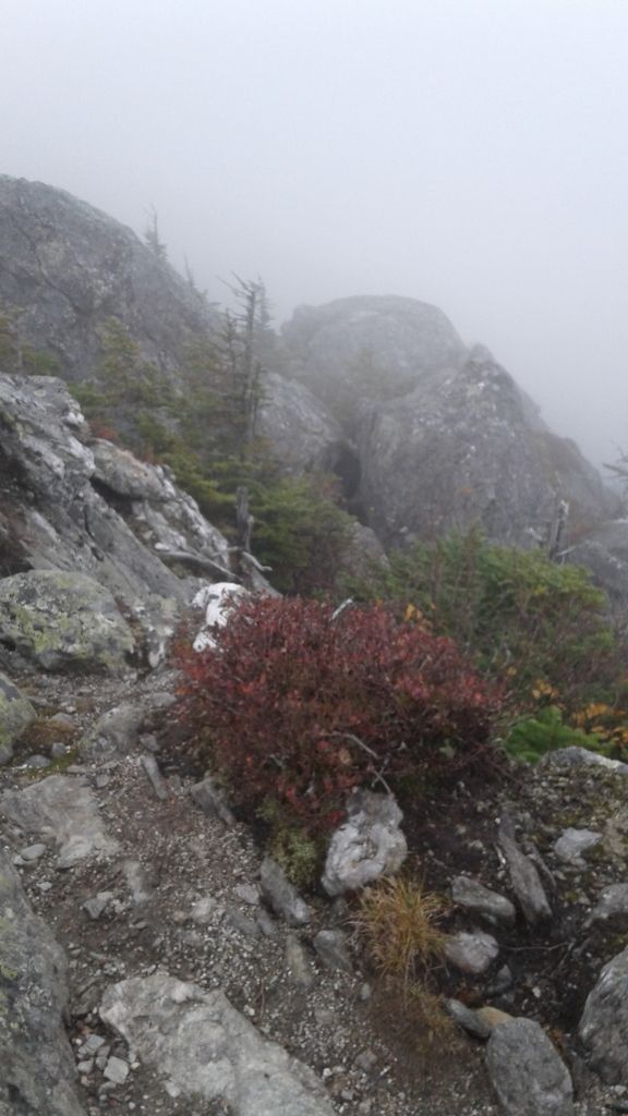
I have no idea what this cairn marks. Probably nothing! Vermonters like to make cairns.
Now we've begun to climb into the clouds. It's an unusual sensation, if you've never had the experience of walking in a high place above the clouds. It's very isolating, yet the sense of your elevation never fully dissipates. It's almost a mild form of sensory deprivation, and I find my thoughts collapsing in on themselves. (Unfortunately on this particular day that interiority took the form of negative self-talk patterns that were very hard to shake.
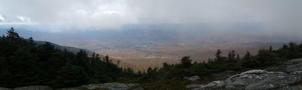
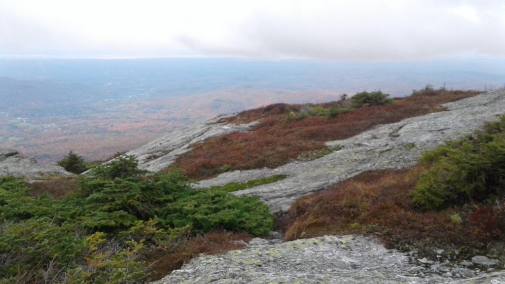
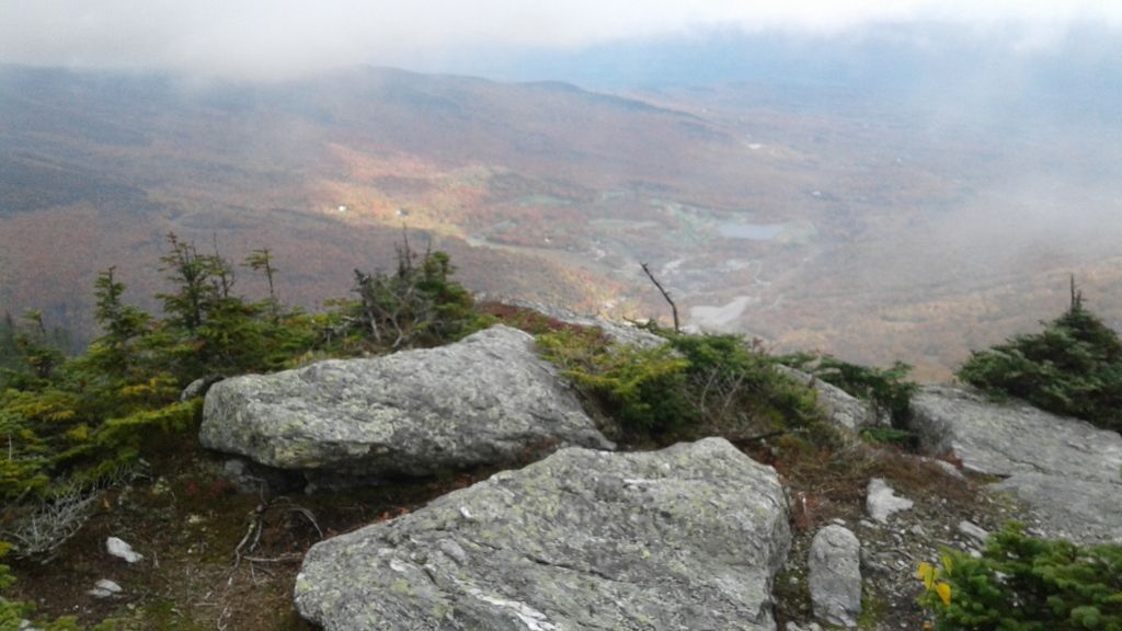
We reached a point near the summit where the clouds cleared a little. This is looking east, down at Stowe. Those patches of open land are a golf course. I love Stowe--it was the first place in Vermont we visited and it made us realize we wanted to live here--but I am glad to go home to the Northeast Kingdom!
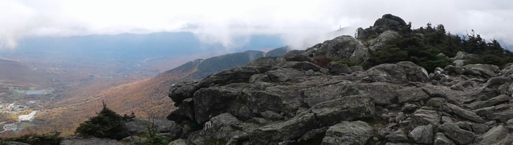
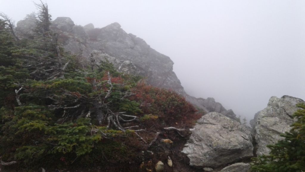
But the clouds closed just as quickly again, and the rest of our walk was shrouded in fog.
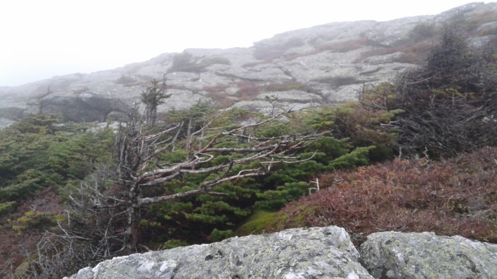
This tree had grown entirely in the direction the wind swept it.
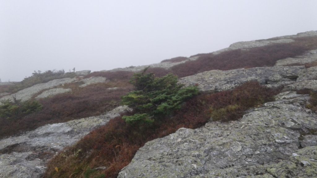
And this one is a good example of the tiny trees that grow at this elevation.
I have mixed feelings about this walk. It was beautiful and strange. It really was NOT a difficult hike but was emotionally difficult that day for many reasons, and it reminds me that no matter how well I feel, there are certain self-perceptions that are lodged deep about my (lack of) self-worth, and I don't know that I'll ever be rid of them. At the time, my thought about the hike was, "I've done that and won't have to do it ever again now," but with some distance, I think I do want to do it again, maybe on a clear day or maybe not (definitely with better boots!), and I suppose that resilience is the more important thing.
This post was originally posted on Dreamwidth and, using my Felagundish Elf magic, crossposted to LiveJournal. You can comment here or there!
http://dawn-felagund.dreamwidth.org/393100.html
The only similarity was the weather: It was borderline unpleasant on both days. This was the weather on the drive down to Stowe. It was supposed to clear up but really didn't.

(As always, click for full-size!)
We ostensibly opted to do the Mansfield hike because of the views, but there weren't many views to be had: We were above the clouds for most of the walk, which only added to the strangeness of the scenery. The temperature on the ridgeline hovered right around freezing with wind chills dipping to the mid-20s F when the wind would kick up. Those were moments of ambivalence: They often swept away enough of the clouds to get a glimpse of the view, but they also tended to occur at moments when I was making crossings on rocks where I was not fully comfortable. I felt like the Fellowship on Caradhras, with the sense that the mountain was mocking me!
The ecosystem is alpine tundra, which exists in isolated pockets atop the highest peaks in New England. The linked Times article describes the alpine tundra as such:
Such is the weird world of alpine tundra, where life adapts to cold stone and thin soil, and snow, ice, wind, water and sunlight mix in rare and intense proportions to mimic conditions not widely seen since the end of the last ice age. Hike uphill high enough in parts of New England and you might as well be trekking in far northern Canada. Save for polar bears and permafrost, the look and feel of places like Mount Mansfield’s summit - a bald schist knob at 4,393 feet - mimic the arctic no-man’s land east of Hudson Bay.
We had originally planned to take the gondola from the resort and hike the Cliff Trail to the summit (called the Chin because the profile of Mansfield looks like a face in repose), but the poor weather made this unwise, so we took the Auto Toll Road to the end and hiked out from there instead. This was a good choice. Especially after my fall this summer and in dire need of new boots, climbing--especially descending--on rocks is anxiety-inducing for me. This walk was bad enough in places, owing to the wind that kicked up whenever I had to cross a fissure or skirt near a cliff.
And walking on the rocks is a requirement here. In places, there were low plants growing, but walking on the vegetation is prohibited, as it is extremely fragile. (Who wouldn't be, living up here?)

The lower sections of the trail progressed along boardwalks, again to keep feet and paws from damaging the plant life.

When we first arose into the alpine tundra, we were still low enough to have some patchy views.

The strings visible in this picture mark the trail, again to keep people from treading off the trail and damaging the delicate ecosystem. This is one of Vermont's most popular hikes, and unfortunately that means that you see irresponsible people who walk off the trail despite the warnings and the trail markers. Before you ascend the Toll Road, you are given a CD that explains the protections needed to preserve the trail, yet we still saw people crossing boundaries, allowing their dogs off-lead, etc. Boo.


The plant life here is unusual. The trees are stunted--few were taller than Bobby--and tiny plants huddle in cracks and crevices away from the unabating wind.


This guy.

Looking west toward Lake Champlain, New York, and the Adirondacks. Lake Champlain was visible, but I don't think it's all that identifiable in the pictures unfortunately. But if you see something that makes you think you're looking at a big body of water ... well, you probably just found Lake Champlain!

I have no idea what this cairn marks. Probably nothing! Vermonters like to make cairns.

Now we've begun to climb into the clouds. It's an unusual sensation, if you've never had the experience of walking in a high place above the clouds. It's very isolating, yet the sense of your elevation never fully dissipates. It's almost a mild form of sensory deprivation, and I find my thoughts collapsing in on themselves. (Unfortunately on this particular day that interiority took the form of negative self-talk patterns that were very hard to shake.


We reached a point near the summit where the clouds cleared a little. This is looking east, down at Stowe. Those patches of open land are a golf course. I love Stowe--it was the first place in Vermont we visited and it made us realize we wanted to live here--but I am glad to go home to the Northeast Kingdom!


But the clouds closed just as quickly again, and the rest of our walk was shrouded in fog.
This tree had grown entirely in the direction the wind swept it.

And this one is a good example of the tiny trees that grow at this elevation.


I have mixed feelings about this walk. It was beautiful and strange. It really was NOT a difficult hike but was emotionally difficult that day for many reasons, and it reminds me that no matter how well I feel, there are certain self-perceptions that are lodged deep about my (lack of) self-worth, and I don't know that I'll ever be rid of them. At the time, my thought about the hike was, "I've done that and won't have to do it ever again now," but with some distance, I think I do want to do it again, maybe on a clear day or maybe not (definitely with better boots!), and I suppose that resilience is the more important thing.
This post was originally posted on Dreamwidth and, using my Felagundish Elf magic, crossposted to LiveJournal. You can comment here or there!
http://dawn-felagund.dreamwidth.org/393100.html