A Hor with a Heart of Gold
Mount Hor has a terrible name. Apparently, Mount Hor is also a mountain in the Bible, and I suppose it was named after that; I haven't been able to find anything about the history behind the name and can't fathom why you'd name a mountain "Mount Hor" without precedent. So Mount Hor is like the poor kid in school who gets assigned a storied, ancestral, and absolutely awful name: Benjamin Dover or Michael Hunt or Richard Lipshitz. And amid the teasing and the alienation that comes from a decision completely outside his control, he has to deal with the "But your great-great-grandfather the Civil War hero was named Benjamin Dover!" LIKE THAT MAKES IT OKAY. (I got relentlessly teased for the last name Walls, for pity's sake! Kids are senseless and cruel!) So poor, poor Mount Hor.
All this to say that yesterday, Bobby and I hiked Mount Hor. It is in what I term The Willoughby Complex but have since learned has the official name of the Northeastern Highlands of VermontTM. This means that they are not technically part of Vermont's Green Mountains! We have already hiked the two larger mountains in the area--Bald Mountain and Mount Pisgah--and I hiked Haystack Mountain* with my school.
*Which, until I learned its real name, I had named Boob Mountain because it looks like a boob in profile! The Willoughby area brings out the middle-schooler in the best of us.
The Willoughby Complex/Northeastern Highlands of VermontTM easily offer the most dramatic landscapes in a region of dramatic landscapes. The gap between the mountains Pisgah and Hor was ripped open by a retreating glacier, leaving Vermont's second deepest lake (the deepest being Lake Champlain) and dramatic cliffs pressing the lake shores on both sides.
The hikes to the summits of Pisgah and especially Bald Mountain were rather steep and rugged. (They are considered "moderate" in our Vermont hiking book, lol!) I expected much the same of Hor, but the mile-long (1.6 km) ascent to the summit was steep but not nearly as rugged, which made for a much nicer climb. I can pace myself on long ascents--this is why I'm good at snowshoeing--but scrambling rocks makes me tense and fatigues me very quickly. The hike to the top offers three different views: to the south and west from the summit overlook (looking toward the Greens) and two overlooks looking to the south of Willoughby and the northeast of Willoughby that are accessed by a flat trail that runs along the lake-facing edge of the mountain. This hike was pleasant enough that it's one I would strongly recommend for the Mereth Aderthad, because it is doable for someone in moderately good shape, even without experience hiking in the mountains. (For the truly adventurous, Bobby and I will take you to the fire tower at the top of Bald Mountain! :D)
All photos are by Bobby (except the picture of him that I took!) and stolen with permission from his Facebook.
The leaves are really beginning to change, especially at elevation. Vermont has a lot of maples, which makes for vivid color.
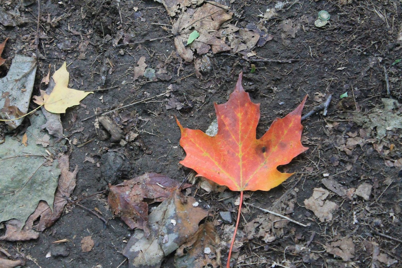
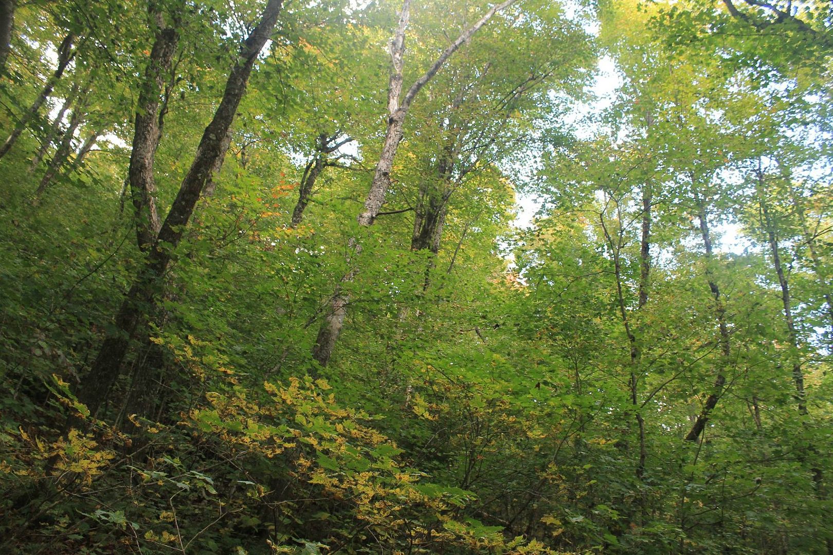
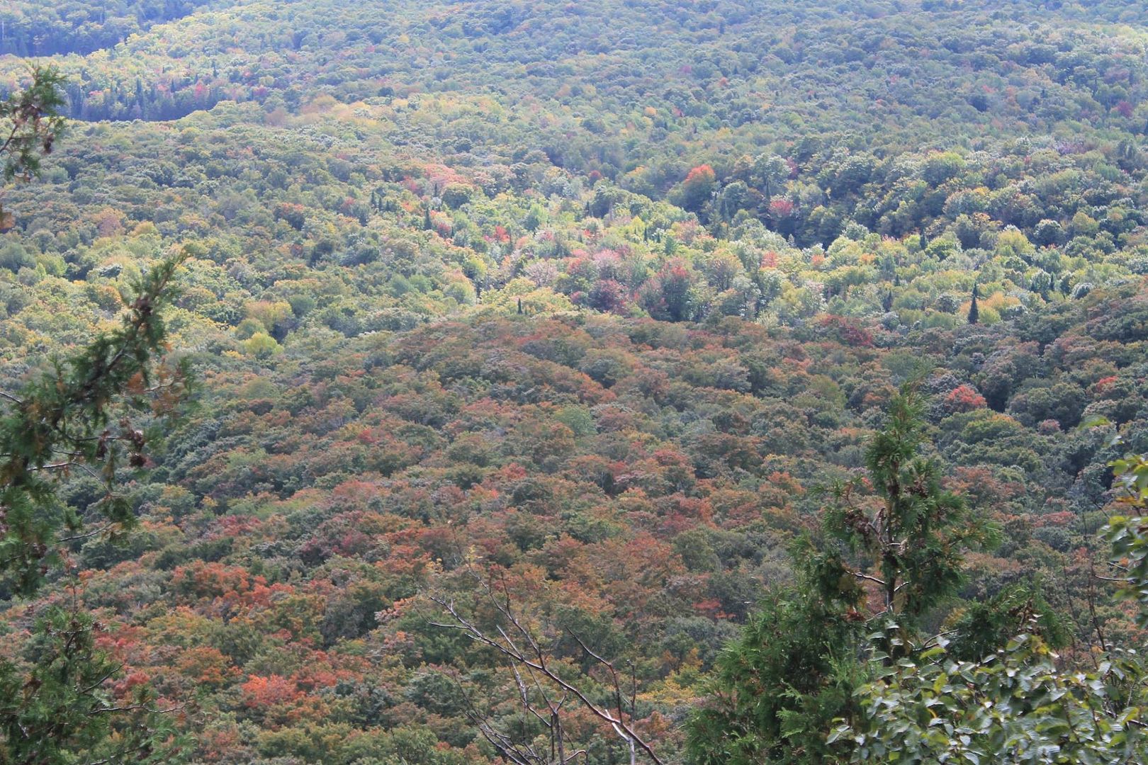
On the lower parts of the hike, the trees were only beginning to hint at the autumn color that will follow in the next few weeks.
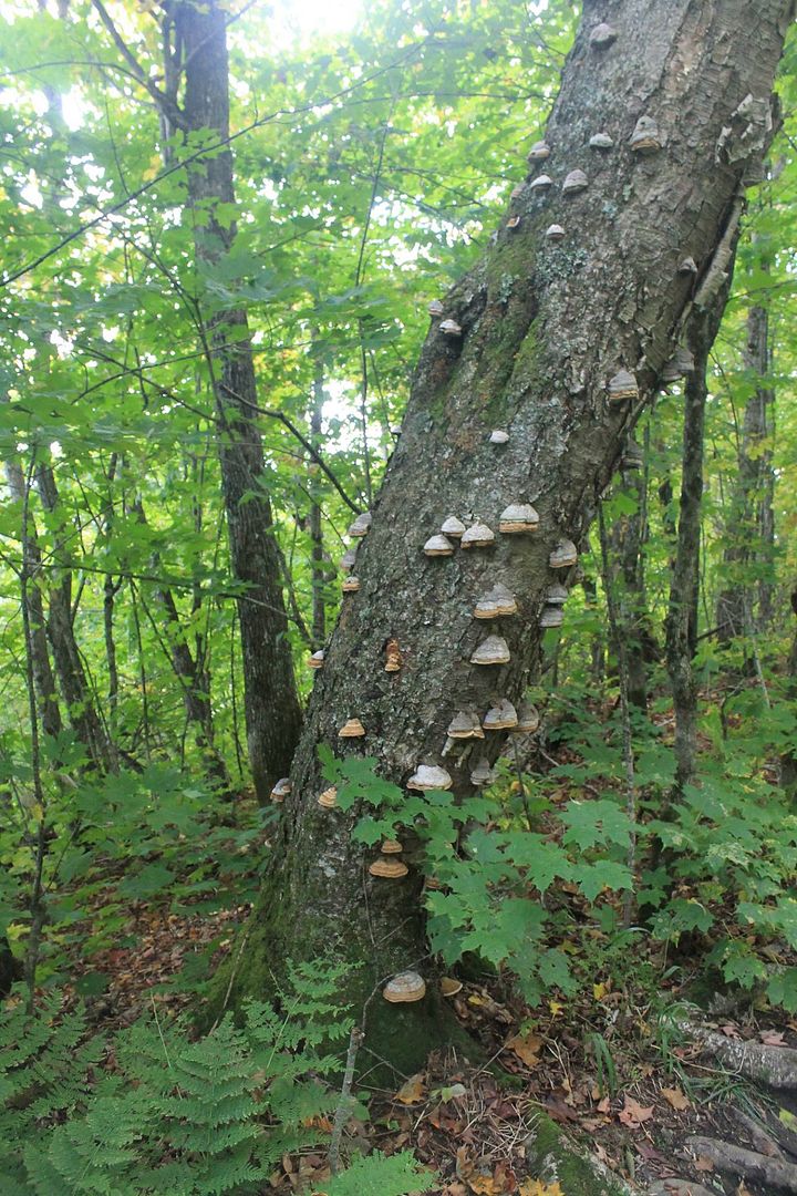
Vermont is home to many edible mushrooms. Unfortunately, we don't yet know what those are--but we are hopefully taking a course in a couple of weeks with our neighbor!
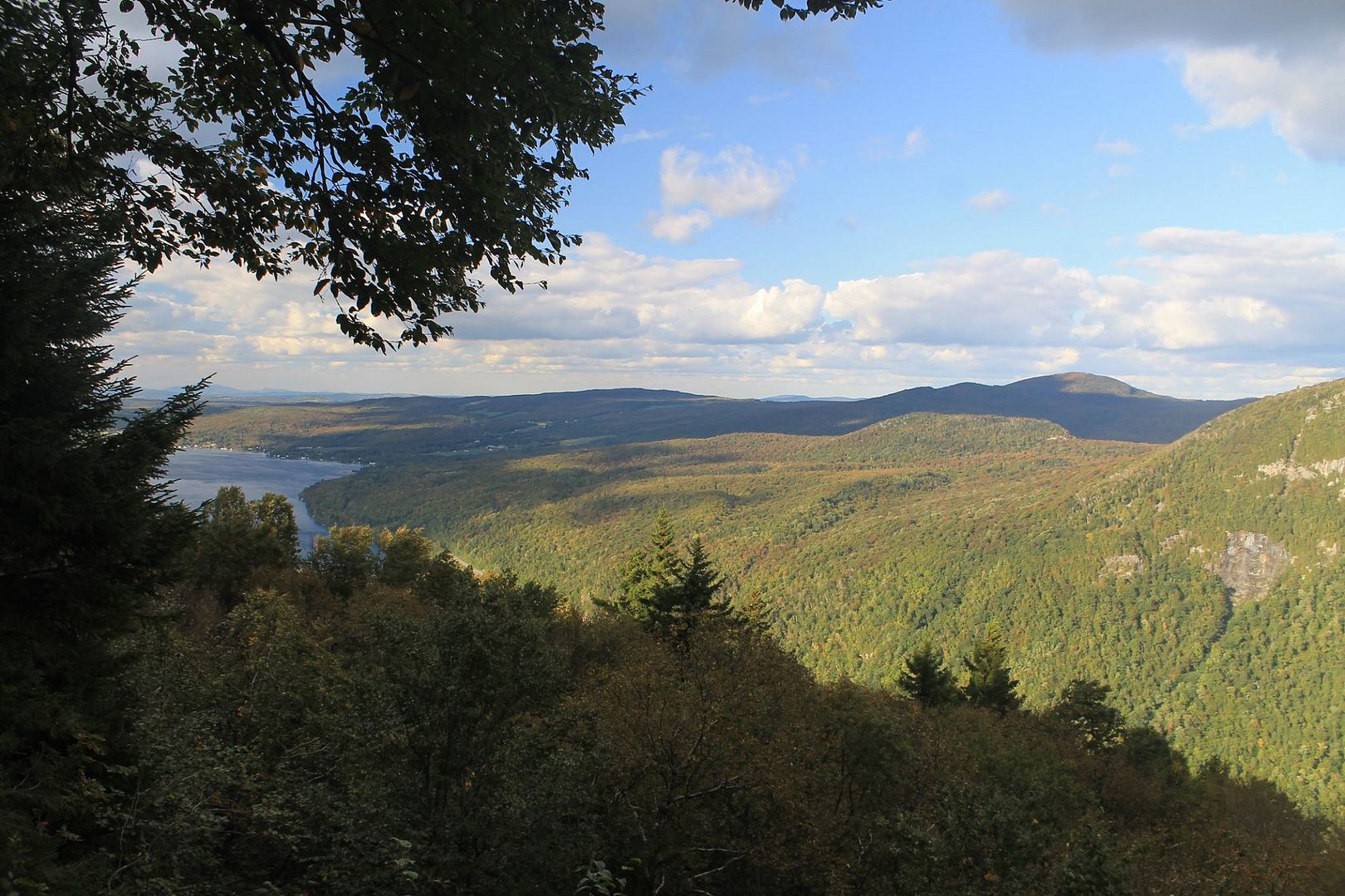
We did the full mile climb right off the bat, to the summit. The overlook here looks west, over several ponds and toward the Green Mountains.
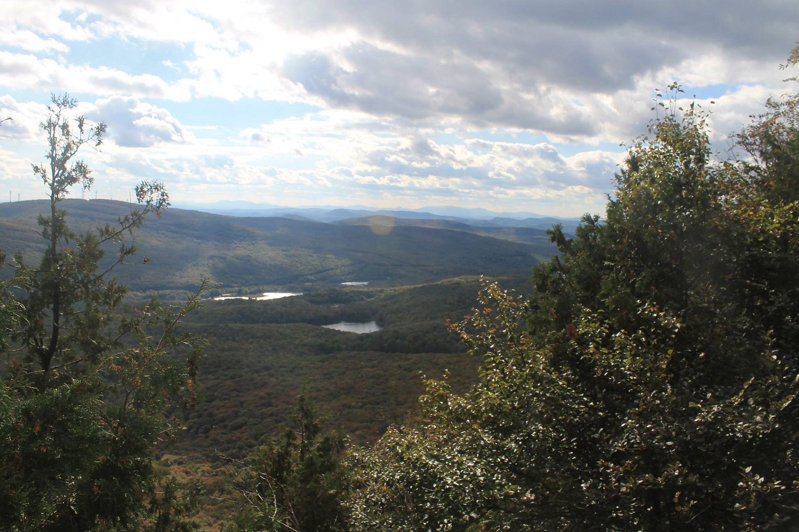
This picture of the valley shows the blush of color that is beginning to creep over the landscape.
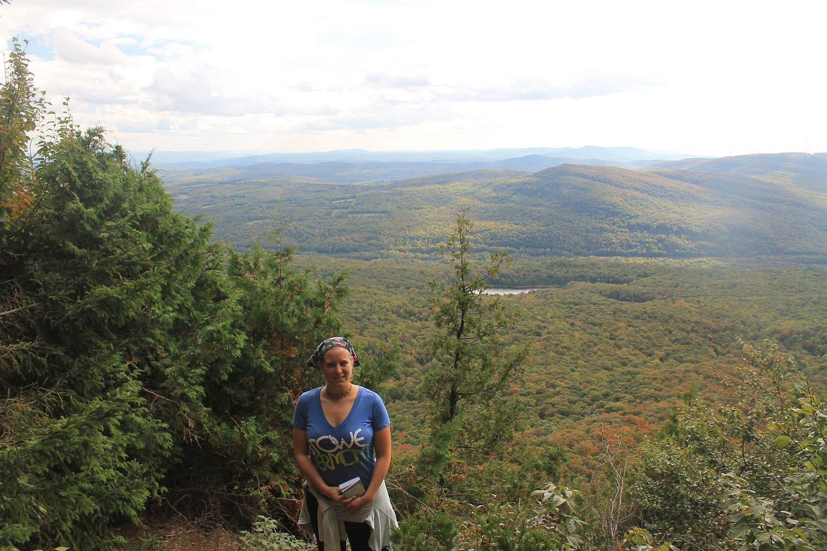
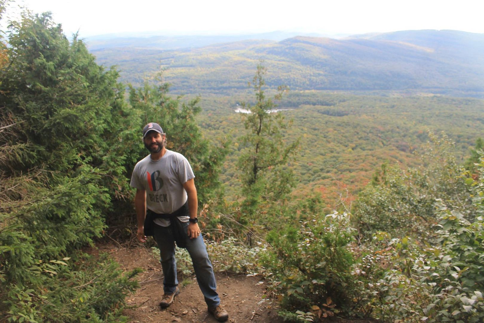
You know these people!
From the summit, we doubled back the way we'd come for a third-mile downhill climb, then following the other fork in the trail, which runs for close to a mile along the edge of the lake-facing side of the mountain.
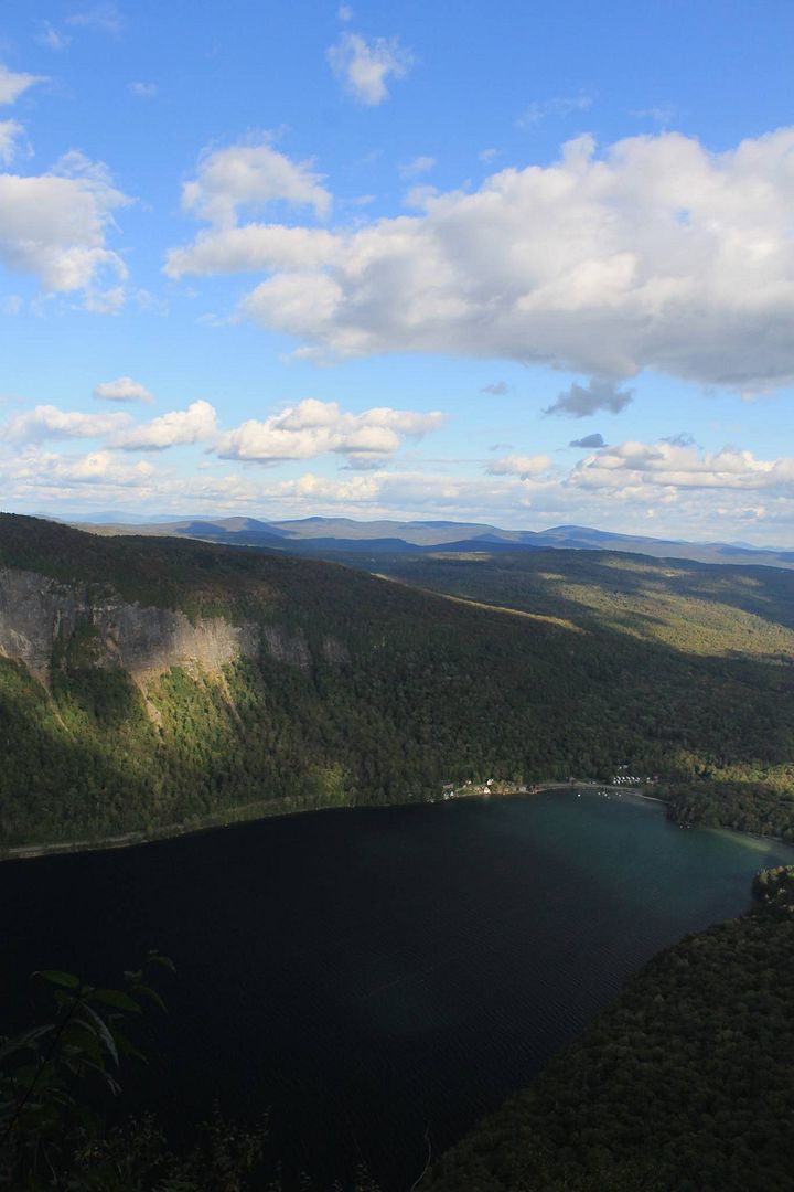
The south end of Willoughby and South Beach. I love this picture because the tiny dots along the water are houses, and the tiny dots in the water are sailboats, so it really gives a sense of scale. The Willoughby area always feels larger than life to me.
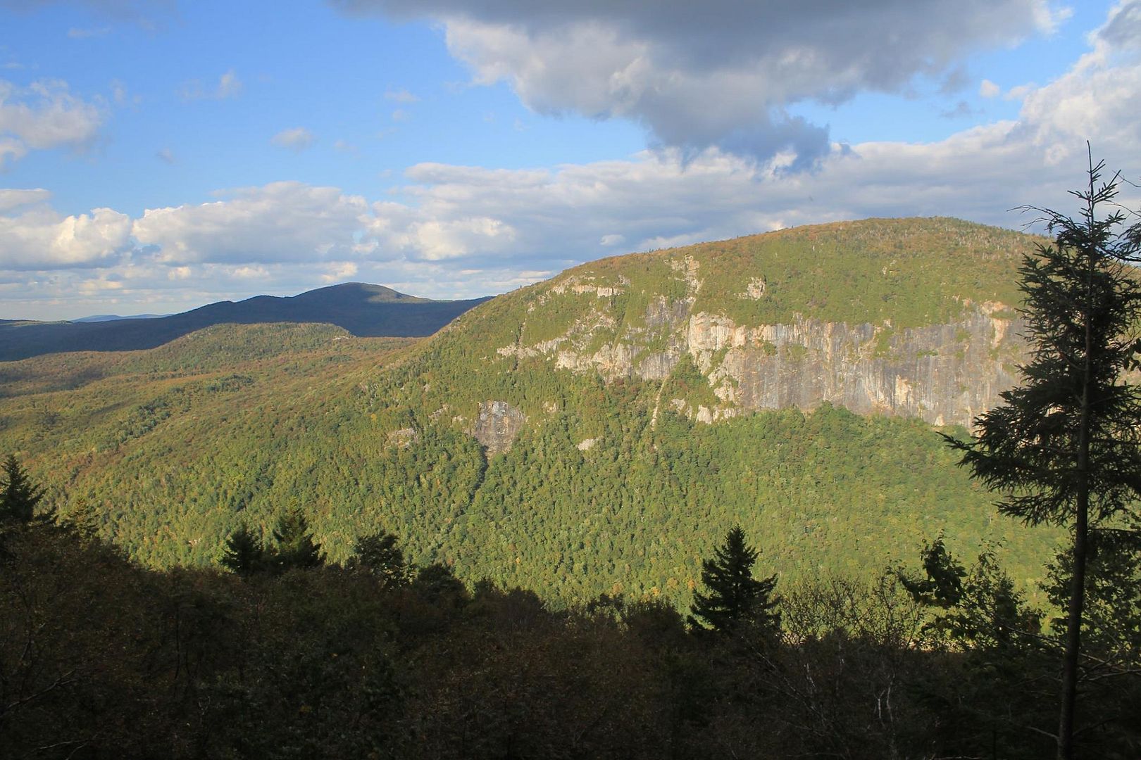
Panning north, this is Mount Pisgah, the companion to Mount Hor (they would have been a single mountain if not for that dratted glacier). Mount Pisgah is a little higher elevation and one of the few mountains in Vermont where arctic and alpine species make their home at the summit. The sheer cliffs are nesting sites for the endangered peregrine falcon (as are the cliffs of Mount Hor, which are below you in this picture!) You can really see here how the trees at the top of the mountain have changed much more than those at the bottom.
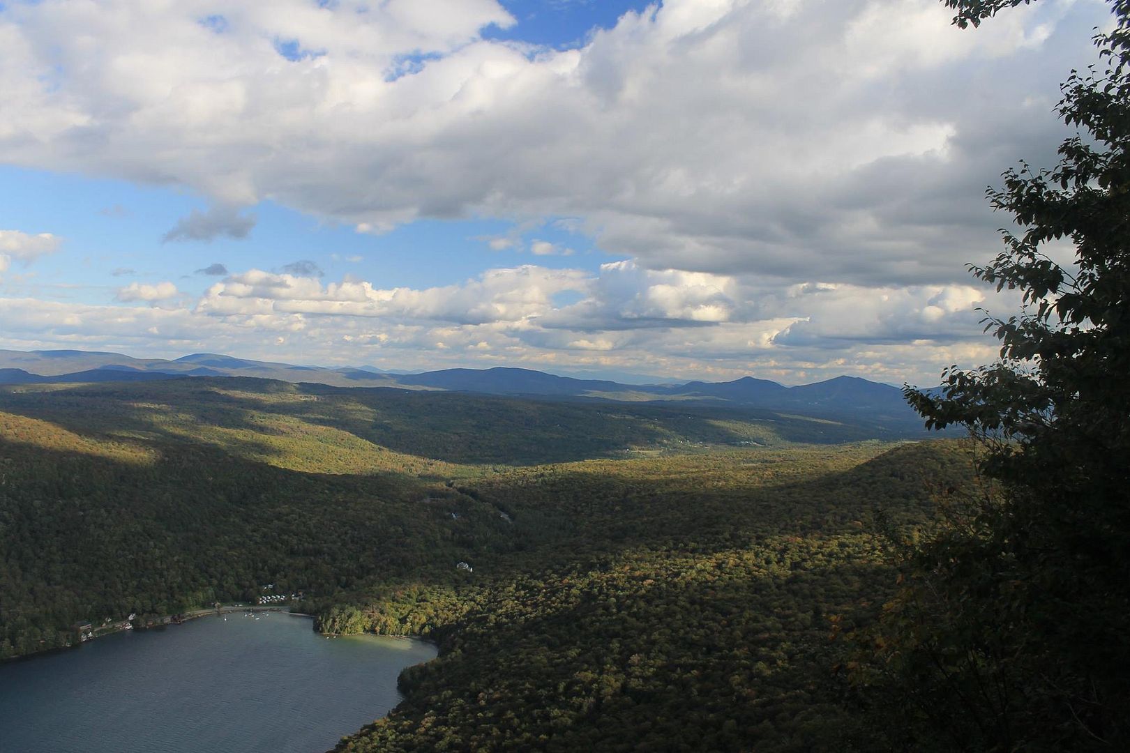
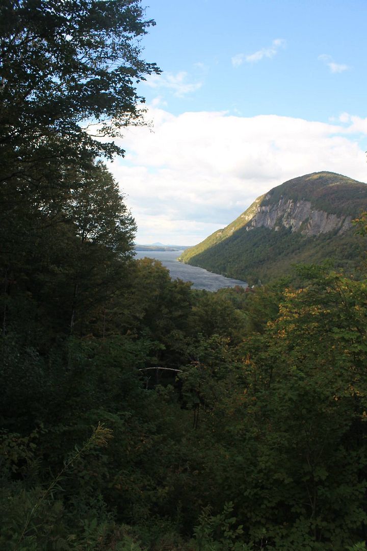
Looking north, toward the northern end of Willoughby (which is 5 miles/8 km long), toward Coventry (home!) and Canada.
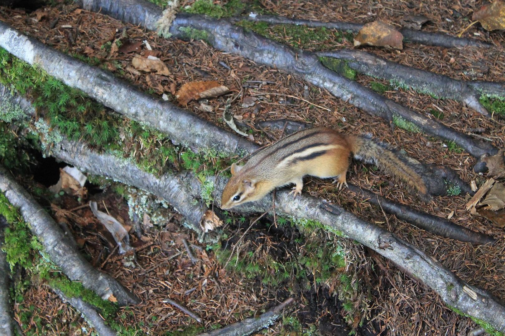
This little guy made an appearance at one of the lake overlooks. Judging by his interest in Bobby's camera backpack and his boldness around us, he has been fed. Lake Willoughby is a huge tourist attraction in the summer. There are nine black duck ducklings that will mill under your feet as you sit on the beach because they've become so tame from being fed by tourists. It makes me sad but is one of those things that no amount of effort or education will probably ever stop. So we can enjoy the cute close-up Bobby was able to get of him, right?
Having now hiked four of the mountains in the Willoughby area, Hor was by far my favorite: a strenuous but not scary hike rewarded by three stunning views!
This post was originally posted on Dreamwidth and, using my Felagundish Elf magic, crossposted to LiveJournal. You can comment here or there!
http://dawn-felagund.dreamwidth.org/390949.html
All this to say that yesterday, Bobby and I hiked Mount Hor. It is in what I term The Willoughby Complex but have since learned has the official name of the Northeastern Highlands of VermontTM. This means that they are not technically part of Vermont's Green Mountains! We have already hiked the two larger mountains in the area--Bald Mountain and Mount Pisgah--and I hiked Haystack Mountain* with my school.
*Which, until I learned its real name, I had named Boob Mountain because it looks like a boob in profile! The Willoughby area brings out the middle-schooler in the best of us.
The Willoughby Complex/Northeastern Highlands of VermontTM easily offer the most dramatic landscapes in a region of dramatic landscapes. The gap between the mountains Pisgah and Hor was ripped open by a retreating glacier, leaving Vermont's second deepest lake (the deepest being Lake Champlain) and dramatic cliffs pressing the lake shores on both sides.
The hikes to the summits of Pisgah and especially Bald Mountain were rather steep and rugged. (They are considered "moderate" in our Vermont hiking book, lol!) I expected much the same of Hor, but the mile-long (1.6 km) ascent to the summit was steep but not nearly as rugged, which made for a much nicer climb. I can pace myself on long ascents--this is why I'm good at snowshoeing--but scrambling rocks makes me tense and fatigues me very quickly. The hike to the top offers three different views: to the south and west from the summit overlook (looking toward the Greens) and two overlooks looking to the south of Willoughby and the northeast of Willoughby that are accessed by a flat trail that runs along the lake-facing edge of the mountain. This hike was pleasant enough that it's one I would strongly recommend for the Mereth Aderthad, because it is doable for someone in moderately good shape, even without experience hiking in the mountains. (For the truly adventurous, Bobby and I will take you to the fire tower at the top of Bald Mountain! :D)
All photos are by Bobby (except the picture of him that I took!) and stolen with permission from his Facebook.
The leaves are really beginning to change, especially at elevation. Vermont has a lot of maples, which makes for vivid color.

On the lower parts of the hike, the trees were only beginning to hint at the autumn color that will follow in the next few weeks.

Vermont is home to many edible mushrooms. Unfortunately, we don't yet know what those are--but we are hopefully taking a course in a couple of weeks with our neighbor!

We did the full mile climb right off the bat, to the summit. The overlook here looks west, over several ponds and toward the Green Mountains.

This picture of the valley shows the blush of color that is beginning to creep over the landscape.

You know these people!


From the summit, we doubled back the way we'd come for a third-mile downhill climb, then following the other fork in the trail, which runs for close to a mile along the edge of the lake-facing side of the mountain.
The south end of Willoughby and South Beach. I love this picture because the tiny dots along the water are houses, and the tiny dots in the water are sailboats, so it really gives a sense of scale. The Willoughby area always feels larger than life to me.


Panning north, this is Mount Pisgah, the companion to Mount Hor (they would have been a single mountain if not for that dratted glacier). Mount Pisgah is a little higher elevation and one of the few mountains in Vermont where arctic and alpine species make their home at the summit. The sheer cliffs are nesting sites for the endangered peregrine falcon (as are the cliffs of Mount Hor, which are below you in this picture!) You can really see here how the trees at the top of the mountain have changed much more than those at the bottom.

Looking north, toward the northern end of Willoughby (which is 5 miles/8 km long), toward Coventry (home!) and Canada.


This little guy made an appearance at one of the lake overlooks. Judging by his interest in Bobby's camera backpack and his boldness around us, he has been fed. Lake Willoughby is a huge tourist attraction in the summer. There are nine black duck ducklings that will mill under your feet as you sit on the beach because they've become so tame from being fed by tourists. It makes me sad but is one of those things that no amount of effort or education will probably ever stop. So we can enjoy the cute close-up Bobby was able to get of him, right?

Having now hiked four of the mountains in the Willoughby area, Hor was by far my favorite: a strenuous but not scary hike rewarded by three stunning views!
This post was originally posted on Dreamwidth and, using my Felagundish Elf magic, crossposted to LiveJournal. You can comment here or there!
http://dawn-felagund.dreamwidth.org/390949.html