Hike No 13 (Siebengebirge) - Enchanted Places

No 13
Date: September 7th
Weather: sunny & warm
Location: Siebengebirge, Germany
Starting point: Margarethenhöhe
Destination: Some train station.
Via: Größer Ölberg
Destination reached: Yes.
Walked Distance: approx. 10 km (6.2 miles)
Duration: 4:00 hours
Treasures found: none
Blisters: none
Main objective for this trip was to climb the highest peak of the Siebengebirge, the "Large Mount of Olives" (Größer Ölberg - which of course has no Olives anywhere near), 460m (1,500 feet) high. Lying on the outer skirts of the Siebengebirge, climbing the peak from Rhine-level on would have been a bit much, so I took the bus right up to the foot of the mountain. I left the bus, turned into the forest and basically started to ascend right away. Beautiful weather, beautiful forest. Ugly, ugly ascent.

It was a short, but violent ascend of roughly half an hour when I reached a pass that, as I discovered later, lead in a full circle around the peak. I went left to a small place with bench to rest. Between the trees you yould see the Dragonrock in a distance. Other than that, the view was not very impressive. Too many trees in the way.

From there I went the last few meteres to the peak. Again, there wasn't much of a view, only a few glimpses between the trees. On the peak, there's a rstaurant and presumable you have a better view from their terace, but there were constructions going on, so I couldn't enter. I guess I have to come back another time for my view.
I left the peak and followed the pass around the peak. The steepness of the slopes to my side was quite impressive. It doesn't translate well into photos, but this one gives you a rough idea:

I reached a clearing at the slopes with another bench. And I found something interesting: from the clearing there was a very small path leading away from the slope on a rock outcrop.
Now that was adventurous! The outcrop was hardly 2 meters broad, the path itself even smaller, and to both sides there was surely 20 meters of almost vertical slopes.

Pic below: the view back to the clearing with the bench. Notice the steep descent to the left. It was even steeper to the right, right after the trees, it was just... going down.


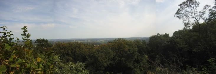
It was worth the small spike of adrenalin though. From the top of the outcrop I finally had my long-awaited view.

Semi-fail panorama photo.
After leaving the outcrop I followed the path around the peak, when I noticed something strange between the trees. It looked like some huge rocky cliff. I left the path and went down a rather thorny route up to the shore of a small lake. Opposite of it there was a huge, vertical wall of rock. It was a great view and the photo doesn't really do it justice.

I strayed around a bit and finally found a small path that lead me nearer to the rocks. This route seemed to be seldomely used and was partially overgrown with thorny and stingy plants, but I made it. I found myself in what was almost some sort of cauldron, apparently an old quarry, partially filled with water. The vertical wall of rocks, surely 20 metres high, seems to be the peak of the whole hill itself - as if someone just chopped of half of the peak and left some huge bricks of basalt lying at its foot.

The pile of rocks looked kinda delicate, as if they would come down any minute, giving me the second spike of adrenalin in half an hour.

The small lake that filled up the lower part of the quarry was of a circular shape, and of a dark, almost black-ish color, making it look like the entrance into some deep, mysterious underworld. Dragonflies chased over the lake and were about the only sound you could hear.

Note the hexagon-shaped basalt bricks to the right.

From there I went to one of the upper ridges of the cauldron and made this attempt at a panaroma photo. Note the "chopped-off" peak on the left and the deep black color of the lake.
At this point I was no longer sad at the lack of far-reaching views on the trip so far. This place was much more gorgeous!
But it was time to continue. I returned to my path and finally concluded the trip around the peak and began to descend.

A look behind. See the mountain ascending steep from left to right.
I walked on for about an hour over a hill called "Wasserfall" ("Waterfall"). Which, I might add, was a blatant case of false adertising. There was not water anywhere near, let alone a waterfall!
There were however some exciting slopes, descending to a street some 40-50 meters below.

The grey-ish thing far down below is said road.
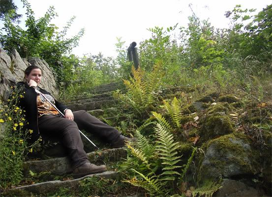
My next peak (a small one) was called Rosenau. Like many other peaks around it sported the remains of a medieval castle. There wasn't much left of it (it was basically part of a corkscrew stair leading up to a small turret) and it was heavily overgrown, giving the whole place a very enchanted feel.


Time for a auto-shoot pic!

After leaving Rosenau I walked on for another hour or so. There would have been another peak to climb but I was too tired. Finally I reached a street with a bus station. I pondered to go on a bit, but when I saw that the next bus was going in exacly 1 minute, I decided to take it. It took me back to the next station and I took the train back to Cologne.
This was quite an unexpected journey. Since I climbed the highest peak I had expected some spectecular views, but instead I found some gorgeous, beautiful and unexpected places. I'll certainly return here some day.