'I'm the map guy.'
I’m not sure if there’s much widespread curiosity for this kind of thing, but I find maps absolutely fascinating. I think the map they have on the DVD field guide is disappointing. Therefore, I decided to compile my own map collection. Some of this came from a lazy search of the internet. Other bits and pieces are scanned in from books I own. (Do they have any maps in any of the Easy books? Alas, I haven’t read them yet and do not know. I’ll be getting Band of Brothers any day now. I swear.)
Warning: Lots of big images! Dial-up users beware!
Part One: Currahee
I don’t have very much for this episode. Camp Toccoa, of course, no longer exists. However, I was able to find this aerial shot from 1943 on the web.
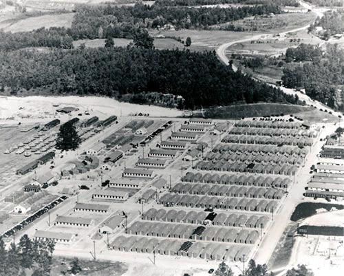
Here’s the link to a page on Toccoa’s history, including some other photographs:
http://www.toccoahistory.com/Currahee-Camp%20Toccoa.htm
As for Camp Mackall, I was able to find a map of its layout. You can’t really make out any of the words, but the large triangle is the airfield.
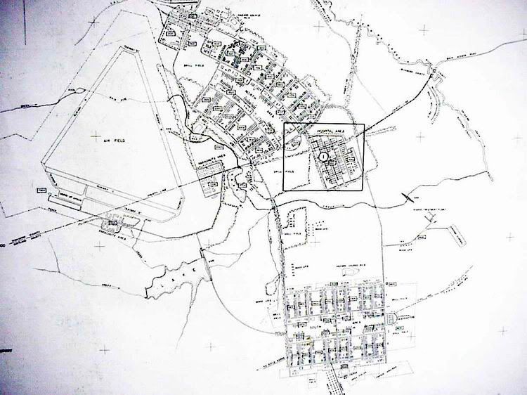
It is located in North Carolina, just west of Fort Bragg.
Here’s a link with the history of Camp Mackall: http://www.bragg.army.mil/18abn/CampMackall.htm
As for Aldbourne and Upottery, I fear I have failed on that aspect, mostly out of sheer laziness. I couldn’t find anything really interesting map-wise besides the typical dot and name that you could find in any old atlas.
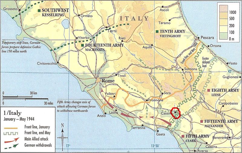
And Sgt. Martin was correct; Monte Cassino is ‘somewhere in Italy’. To be specific, it is a bit southeast of Rome. Just because I can, here’s a map of the military action in that area, with Monte Cassino circled in red.
Part Two: Day of Days
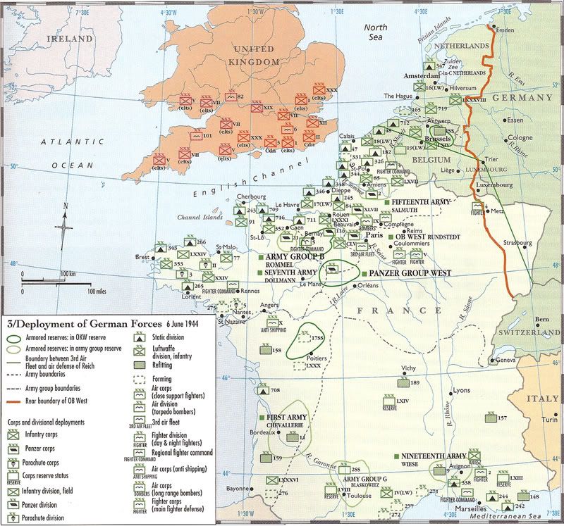
The first map, of course, is that of England and France just before D-Day. You can get the general idea of how the troops on both sides were situated. Nothing too interesting, though you can spot the 101st and 82nd.
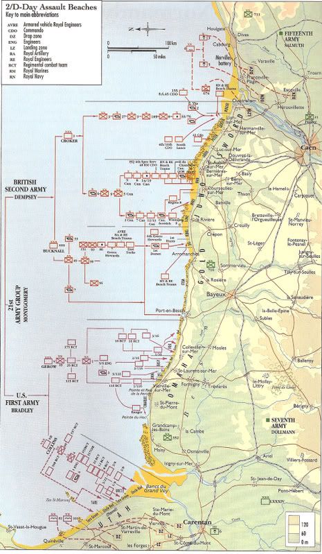
Next we have a map of the D-Day assault. Utah is at the bottom (which is actually west).
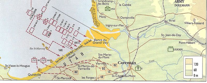
Close up of Utah:
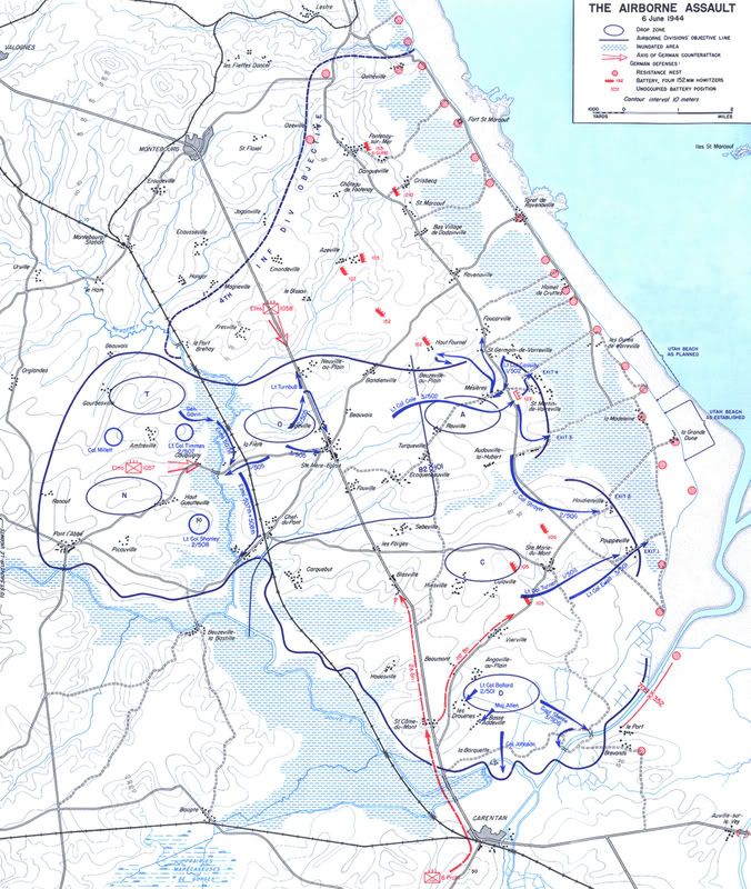
Here’s a rather nifty military map of the Airborne assault, with drop zones and German batteries indicated. This is the most interesting map of the bunch, I believe.
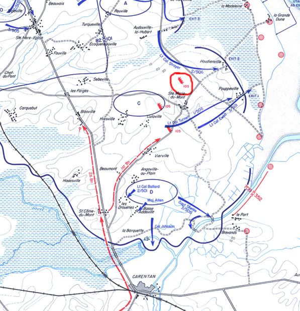
The following is a more detailed map of the previous. Winters landed near Ste. Mère-Eglise, which is in the northwest corner of the map. The German battery near Brecourt Manor is just north of Ste. Marie-du-Mont… I circled it in red. (Utah beach is at the very edge of the map, northeast.) Though technically not part of this episode, you can see Carentan in the south.
Here are some wonderful links through googlemaps.
The first pinpoints some important places in Easy’s history from Toccoa to Market Garden (including Aldbourne and Upottery, which almost makes up for my neglecting them earlier - now you can get an idea of where exactly in England they are). Even Fort Benning’s there:
http://maps.google.com/maps?hl=en&ie=UTF8&q=http://bbs.keyhole.com/ubb/placemarks/54046-BandofBrothers.kml&ftid=DC75BCC01E9D7FBA
The second link is a subset of the first, and gives the details of Brecourt Manor. There’s even a marker for Lipton’s tree! It really helps you get a feel for what went on during the action… definitely much better than relying solely on Winters’ quick little sketch of x’s and arrows:
http://maps.google.com/maps?q=http://bbs.keyhole.com/ubb/download.php?Number=57448&t=k&om=1
If anyone wants the files for any of the maps, feel free to ask!
Also, would it behoove me to do this for the rest of the rewatch? I don’t want to post if no one’s interested…