Severe Storms With Lg to Very Lg Hail & Wind Probable in Central Tx Later Today
Scattered to numerous thunderstorms, many severe and congealing into one or more complexes, are likely across much of the Hill Country and south and east Texas today.
As of this post, severe thunderstorms are already in progress across west Texas, mostly drifting east.
A Severe Thunderstorm Watch which includes Travis, Williamson & nearby counties is in effect until at least late evening/tonight.
From the Storm Prediction Center (Click image for more details)
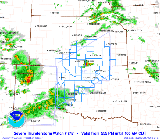
Hazard Tornadoes EF2+ Tornadoes Likelihood Low Very Low Severe Wind 65 kt+ Wind Moderate Moderate Severe Hail 2"+ Hail High Moderate
For each watch, probabilities for particular events inside the watch (listed above in each table) are determined by the issuing forecaster. The "Low" category contains probability values ranging from less than 2% to 20% (F2-F5 tornadoes), less than 5% to 20% (all other probabilities), "Moderate" from 30% to 60%, and "High" from 70% to greater than 95%.